I drive around the College Park Metro Station a lot. That area is home to one of the most notable examples on Prince George's County's long list of misguided transportation infrastructure disasters. The College Park Trolley Trail crossing at Paint Branch Parkway. Rethink College Park has chronicled the embarrassingly over-the-top markings, signs, and traffic implements to bring notice to the heavily traveled bike path crossing.
Allow me to set the scene: The College Park Trolley Trail runs along the bits and fragments of a disjointed Rhode Island Avenue between Route 1 and the MARC/Metro tracks. It is a heavily used trail that connects north College Park to the University and the Metro Center, and this crossing is a crucial point on the path. Paint Branch Parkway is a four lane road with a double yellow line. The south side of the road has a sidewalk that goes under the train tracks to the Metro station. The north side has nothing between the train tracks and Route 1 despite several bus stops along the route. The only signalized crossing accessible to the north side of the CPTT is at Route 1, about a quarter mile west. And as mentioned above, there are no sidewalks to get there.
College Park has been trying to get a HAWK signal at the intersection, an option the County dismissed quickly. There is another way to get the crossing signalized, however College Park is likely to foolishly dismiss it: connect Rhode Island Avenue to Paint Branch Parkway.
View Larger Map
The CPTT and Rhode Island Avenue would intersect Paint Branch Parkway at the same place, and the vehicular intersection could receive a traffic signal on which the bike and pedestrian path could piggy-back. This would also improve street connectivity in traffic-clogged College Park. But that's exactly why the idea will probably never be explored. It would attract cars into the neighborhood, a notion that the University and the residents will likely balk at. Never mind the fact that it houses College Park's newest parking garage at Knox Road and Yale Avenue. People won't want through traffic by-passing traffic-choked Route 1 on the narrow, speed-bumpy neighborhood streets.
Prince George's County, like most of the rest of the nation, favors funneling traffic onto main streets instead of keeping a permeable network of interconnected and redundant streets. Usually, this just isolates communities and creates traffic problems. In this case, however, it hurts (sometimes literally) pedestrians and bikers who cannot count on Paint Branch Parkway drivers to obey the 35 mph speed limit or the state law that mandates cars stop at all crosswalks for bikes and peds.
In most other wealthy countries on earth, bikes, cars, pedestrians and transit find a way to coexist together on publicly maintained roads. This separation of modes with a grossly negligent safety situation once again emphasizes that in a country that is already bad at that, Prince George's County finds a way to prove they are one of the worst.
Showing posts with label transit planning. Show all posts
Showing posts with label transit planning. Show all posts
Tuesday, March 30, 2010

Wednesday, February 17, 2010
Sneak Peek at Imagine, DC Transit Vision
Further explanation forthcoming, but at the GGW meet-up in Silver Spring tonight, a couple folks asked me about it, so here it is
What is on it?
-Potential extension of existing and under construction Metro Lines (including Silver), separated from each other to maximize capacity
-Two Metro Light Rail lines, the Purple Line (proposed) and the Black or "Columbia" Line (which hits Columbia Pike in MoCo, Columbia Heights, and Columbia Pike in VA)
-A vision for DC streetcars (red), Ride-On streetcars (light blue), streetcars for municipalities in Prince George's (various blues and purples), ART/DART (light green) and Fairfax Connector (white)
-Southern Maryland Area Rail Transport (SMART light rail, in yellow)
What's not on here yet:
-Corridor Cities Transitway
-MARC/VRE
-Baltimore Transit
-A "Pink Line" heavy rail inner loop
-A "Brown Line" crosstown light rail
I probably won't add these, it doesn't mean I don't think we should have them:
-Tram/Streetcar stations
-Intercity/HSR/MagLev
-Rapid/express bus (vision supplants most of this with rail anyway)
-Redevelopment and suburban ruralization that would ideally accompany this sort of plan
-Bicycle facilities (not my wheelhouse... yet)
-New/changed/removed freeways, parkways, and interchanges, as well as newly tolled roads
Here's a disclaimer: I am not under the delusion that this vision is feasible, politically expedient, affordable, cost effective, or in any other way possible. But I imagine it would be able to quickly and safely transport most of the area's growing population after gas prices breach the threshold of affordability.
Sorry I am currently incapable of putting together a beautiful graphic like many of my fellow transit nerds at BeyondDC, Track Twenty-Nine, or Greater Greater Washington, but hopefully the arrangement I have thrown together on GoogleMaps will give people an idea of what I'm going for here.
What is on it?
-Potential extension of existing and under construction Metro Lines (including Silver), separated from each other to maximize capacity
-Two Metro Light Rail lines, the Purple Line (proposed) and the Black or "Columbia" Line (which hits Columbia Pike in MoCo, Columbia Heights, and Columbia Pike in VA)
-A vision for DC streetcars (red), Ride-On streetcars (light blue), streetcars for municipalities in Prince George's (various blues and purples), ART/DART (light green) and Fairfax Connector (white)
-Southern Maryland Area Rail Transport (SMART light rail, in yellow)
What's not on here yet:
-Corridor Cities Transitway
-MARC/VRE
-Baltimore Transit
-A "Pink Line" heavy rail inner loop
-A "Brown Line" crosstown light rail
I probably won't add these, it doesn't mean I don't think we should have them:
-Tram/Streetcar stations
-Intercity/HSR/MagLev
-Rapid/express bus (vision supplants most of this with rail anyway)
-Redevelopment and suburban ruralization that would ideally accompany this sort of plan
-Bicycle facilities (not my wheelhouse... yet)
-New/changed/removed freeways, parkways, and interchanges, as well as newly tolled roads
Here's a disclaimer: I am not under the delusion that this vision is feasible, politically expedient, affordable, cost effective, or in any other way possible. But I imagine it would be able to quickly and safely transport most of the area's growing population after gas prices breach the threshold of affordability.
Sorry I am currently incapable of putting together a beautiful graphic like many of my fellow transit nerds at BeyondDC, Track Twenty-Nine, or Greater Greater Washington, but hopefully the arrangement I have thrown together on GoogleMaps will give people an idea of what I'm going for here.
Sunday, January 3, 2010
Imagine a streetcar on Alabama Avenue
When DDOT unveiled its Streetcar vision in October, I was little disappointed by the amount of service in River East. Indeed, the area's reputation has been mired in negativity for quite some time, which has lead to, for better or worse, a very different kind of land and economic development in Wards 7 and 8. This is evident in the distribution of services proposed by DDOT.
River East has experienced a great deal of suburban style development. Wickedly suburban. Affordable housing is often not accessible to the six Metro stations that serve this third of the city. Isolated affordable housing can often turn out to be frighteningly similar to ill-fated housing projects. Requiring people of lower income to rely on automobile transport greatly increases their cost of living, further exacerbating the poverty. But shiny new developments in River East, for all their efforts at civic improvement, are still focused around the automobile.
What really disappointed me about DDOT's plan is that all the streetcar lines appear to run THROUGH River East. Along the Anacostia River, perhaps, but they fail to connect many of the neighborhoods to the system, including several that are not very accessible to Metro. This plan would lead me to infer that Congress Heights and Fairlawn are and will be for the foreseeable future dependent on the rest of the city to be a viable place to live. The lines connect River East to the rest of the city, but they don't connect River East to River East. Not as much as it could, at least.
With DC's population rocketing past 600,000 and developers running out of "River West" real estate to develop, Benning, Deanwood, Anacostia, Washington Highlands, Hillcrest, Fort Dupont, and the rest of River East's many neighborhoods will becoming increasingly attractive for development. But the same type of dense, walkable, transit-oriented, traditional neighborhood design is not possible if River East goes as underserved by streetcar as it is by Metro (6 stations versus 31 in the rest of DC and not transfer stations). So I conceived a line that would make it feasible to live in Congress Heights and work in Capitol Heights without taking Metro all the way to L'Enfant Plaza first. I give you a proposal for a ninth streetcar line, the Alabama Avenue line:
View River East Streetcars in a larger map
Blue indicates lines laid out in the DDOT plan, purple indicates possible future streetcar extension laid out in the plan, and red is the Alabama Avenue line. Obviously, significant portions of the line also run along Southern Avenue and Nannie Helen Burroughs Avenue. It connects prominent neighborhoods to Metro stations and other streetcar lines. It puts more of the rail transit infrastructure within walking distance for District residents who will benefit most from its service and economic development. It is intended to interact with the neighborhoods as places where a significant portion of the District now lives and could potentially work in the future.
Where the city will ultimately have a streetcar network, River East will only have lines. The Alabama Avenue line would create a network that would compliment the existing Metro stations and the already-planned streetcar lines. It may not generate enormous ridership projections right now, but it would certainly draw more walkable urban development to Alabama Avenue and the other proposed corridors. We plan roads in anticipation of future development. Why can't we make that same investment with our streetcar network?
Cross-posted on Imagine, DC
River East has experienced a great deal of suburban style development. Wickedly suburban. Affordable housing is often not accessible to the six Metro stations that serve this third of the city. Isolated affordable housing can often turn out to be frighteningly similar to ill-fated housing projects. Requiring people of lower income to rely on automobile transport greatly increases their cost of living, further exacerbating the poverty. But shiny new developments in River East, for all their efforts at civic improvement, are still focused around the automobile.
What really disappointed me about DDOT's plan is that all the streetcar lines appear to run THROUGH River East. Along the Anacostia River, perhaps, but they fail to connect many of the neighborhoods to the system, including several that are not very accessible to Metro. This plan would lead me to infer that Congress Heights and Fairlawn are and will be for the foreseeable future dependent on the rest of the city to be a viable place to live. The lines connect River East to the rest of the city, but they don't connect River East to River East. Not as much as it could, at least.
With DC's population rocketing past 600,000 and developers running out of "River West" real estate to develop, Benning, Deanwood, Anacostia, Washington Highlands, Hillcrest, Fort Dupont, and the rest of River East's many neighborhoods will becoming increasingly attractive for development. But the same type of dense, walkable, transit-oriented, traditional neighborhood design is not possible if River East goes as underserved by streetcar as it is by Metro (6 stations versus 31 in the rest of DC and not transfer stations). So I conceived a line that would make it feasible to live in Congress Heights and work in Capitol Heights without taking Metro all the way to L'Enfant Plaza first. I give you a proposal for a ninth streetcar line, the Alabama Avenue line:
View River East Streetcars in a larger map
Blue indicates lines laid out in the DDOT plan, purple indicates possible future streetcar extension laid out in the plan, and red is the Alabama Avenue line. Obviously, significant portions of the line also run along Southern Avenue and Nannie Helen Burroughs Avenue. It connects prominent neighborhoods to Metro stations and other streetcar lines. It puts more of the rail transit infrastructure within walking distance for District residents who will benefit most from its service and economic development. It is intended to interact with the neighborhoods as places where a significant portion of the District now lives and could potentially work in the future.
Where the city will ultimately have a streetcar network, River East will only have lines. The Alabama Avenue line would create a network that would compliment the existing Metro stations and the already-planned streetcar lines. It may not generate enormous ridership projections right now, but it would certainly draw more walkable urban development to Alabama Avenue and the other proposed corridors. We plan roads in anticipation of future development. Why can't we make that same investment with our streetcar network?
Cross-posted on Imagine, DC
Saturday, November 21, 2009
Core Capacity & Freemark's Pink Line
The Transport Politic often showcases unique and clever transit solutions visualized by the site's author, Yonah Freemark. Recently he looked into the WMATA system and made an interesting proposal: a separated Blue Line, and running along it, another investment, a so-called Pink Line. Though Freemark's plan would add invaluable capacity and connectivity to our system, I believe a similar vision could be achieved without building another costly Potomac Crossing. That's not to say we shouldn't, but perhaps a closer term solution might look more like this:
View Pink Line in a larger map
The existing Potomac crossing where the Yellow Line connects Downtown and Pentagon City is underutilized and ought to have it's capacity increased before another crossing is built. This alternative combines the cross-Arlington connectivity that Freemark envisions without the circuitous route back through Rosslyn. This investment could be increased even more if the Green and Yellow Lines could be separated downtown, which might prove cheaper than the Blue Line separation. Another advantage would be that this line could just be an extension of the Silver Line, which would eliminate the need for a new line color.
New track miles are most valuable in the core. Unfortunately, they're also generally the most expensive new track miles. But the benefits to the entire region are huge across the entire system, making it a worthwhile investment. And it's about time we started considering "the rest of Arlington" more a part of the core.
View Pink Line in a larger map
The existing Potomac crossing where the Yellow Line connects Downtown and Pentagon City is underutilized and ought to have it's capacity increased before another crossing is built. This alternative combines the cross-Arlington connectivity that Freemark envisions without the circuitous route back through Rosslyn. This investment could be increased even more if the Green and Yellow Lines could be separated downtown, which might prove cheaper than the Blue Line separation. Another advantage would be that this line could just be an extension of the Silver Line, which would eliminate the need for a new line color.
New track miles are most valuable in the core. Unfortunately, they're also generally the most expensive new track miles. But the benefits to the entire region are huge across the entire system, making it a worthwhile investment. And it's about time we started considering "the rest of Arlington" more a part of the core.
Monday, October 19, 2009
Transit Capacity
Last month I criticized the plan to scale back Tysons Corner because of the need for increased freeway capacity. The more I think about it, the more merit I see in the notion that a revamped Tysons Corner will be desperately transit-starved. Freeways, however, are not the panacea. The plan to urbanize the region's most prominent edge city will bring thousands more jobs and residents to the area. Even if the area becomes more self contained, it will require much greater capacity for transportation in and out of the area's densest job center.
 Downtown Silver Spring from the Metro station. Photo by mindgutter
Tysons will have 4 stations, but they will only be able to handle about 40% of the rides of stations at Silver Spring, Bethesda, Rosslyn, and King Street. Matt Johnson at Track Twenty-Nine created an excellent diagram showing how track sharing by Metro lines closer in to the city prevent the same capacities on the outer spokes of the system (except on the Red Line, which does not share tracks with any other line). Even with four stations, the capacity of the line does not stack up to urbanizations in Montgomery County, Arlington, and Alexandria. Can it support an even larger development with less system capacity? Can the already-clogged North Arlington Orange Line corridor support the additional riders with its finite capacity? Optimal success of the Tysons plan would require more Metro capacity such as a separated Blue Line on a new Potomac crossing.
I'm also lead to wonder if this has not contributed to the overall inferior urbanization in Prince George's County. No station in Prince George's has more than 60% capacity because the Green, Blue, and Orange lines all share track inside the District (though the northern section of the Green Line as the potential to do so if the Yellow Line ever runs all the way to Greenbelt regularly). Certainly the County's poor planning policies have contributed to the lack of urban development around virtually all 14 Metro stations, often egregiously, but perhaps lack of capacity has contributed as well.
The stretch of Metro in Prince George's County with the most service, the northern Green(/sometimes Yellow) Line has experienced the most development. Prince George's Plaza Station has probably seen the most. Though not exactly Downtown Silver Spring yet, University Town Center is probably the best example of urban development around a Metro station in Prince George's. Much has been planned for West Hyattsville, College Park, and Greenbelt, though little has come to fruition. New Carrollton, which will have added capacity once the Purple Line comes to town, also has grand plans for development. Stops on the Blue and lower Green Lines, however, are not experiencing as much planning buzz.
I have never heard of any study that implies the impact of station capacity versus development around stations, but it stands to reason that the more capacity, the more successful and robust development can be. The Orange Line corridor might be somewhat of an exception. West of Rosslyn, the Orange line can handle about 60% of the trips Silver Spring or Bethesda can handle. The strip is anchored, however, by Rosslyn, which has the same capacity as Silver Spring and Bethesda.
David Alpert suggested some innovative ways to create more system capacity by separating the Green and Yellow lines and rerouting some of the Silver Line trains. This would help Prince George's County, Tysons Corner, and other locations in Virginia and still be cheaper (in theory) than a separated Blue Line. If Silver Spring, Bethesda, and Rosslyn are models we seek to emulate, station capacity ought to be equivalent of those successful areas.
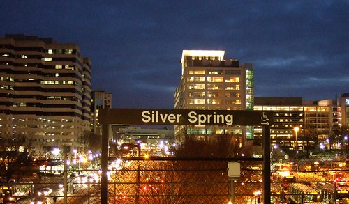 Downtown Silver Spring from the Metro station. Photo by mindgutter
Tysons will have 4 stations, but they will only be able to handle about 40% of the rides of stations at Silver Spring, Bethesda, Rosslyn, and King Street. Matt Johnson at Track Twenty-Nine created an excellent diagram showing how track sharing by Metro lines closer in to the city prevent the same capacities on the outer spokes of the system (except on the Red Line, which does not share tracks with any other line). Even with four stations, the capacity of the line does not stack up to urbanizations in Montgomery County, Arlington, and Alexandria. Can it support an even larger development with less system capacity? Can the already-clogged North Arlington Orange Line corridor support the additional riders with its finite capacity? Optimal success of the Tysons plan would require more Metro capacity such as a separated Blue Line on a new Potomac crossing.
I'm also lead to wonder if this has not contributed to the overall inferior urbanization in Prince George's County. No station in Prince George's has more than 60% capacity because the Green, Blue, and Orange lines all share track inside the District (though the northern section of the Green Line as the potential to do so if the Yellow Line ever runs all the way to Greenbelt regularly). Certainly the County's poor planning policies have contributed to the lack of urban development around virtually all 14 Metro stations, often egregiously, but perhaps lack of capacity has contributed as well.
The stretch of Metro in Prince George's County with the most service, the northern Green(/sometimes Yellow) Line has experienced the most development. Prince George's Plaza Station has probably seen the most. Though not exactly Downtown Silver Spring yet, University Town Center is probably the best example of urban development around a Metro station in Prince George's. Much has been planned for West Hyattsville, College Park, and Greenbelt, though little has come to fruition. New Carrollton, which will have added capacity once the Purple Line comes to town, also has grand plans for development. Stops on the Blue and lower Green Lines, however, are not experiencing as much planning buzz.
I have never heard of any study that implies the impact of station capacity versus development around stations, but it stands to reason that the more capacity, the more successful and robust development can be. The Orange Line corridor might be somewhat of an exception. West of Rosslyn, the Orange line can handle about 60% of the trips Silver Spring or Bethesda can handle. The strip is anchored, however, by Rosslyn, which has the same capacity as Silver Spring and Bethesda.
David Alpert suggested some innovative ways to create more system capacity by separating the Green and Yellow lines and rerouting some of the Silver Line trains. This would help Prince George's County, Tysons Corner, and other locations in Virginia and still be cheaper (in theory) than a separated Blue Line. If Silver Spring, Bethesda, and Rosslyn are models we seek to emulate, station capacity ought to be equivalent of those successful areas.
Friday, September 4, 2009
Baltimore Yellow Line Boondoggle
GGW's breakfast links yesterday had a troubling article at the bottom. The Central Maryland Transit Alliance wants to prioritize extending Baltimore's Yellow Line light rail to Columbia over extending the Green Line subway to White Marsh. I can't even begin to express how dumb of an idea this is.
The Green Line extension will hit developed areas in a large city with a burgeoning centralized train system in place. This is smart. The Yellow Line extension will connect Columbia to downtown Baltimore on a very long, very circuitous route that by-passes Fort Meade, the largest employment center in the state of Maryland.
Baltimore City needs transit connections. It needs an expanded system. It needs a centralized system. A Yellow Line extension would bolster businesses in Columbia and Towson. These are decentralized locations. A Green Line extension would bolster more centralized business districts like the Belair Road and Harford Road corridors. These are centralized areas. Baltimore has been decentralizing for fifty years, and it's not working.
From Columbia, the Yellow Line would take 42 minutes to get to BWI Airport, and then another 27 to get to downtown Baltimore. An hour and nine minutes to get from Columbia to Baltimore. The northern section of the Yellow Line is actually a good idea, connecting several colleges along a main thoroughfare through the city proper. But the southern portion is as circuitous and useless as the current plan for the CCT in Gaithersburg.
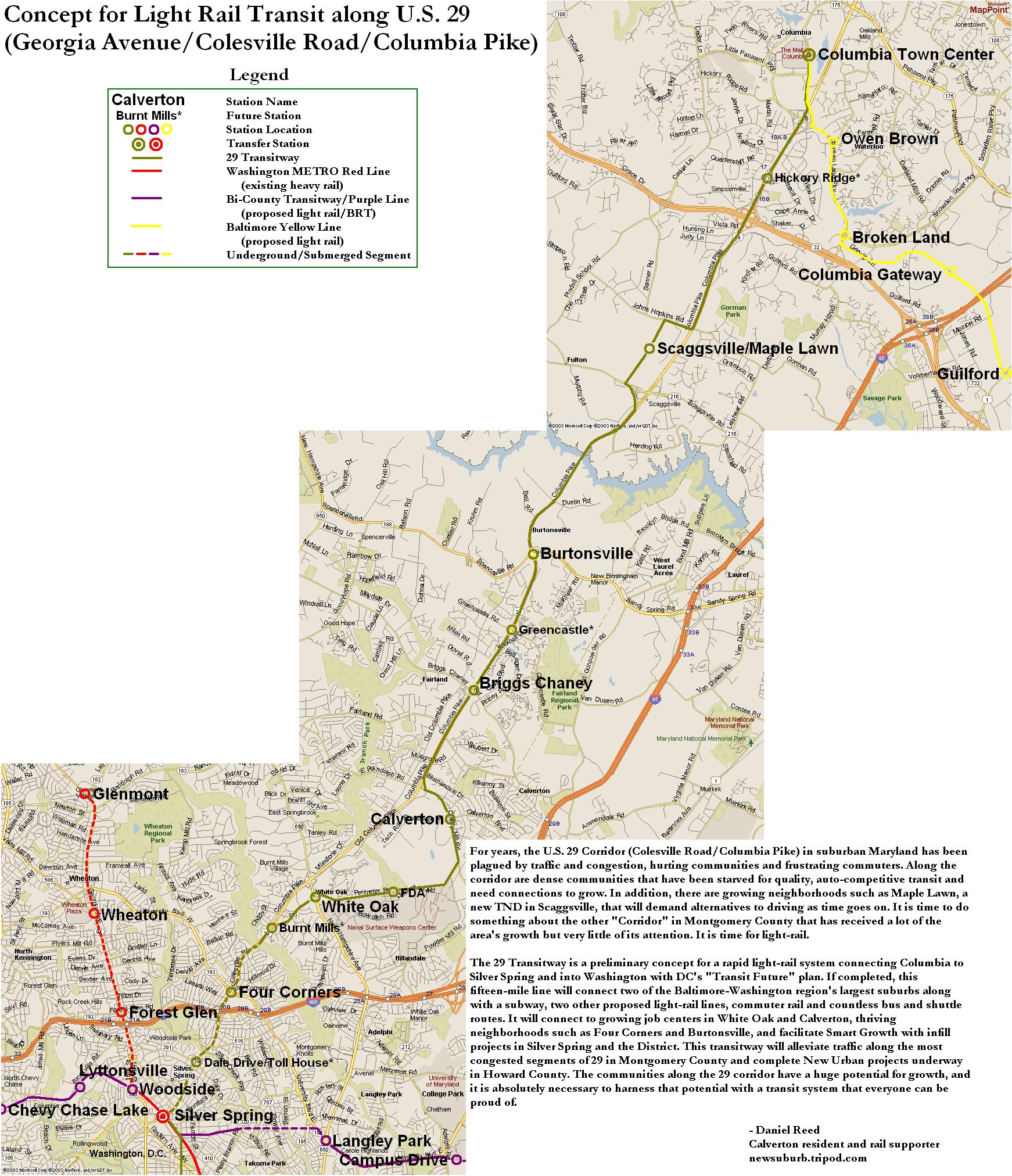
CMTA, if you want light rail connecting Columbia to the city, why not push for the US-29 light rail project that was once promised to run from Silver Spring to Columbia? A direct route to the city, not a circuitous one, that hits several established communities along the way is what Central Maryland Transit Alliance ought to be seeking. I don't know how long Dan Reed's alignment (linked above) would take to get from Columbia to downtown DC, but I bet it's faster than 69 minutes.
And if Maryland does decide to run light rail further away from Baltimore, can you at least make some effort to hit the 50,000+ job center at Fort Meade before it is completely choking the region with traffic? I bet you a rail right-of-way that a lot of those employees live in Columbia.
The Green Line extension will hit developed areas in a large city with a burgeoning centralized train system in place. This is smart. The Yellow Line extension will connect Columbia to downtown Baltimore on a very long, very circuitous route that by-passes Fort Meade, the largest employment center in the state of Maryland.
Baltimore City needs transit connections. It needs an expanded system. It needs a centralized system. A Yellow Line extension would bolster businesses in Columbia and Towson. These are decentralized locations. A Green Line extension would bolster more centralized business districts like the Belair Road and Harford Road corridors. These are centralized areas. Baltimore has been decentralizing for fifty years, and it's not working.
From Columbia, the Yellow Line would take 42 minutes to get to BWI Airport, and then another 27 to get to downtown Baltimore. An hour and nine minutes to get from Columbia to Baltimore. The northern section of the Yellow Line is actually a good idea, connecting several colleges along a main thoroughfare through the city proper. But the southern portion is as circuitous and useless as the current plan for the CCT in Gaithersburg.
CMTA, if you want light rail connecting Columbia to the city, why not push for the US-29 light rail project that was once promised to run from Silver Spring to Columbia? A direct route to the city, not a circuitous one, that hits several established communities along the way is what Central Maryland Transit Alliance ought to be seeking. I don't know how long Dan Reed's alignment (linked above) would take to get from Columbia to downtown DC, but I bet it's faster than 69 minutes.
And if Maryland does decide to run light rail further away from Baltimore, can you at least make some effort to hit the 50,000+ job center at Fort Meade before it is completely choking the region with traffic? I bet you a rail right-of-way that a lot of those employees live in Columbia.
Friday, July 3, 2009
Imagine a Better Rail Link to Frederick
I have always hated Interstate 270. Always. It is a little confusing with the local and HOV lanes. It is much, much wider than it ought to be, creating huge bottlenecks in northern Montgomery County and at the Beltway. It is preposterously ugly, unbearably congested, and I feel particularly unsafe driving it. It is, in my humble opinion, very poorly planned. The last thing we need is more of it. But that is what they want to give us.
Lots of people travel this corridor in both directions every day. Frederick County has a population of a quarter million and growing. The Bethesda-Gaithersburg-Frederick corridor has a population encroaching on five times that number, or roughly 20% of the Metropolitan area population. Downtown DC and Frederick are about 40 miles apart from each other. So this is a long corridor with a lot of people on it. A transportation solution must be found.
Obviously MARC's Brunswick Line is not getting it done. Its circuitous route through Brunswick adds several additional miles to the trip. Stops at small stations like Garrett Park, Washington Grove, Boyds, Barnesville, and Dickerson. Only 7000 people are riding this line daily (warning: pdf), and it is pushing its capacity. Even MARC's 2035 plan (pdf) only raise the capacity 26,000 per day (pdf). Meanwhile, between 75,000 and 108,000 vehicles clog I-270 every day. Imagine if we were talking about a solution that was faster than an expanded freeway or an improved MARC.
Widening I-270 is a colossal failure of an idea. Creating a bigger bottleneck at the Beltway for commuters from Frederick is just going to increase the number of cars that will sit on the parking lot that is 270 southbound in the morning. Here is my vision for a rail solution:
View Frederick Line in a larger map
If local transit (light rail, buses, etc.) ferried these commuters to a few stations, the trains could make fewer stops and travel at higher speeds. A system like this, I envision an average speed of 90 mph. Eight stops along the way, that's it. Stops at major transit centers and major suburbs along I-270.
There is nothing on the books for a direct high speed service between DC and Frederick. There are plenty of other transit priorities at this time. And I understand that some people have no choice but to drive to their jobs. I am one of them. But I live six miles from my job. If I am going to subsidize someone else's extra-long commute, I want to do it with a system that will work, not one that will only increase the number of cars that are wasting fuel while sitting idly on a congested freeway.
Lots of people travel this corridor in both directions every day. Frederick County has a population of a quarter million and growing. The Bethesda-Gaithersburg-Frederick corridor has a population encroaching on five times that number, or roughly 20% of the Metropolitan area population. Downtown DC and Frederick are about 40 miles apart from each other. So this is a long corridor with a lot of people on it. A transportation solution must be found.
Obviously MARC's Brunswick Line is not getting it done. Its circuitous route through Brunswick adds several additional miles to the trip. Stops at small stations like Garrett Park, Washington Grove, Boyds, Barnesville, and Dickerson. Only 7000 people are riding this line daily (warning: pdf), and it is pushing its capacity. Even MARC's 2035 plan (pdf) only raise the capacity 26,000 per day (pdf). Meanwhile, between 75,000 and 108,000 vehicles clog I-270 every day. Imagine if we were talking about a solution that was faster than an expanded freeway or an improved MARC.
Widening I-270 is a colossal failure of an idea. Creating a bigger bottleneck at the Beltway for commuters from Frederick is just going to increase the number of cars that will sit on the parking lot that is 270 southbound in the morning. Here is my vision for a rail solution:
View Frederick Line in a larger map
If local transit (light rail, buses, etc.) ferried these commuters to a few stations, the trains could make fewer stops and travel at higher speeds. A system like this, I envision an average speed of 90 mph. Eight stops along the way, that's it. Stops at major transit centers and major suburbs along I-270.
There is nothing on the books for a direct high speed service between DC and Frederick. There are plenty of other transit priorities at this time. And I understand that some people have no choice but to drive to their jobs. I am one of them. But I live six miles from my job. If I am going to subsidize someone else's extra-long commute, I want to do it with a system that will work, not one that will only increase the number of cars that are wasting fuel while sitting idly on a congested freeway.
Thursday, June 25, 2009
Imagine A Seperate Green and Yellow Line
Naturally, there has been much written about the terrible Metro crash on the Red Line earlier this week. Had this been a nasty pile-up on the Beltway, we might have heard about it by by this point, we probably would have stopped talking about it by now, and it certainly never would have been international news. It is out of the ordinary, tragic, and was a failure of public infrastructure, unlike traffic accidents, which are usually the failures of individual drivers (we'll forgo the argument that fault may lie in road design). The fact that service disruptions continue on the Red Line is another reminder of this horrible accident. After all, these disruptions have a far greater impact on Metro than a bad traffic accident has on area highways.
If there is an accident on US-29 in Montgomery County, I can drive on Georgia or New Hampshire Avenues. But the stations that were shut down the past couple days isolated eastern Montgomery County from the rest of the Metro System. Originally, I tinkered with a map showing a separated Yellow Line for the sake of greater capacity and more geographic coverage for the Metro System. This week's accident has shown that adding redundancy to the system can be just as valuable as adding capacity.
Realizing the need for more redundancy on the system in the wake of this tragic crash is not an original idea. The Purple Line would obviously create alternate routes throughout the system. The Purple Line is both necessary and long overdue, however separating the Yellow and Green Lines would add capacity to existing track, much like separating the Blue and Orange Lines. In the case of the Yellow Line, it would allow for increased capacity on its Potomac River Bridge. If separated, the entire Green Line and the Yellow Line north of Pentagon would have the same capacity as the Red Line.
Here's what I would do with a separate Yellow Line:
View Separate Yellow Line in a larger map
This alignment is not 100% original either. Bringing Metro to North Capitol Street and Georgia Avenue is in no way a new idea. In these cases, however, people seem to want it for the geographic coverage, and not the additional capacity or system redundancy. Coverage is good, it brings transit to a new area. Capacity and redundancy, however, improve the entire system.
Perhaps I added a few too many stations, but they are just suggestions. While this would add service to the North Capitol Street and Georgia Avenue corridors, it would add redundancy to both the Green and Red Lines via Silver Spring, Georgia Av/Petworth, Union Station, and L'Enfant Plaza.
If this line existed already, the station closures on the Red Line might only have meant an additional transfer for Montgomery County commuters instead of the shuttle services to which Metro resorted after the crash.
If there is an accident on US-29 in Montgomery County, I can drive on Georgia or New Hampshire Avenues. But the stations that were shut down the past couple days isolated eastern Montgomery County from the rest of the Metro System. Originally, I tinkered with a map showing a separated Yellow Line for the sake of greater capacity and more geographic coverage for the Metro System. This week's accident has shown that adding redundancy to the system can be just as valuable as adding capacity.
Realizing the need for more redundancy on the system in the wake of this tragic crash is not an original idea. The Purple Line would obviously create alternate routes throughout the system. The Purple Line is both necessary and long overdue, however separating the Yellow and Green Lines would add capacity to existing track, much like separating the Blue and Orange Lines. In the case of the Yellow Line, it would allow for increased capacity on its Potomac River Bridge. If separated, the entire Green Line and the Yellow Line north of Pentagon would have the same capacity as the Red Line.
Here's what I would do with a separate Yellow Line:
View Separate Yellow Line in a larger map
This alignment is not 100% original either. Bringing Metro to North Capitol Street and Georgia Avenue is in no way a new idea. In these cases, however, people seem to want it for the geographic coverage, and not the additional capacity or system redundancy. Coverage is good, it brings transit to a new area. Capacity and redundancy, however, improve the entire system.
Perhaps I added a few too many stations, but they are just suggestions. While this would add service to the North Capitol Street and Georgia Avenue corridors, it would add redundancy to both the Green and Red Lines via Silver Spring, Georgia Av/Petworth, Union Station, and L'Enfant Plaza.
If this line existed already, the station closures on the Red Line might only have meant an additional transfer for Montgomery County commuters instead of the shuttle services to which Metro resorted after the crash.
Wednesday, January 7, 2009
Another Great Metro Vision
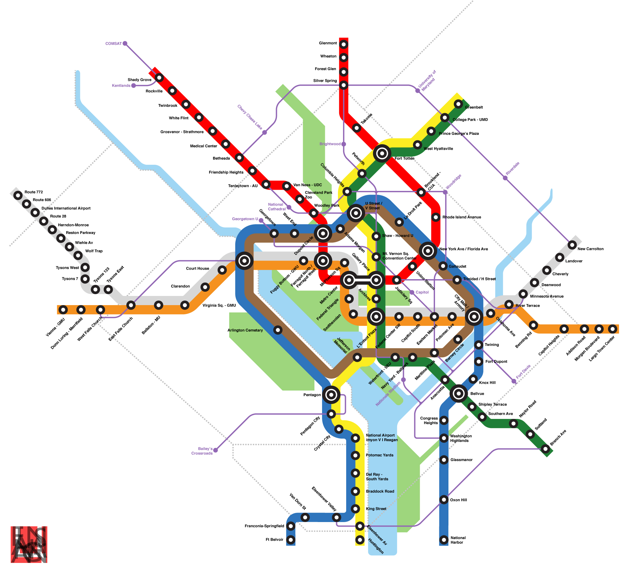
Beyond DC, GGW, and Track Twenty Nine have all done incredible visions of what Metro could look like in the future. Now Цаrьchitect has envisioned something entirely different for the Blue Line.

I highly recommend checking Цаrьchitect's map and his description of the proposal. One of these days, I promise I'll get my own out onto the internet.
I highly recommend checking Цаrьchitect's map and his description of the proposal. One of these days, I promise I'll get my own out onto the internet.
Wednesday, December 17, 2008
High(way) Speed Rail
Beyond DC has a great post about the Department of Transportation soliciting proposals for high speed rail corridors. This is a great development, one step closer to catching up to the rest of the civilized world with a real train network.
As these corridors are planned, I really hope there is a serious effort to build the HSR lines along interstate highways. This minimizes the need for right-of-way acquisition, and it makes our interstate corridors multi-modal. I imagine in some areas it may drive up the cost of construction, but as long as we have these corridors already built and engineered for high speeds, I believe it makes the most sense to put the trains there too.
In any event, I'm very excited about the prospect of being able to hop a train to Chicago and get there in less than 20 hours. With any luck, I'll be able to do that before I retire.
As these corridors are planned, I really hope there is a serious effort to build the HSR lines along interstate highways. This minimizes the need for right-of-way acquisition, and it makes our interstate corridors multi-modal. I imagine in some areas it may drive up the cost of construction, but as long as we have these corridors already built and engineered for high speeds, I believe it makes the most sense to put the trains there too.
In any event, I'm very excited about the prospect of being able to hop a train to Chicago and get there in less than 20 hours. With any luck, I'll be able to do that before I retire.
Tuesday, November 18, 2008
I Thought Crime Took Transit?
Last month, the ridiculous argument that transit brings crime into the innocent little suburbs was revisited in response to this article in Freakonomics. More recently, Just Up the Pike followed a shooting that occurred on a Silver Spring bus recently, prompting more discussion on the possibility that mass transit has an effect on crime.
I eventually had to defend this argument to a good friend of mine who happens to be a Baltimore City police officer. His anecdotal claim: the subway in Baltimore has done absolutely nothing to positively impact the safety of the surrounding areas, and if anything has made them worse.
I argue that it has more to do with the bad urbanism for which the Baltimore Metro is now notorious. I believe even bad transit can positively impact crime rates in many cases, if for no other reason than by potentially lowering the cost of living. But perhaps the fact of the presence of transit has no impact on crime whatsoever, perhaps the onus lies entirely on the good urbanism that ought to come with transit. Maybe large, spread out parking lots are what really draw crime. Many transit stations have those, and it's bad urbanism. I certainly feel much safer getting off at Gallery Place late at night versus Greenbelt for that reason.
Recently, some federal employees at Fort Meade received an email alert cautioning them to stay away from Arundel Mills Mall after dark. Think about that: stay away from the largest shopping center in Central Maryland while the holiday shopping rush looms upon us. Why? Inside Charm City points toward this Baltimore Sun article that tells of a woman and her young child being robbed at gunpoint in the parking lot. Most disturbing is the fact that police believe that this crime is unrelated to two other robberies that took place around the giant oasis of auto-oriented commerce near the MD-100 interchange with the Baltimore-Washington Parkway. I did some further pecking and found another Sun article published just Thursday. There have been five robberies in the Arundel Mills parking lot in just the last month. Concerns over the robberies were echoed on MyFoxDC.
Urbanism doesn't get much worse than at Arundel Mills:
View Larger Map
But in most of the robberies reported there, did the criminals hop on the light rail back to Baltimore city? No, they hopped into a car and then disappeared into traffic. But no one ever says "That new highway is going to bring more crime!"
I eventually had to defend this argument to a good friend of mine who happens to be a Baltimore City police officer. His anecdotal claim: the subway in Baltimore has done absolutely nothing to positively impact the safety of the surrounding areas, and if anything has made them worse.
I argue that it has more to do with the bad urbanism for which the Baltimore Metro is now notorious. I believe even bad transit can positively impact crime rates in many cases, if for no other reason than by potentially lowering the cost of living. But perhaps the fact of the presence of transit has no impact on crime whatsoever, perhaps the onus lies entirely on the good urbanism that ought to come with transit. Maybe large, spread out parking lots are what really draw crime. Many transit stations have those, and it's bad urbanism. I certainly feel much safer getting off at Gallery Place late at night versus Greenbelt for that reason.
Recently, some federal employees at Fort Meade received an email alert cautioning them to stay away from Arundel Mills Mall after dark. Think about that: stay away from the largest shopping center in Central Maryland while the holiday shopping rush looms upon us. Why? Inside Charm City points toward this Baltimore Sun article that tells of a woman and her young child being robbed at gunpoint in the parking lot. Most disturbing is the fact that police believe that this crime is unrelated to two other robberies that took place around the giant oasis of auto-oriented commerce near the MD-100 interchange with the Baltimore-Washington Parkway. I did some further pecking and found another Sun article published just Thursday. There have been five robberies in the Arundel Mills parking lot in just the last month. Concerns over the robberies were echoed on MyFoxDC.
Urbanism doesn't get much worse than at Arundel Mills:
View Larger Map
But in most of the robberies reported there, did the criminals hop on the light rail back to Baltimore city? No, they hopped into a car and then disappeared into traffic. But no one ever says "That new highway is going to bring more crime!"
Friday, October 31, 2008
cArmy Base: Fort Meade
Military bases dot the landscape all around the Capital region. This is a unique presence, as many cities in America are largely defined by the one or two military bases near their boundaries, cities like Fayetteville, NC; Pensacola, FL; Kileen, TX; Norfolk, VA; and even San Diego, CA. Washington, DC, however, is home to the entire Federal Government, so the fact of a few military bases is pocket change in comparison. among the more prominent is a WWI-era base halfway between DC and Baltimore called Fort George G. Meade.
Nestled at the northeast corner of the junction of the Baltimore-Washington Parkway and MD-32, Fort Meade is by far the largest single job center in the state of Maryland and, after Downtown and Tysons Corner, the third largest in the metro area, and this does not account for National Business Park, a huge complex of government contractor buildings right across the B-W Parkway. Fort Meade is home to tens of thousands of military personnel from all five branches, plus retirees. It houses several major Army units, including the Defense Information School, Defense Courier Service, and the US Army Field Band. The Environmental Protection Agency has a large facility, and let's not forget about the National Security Agency, which housed over 30,000 jobs according to James Bamford's 2000 book Body of Secrets. No doubt that number has increased in recent years. Additionally, 5,700 jobs are being relocated to Fort Meade in the Base Relocation and Closure.
The continued growth of the base is of great concern, considering the institutional problems within the defense department when it comes to planning policy. The Pentagon, for example, sits atop two lines of Metro, yet it still has the largest surface parking lot in Arlington County. Fort Meade's total surface parking rivals (if not overtakes) FedEx Field's. This is particularly alarming considering the surface parking's negative effects on storm water runoff into the adjacent Patuxent Research Refuge (to the point where the NSA has an entire section devoted to it on its website). But the base's planning priority? Two 18 hole golf courses to "maintain soldiers' quality of life".
Surely with all these jobs, thousands of residents, and an explosion of growth in the near future, there must be some kind of transit node on the base, right? Not really.
The base is served by a single bus, a 24-seater that runs only twice in the morning and twice in the evening and serves only portions of the city of Laurel to the NSA's main gate. Various agencies on the base offer shuttles that run a few times a day from the Odenton and Savage MARC stations, which are two and five miles from the NSA main gate, respectively, and each three miles from the nearest regular base gate. It is literally illegal to walk any of those routes, as they are largely along MD-32, a freeway of interstate standards. Even servicemen living on base are likely to commute by car, as the base is so spread out that it is a long walk from any of the housing to any of the jobs on post, including almost all of the shopping and recreation amenities.
The first thing I did when I got stationed at Fort Meade? Buy a car. Sure, I wanted a car to go home and visit my family regularly. But I would not have been able to attend my morning physical training without a car. And this was when I lived in the battalion barracks!
So what do you care about a base 20 miles outside of DC?
Consider that a traffic nightmare reaching the base would have a major impact on transportation between Baltimore and Washington. The economic impacts of the resulting disconnect between the two cities could be drastic. Ryan Avent considered the positive impacts that a high speed rail between DC and Baltimore would provide. clogging the highways between the two cities would likely have the opposite effect.
I have often considered Fort Meade an ideal place for the Baltimore and Washington rail systems to meet. I know many detractors consider it wasteful to run the system all the way out to Fort Meade. But smaller jobs centers in Chantilly and Reston, similarly unserved by transit currently will be getting Silver Line service within a decade. And transportation implications in northwestern Fairfax County do not affect passage between two major cities. Other bases involved in the BRAC, such as Andrews AFB, Bolling AFB, Fort Belvoir, and Bethesda Naval Medical Center, have all had plenty of proposals thrown around to improve transit access to the bases (in some cases, like Bolling and Bethesda Naval, increasing existing transit efficiency). Fort Meade has not, despite the unique opportunity of potentially being able to serve the base by two major cities' transit systems. To alleviate traffic at enormous (50,000+) job centers, connector shuttles from commuter rails (i.e. a necessary modal shift) just won't do the trick. Perhaps for a Metro station, the NSA could donate some of it's 900+ acres of parking.
But today, long before ground will ever be broken on any kind of rail connections, wouldn't it at LEAST be appropriate for Fort Meade to receive some sort of express bus service from Greenbelt Metro? Perhaps more regular service from towns like Columbia, Laurel, Odenton and Annapolis? A bus system for the base itself so that a young GI doesn't have to waste his first few paychecks on a new car?
It blows my mind that 18 year old privates are not allowed to drink alcohol, but they are expected to be mature enough to finance, purchase, insure, and properly operate their own heavy machinery, which they may legally store on base free of charge. Shame on Army bases across the country, but particularly Fort Meade, which has the resources nearby to outgrow ridiculous and deleterious planning policies. For a service known for moving on foot, the Army's bases certainly don't embrace any mode of transportation beyond the car.
Nestled at the northeast corner of the junction of the Baltimore-Washington Parkway and MD-32, Fort Meade is by far the largest single job center in the state of Maryland and, after Downtown and Tysons Corner, the third largest in the metro area, and this does not account for National Business Park, a huge complex of government contractor buildings right across the B-W Parkway. Fort Meade is home to tens of thousands of military personnel from all five branches, plus retirees. It houses several major Army units, including the Defense Information School, Defense Courier Service, and the US Army Field Band. The Environmental Protection Agency has a large facility, and let's not forget about the National Security Agency, which housed over 30,000 jobs according to James Bamford's 2000 book Body of Secrets. No doubt that number has increased in recent years. Additionally, 5,700 jobs are being relocated to Fort Meade in the Base Relocation and Closure.
The continued growth of the base is of great concern, considering the institutional problems within the defense department when it comes to planning policy. The Pentagon, for example, sits atop two lines of Metro, yet it still has the largest surface parking lot in Arlington County. Fort Meade's total surface parking rivals (if not overtakes) FedEx Field's. This is particularly alarming considering the surface parking's negative effects on storm water runoff into the adjacent Patuxent Research Refuge (to the point where the NSA has an entire section devoted to it on its website). But the base's planning priority? Two 18 hole golf courses to "maintain soldiers' quality of life".
Surely with all these jobs, thousands of residents, and an explosion of growth in the near future, there must be some kind of transit node on the base, right? Not really.
The base is served by a single bus, a 24-seater that runs only twice in the morning and twice in the evening and serves only portions of the city of Laurel to the NSA's main gate. Various agencies on the base offer shuttles that run a few times a day from the Odenton and Savage MARC stations, which are two and five miles from the NSA main gate, respectively, and each three miles from the nearest regular base gate. It is literally illegal to walk any of those routes, as they are largely along MD-32, a freeway of interstate standards. Even servicemen living on base are likely to commute by car, as the base is so spread out that it is a long walk from any of the housing to any of the jobs on post, including almost all of the shopping and recreation amenities.
The first thing I did when I got stationed at Fort Meade? Buy a car. Sure, I wanted a car to go home and visit my family regularly. But I would not have been able to attend my morning physical training without a car. And this was when I lived in the battalion barracks!
So what do you care about a base 20 miles outside of DC?
Consider that a traffic nightmare reaching the base would have a major impact on transportation between Baltimore and Washington. The economic impacts of the resulting disconnect between the two cities could be drastic. Ryan Avent considered the positive impacts that a high speed rail between DC and Baltimore would provide. clogging the highways between the two cities would likely have the opposite effect.
I have often considered Fort Meade an ideal place for the Baltimore and Washington rail systems to meet. I know many detractors consider it wasteful to run the system all the way out to Fort Meade. But smaller jobs centers in Chantilly and Reston, similarly unserved by transit currently will be getting Silver Line service within a decade. And transportation implications in northwestern Fairfax County do not affect passage between two major cities. Other bases involved in the BRAC, such as Andrews AFB, Bolling AFB, Fort Belvoir, and Bethesda Naval Medical Center, have all had plenty of proposals thrown around to improve transit access to the bases (in some cases, like Bolling and Bethesda Naval, increasing existing transit efficiency). Fort Meade has not, despite the unique opportunity of potentially being able to serve the base by two major cities' transit systems. To alleviate traffic at enormous (50,000+) job centers, connector shuttles from commuter rails (i.e. a necessary modal shift) just won't do the trick. Perhaps for a Metro station, the NSA could donate some of it's 900+ acres of parking.
But today, long before ground will ever be broken on any kind of rail connections, wouldn't it at LEAST be appropriate for Fort Meade to receive some sort of express bus service from Greenbelt Metro? Perhaps more regular service from towns like Columbia, Laurel, Odenton and Annapolis? A bus system for the base itself so that a young GI doesn't have to waste his first few paychecks on a new car?
It blows my mind that 18 year old privates are not allowed to drink alcohol, but they are expected to be mature enough to finance, purchase, insure, and properly operate their own heavy machinery, which they may legally store on base free of charge. Shame on Army bases across the country, but particularly Fort Meade, which has the resources nearby to outgrow ridiculous and deleterious planning policies. For a service known for moving on foot, the Army's bases certainly don't embrace any mode of transportation beyond the car.
Friday, October 24, 2008
Crime Rides the Train
I have seen a million things like this since I started reading about mass transit expansion. Ryan Avent pointed me towards this article complaining about crime rising in a shopping center once a transit connection was made in East St. Louis. Mass transit will connect ruffians to places decent people like to shop. Reminds me of the Purple Line. I've established a modest readership of decent people, so I'll subdue my urge to curse like I did back in my Army days.
I'll admit, mass transit can get groups of people to visit areas they might not otherwise visit. Silver Spring is a good example, with its Red Line and ample bus line service, clientele from Northeast DC flocks to the area regularly. Are we to view this as a bad thing?
Fact of the matter is, kids from Northeast flock to down town Silver Spring because there is nothing to do in a good sized chunk of Northeast. Fortunately, Silver Spring is a very diverse area, and only a minority take issue with "bad city people" impacting their quality of life.
This xenophobic and often racist attitude is, in my opinion, largely counter productive. First of all, transit access does not increase crime. It may relocate some of it, but the fact of the matter is that right now, roads could just as easily connect criminals with whatever hangouts much easier than trains do.
Now, what do we do if crime moves into our lovely Christian suburb? You stand up to it, and make it known that it is not tolerated in Bethesda or Silver Spring or Falls Church. Then perhaps that mentality will follow the would-be thugs back to Hillcrest Heights or Deanwood, where perhaps they will be that much less tolerant of crime in their own neighborhood. Perhaps allowing people to take advantage of these wonderful amenities will inspire them to go back to Trinidad or Chillum and demand those amenities in their neighborhood, which might give the kids there something to do, and keep them off of crime. Who knows, maybe one day you'll leave your little upper-middle class bubble in Great Falls or Olney or Potomac and visit the shops at Langley Park or a new restaurant in Benning Ridge.
The change is going on right now in Anacostia, Hyattsville, and Capitol Heights.
But if we as a society are going to quarantine "undesirable" people to the "undesirable" parts of town, we are only guaranteeing that they will remain undesirable.
Besides, who gets to decide what is "undesirable"? Perhaps it is undesirable for lower income residents in parts of the region to be required to spend a good portion of their paycheck on an automobile to get to their job. Perhaps it is undesirable for University of Maryland students to trek a mile to the Metro station because the same type of xenophobia kept the train far from the campus.
I've lived in this area my entire life. Let me assure you that as recent as 20 years ago, there were parts of Georgetown that most well intentioned suburbanites wouldn't dream of visiting. While I was in high school in the mid 1990's, Columbia Heights was considered unsafe, and there were was practically nothing to do there. As recent as five years ago, the US Army banned soldiers at Fort Meade to go to Near Southeast unless they had some kind of official business there.
Without transit, U Street probably never would have recovered from the 1968 riots. NoMa would be just a bunch of empty parking lots. The Rosslyn-Ballston corridor would just be a bunch of derelict garages and warehouses. Rockville Pike would look more like Route 1 in Howard County.
So to Saint Louis, I say stand up to the crime there. Force that agenda on anyone wishing to visit the nicer parts of your town. force them to bring that back to East Saint Louis, and eventually it will be a place you might want to go visit. That's what we do here in DC.

I'll admit, mass transit can get groups of people to visit areas they might not otherwise visit. Silver Spring is a good example, with its Red Line and ample bus line service, clientele from Northeast DC flocks to the area regularly. Are we to view this as a bad thing?
Fact of the matter is, kids from Northeast flock to down town Silver Spring because there is nothing to do in a good sized chunk of Northeast. Fortunately, Silver Spring is a very diverse area, and only a minority take issue with "bad city people" impacting their quality of life.
This xenophobic and often racist attitude is, in my opinion, largely counter productive. First of all, transit access does not increase crime. It may relocate some of it, but the fact of the matter is that right now, roads could just as easily connect criminals with whatever hangouts much easier than trains do.
Now, what do we do if crime moves into our lovely Christian
The change is going on right now in Anacostia, Hyattsville, and Capitol Heights.
But if we as a society are going to quarantine "undesirable" people to the "undesirable" parts of town, we are only guaranteeing that they will remain undesirable.
Besides, who gets to decide what is "undesirable"? Perhaps it is undesirable for lower income residents in parts of the region to be required to spend a good portion of their paycheck on an automobile to get to their job. Perhaps it is undesirable for University of Maryland students to trek a mile to the Metro station because the same type of xenophobia kept the train far from the campus.
I've lived in this area my entire life. Let me assure you that as recent as 20 years ago, there were parts of Georgetown that most well intentioned suburbanites wouldn't dream of visiting. While I was in high school in the mid 1990's, Columbia Heights was considered unsafe, and there were was practically nothing to do there. As recent as five years ago, the US Army banned soldiers at Fort Meade to go to Near Southeast unless they had some kind of official business there.
Without transit, U Street probably never would have recovered from the 1968 riots. NoMa would be just a bunch of empty parking lots. The Rosslyn-Ballston corridor would just be a bunch of derelict garages and warehouses. Rockville Pike would look more like Route 1 in Howard County.
So to Saint Louis, I say stand up to the crime there. Force that agenda on anyone wishing to visit the nicer parts of your town. force them to bring that back to East Saint Louis, and eventually it will be a place you might want to go visit. That's what we do here in DC.
Monday, October 6, 2008
Ambitious Transit Advocacy
I really liked a point Ryan Avent made this week:
This is an excellent point, and one that ought to be further explored within the DC metropolitan region. We can build roads to support future development, but rails? Forget it. Furthering this point, Richard Layman had a good post on the sort of fundamental paradigm shifts we will to need to undergo in order to take the economic and environmental burden out of transit provision.
But if we could build rails anticipating future developments, I believe areas such as incorporated, close-in, traditionally-built suburban towns ought to be among the to speculate transit expansions. Incorporated towns because the local government may have a shorter route to approving smarter development around transit, close in so that they are relevant to the heart of the transit system, and traditionally-built neighborhoods because the open connectivity is conducive to residents reaching the transit station. Places like Hyattsville, Takoma Park, Kensington, Falls Church, and Forest Heights ought to be considered for such speculation.
 I have been toying around in Google Earth trying to imagine a transit system for the DC area that would make it easy to live anywhere in the region without a car, much like Manhattan. It is probably not a very feasible system, with 14 lines and 550+ miles of heavy and light rail track, plus the fact that my quasi-scientific formulas for designing my system have no way of predicting ridership or optimal routes. But I'm kind of curious as to why the DC metropolitan area and other cities aren't advocating for such a system that takes cars off the roads.
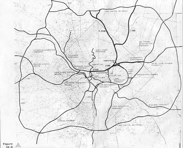
The extremely ambitious highway plan of half a century ago makes such a system of passenger trains seem rather small. Freeway revolts nixed much of the more detrimental inner city freeways, however much of the freeway infrastructure in our region has come to fruition. Remember, freeways don't necessarily have to be interstates (much like Metro doesn't necessarily have to be heavy rail, it can be light rail)
Below, I've listed the limited access divided freeways of our region (DC, plus Montgomery, Prince George's, Arlington, Fairfax and northeastern Prince William County and Alexandria City) Lengths approximate:
Mostly or completely pure freeway:
I-95 Maryland (College Park to Howard County) 8 miles
MD/DC-295, Balt-Wash Parkway (Anacostia to Fort Meade) 21 miles
I-495, Capital Beltway (loop around the city) 66 miles
I-270 (Bethesda to Frederick) 33 miles
I-95/395, Shirley Highway (Dale City to Downtown) 26 miles
I-295, Anacostia/Southeast Freeway (Oxon Hill to Downtown) 8 miles
Suitland Parkway (Anacostia to Andrews AFB) 10 miles
US-50, John Hanson Highway (Cheverly to Annapolis) 25 miles
US-50, Arlington Boulevard (Merrifield to The Mall) 11 miles
I-66 Custis Memorial Freeway (Gainesville to The Mall) 32 miles
Clara Barton Parkway (Georgetown to Potomac, MD) 10 miles
I-370/MD-200, Intercounty Connector (Gaithersburg to Laurel, under construction) 18 miles
George Washington Memorial Parkway (Alexandria to Great Falls) 15 miles
Dulles Toll Road/Greenway (Arlington to Loudon County) 16 miles
Key Br/Whitehurst Fwy/Potomac River Fwy (Rosslyn to The Mall) 2 miles
US-29, Columbia Pike (Silver Spring to Howard County) 11 miles
MD-4 Pennsylvania Avenue (Suitland to Anne Arundel County) 11 miles
MD-5 Branch Avenue (Suitland to Brandywine) 12 miles
VA-28 Sully Road (Manassas to Dulles International Airport) 21 miles
Montrose Parkway (Rockville) 4 Miles
Rock Creek Parkway (Woodley Park to The Mall) 3 miles
Rapidly becoming pure freeways:
US-301, Blue Star Memorial Highway (Bowie to Waldorf) 26 miles
MD-210, Indian Head Highway (Forest Heights to Accokeek) 11 miles
VA-7100, Fairfax County Parkway (Herndon to Springfield) 35 miles
VA-3000, Prince William Parkway (Woodbridge to Manassas) 16 miles
451 miles of freeway in Washington DC and adjacent counties. Sure makes the downtown sections that didn't get built seem like small apples. This doesn't include "mini freeways" embedded into the traffic system. It does not include the express tunnels on North Capitol, South Capitol, Connecticut Avenue, Massachusetts Avenue, or K Street. Nor do they include spur freeways like the Cabin John Parkway, 270 spur, Spout Run Parkway, or the E Street Expressway. Nor does it include roads that become freeways for short stretches, like Central Avenue in Largo, Military Road west of 14th Street, North Capitol Street north of the Hospitals, or Franconia Road in Springfield. Nor does it include interchanges at non-freeways, like Tyson's Corner, Glenmont, University Boulevard at Route 1, or Kingle Road. Nor does it take into account express lanes, HOV lanes, or exit ramps. I figure all of this combined ought to add up to at least 100 miles.
I'm curious about the percentage of area residents that live within walking distance to fixed transit versus the percentage of area residents that live within walking distance to a freeway or an interchange. I'd be willing to bet that the latter is the larger number. If highways can have their 550 miles of coverage, why not rails?
Perhaps highway advocates threw a bunch of ideas at the wall to see what stuck. Perhaps it was the relentless lobbying. But whatever it is, it is the highway lobby had more ambition than our current transit advocacy currently exudes. If we can emulate one thing from the freeway lobby of the mid-20th Century, it is the ambitious fortitude with which they lobbied for what ultimately became the largest public works project in world history.
I'm not going to settle for a transit system that doesn't allow most of the metropolitan area to survive without an automobile. I'm going to keep pushing for my 550 miles of fixed rail.
The point that highways are built speculatively all the time while transit is not is a very good one, and one which never fails to get my goat. But I think it’s worth emphasizing that speculative transit isn’t really about building lines into the wilderness. It’s about building lines into places people already live in order to take better advantage of valuable land there.
For instance, if we imagine a sunbelt boomtown, it’s easy to see an exurban ring road being built to accommodate “future development.” At the same time, a rail transit system through the downtown area would be nixed in a heartbeat because that area lacked an appropriate density for transit. But transportation linkages shape development whether they’re road or rail. When you fail to use the same speculative criteria for one mode that you do for another, you are making a judgment about what kind of development is appropriate. For decades, government has essentially said that in the overwhelming majority of cases, auto-oriented development is appropriate and nothing else. Considering the effects of that decision, it must be one of the most momentous government interventions of all time.
This is an excellent point, and one that ought to be further explored within the DC metropolitan region. We can build roads to support future development, but rails? Forget it. Furthering this point, Richard Layman had a good post on the sort of fundamental paradigm shifts we will to need to undergo in order to take the economic and environmental burden out of transit provision.
But if we could build rails anticipating future developments, I believe areas such as incorporated, close-in, traditionally-built suburban towns ought to be among the to speculate transit expansions. Incorporated towns because the local government may have a shorter route to approving smarter development around transit, close in so that they are relevant to the heart of the transit system, and traditionally-built neighborhoods because the open connectivity is conducive to residents reaching the transit station. Places like Hyattsville, Takoma Park, Kensington, Falls Church, and Forest Heights ought to be considered for such speculation.
 I have been toying around in Google Earth trying to imagine a transit system for the DC area that would make it easy to live anywhere in the region without a car, much like Manhattan. It is probably not a very feasible system, with 14 lines and 550+ miles of heavy and light rail track, plus the fact that my quasi-scientific formulas for designing my system have no way of predicting ridership or optimal routes. But I'm kind of curious as to why the DC metropolitan area and other cities aren't advocating for such a system that takes cars off the roads.
The extremely ambitious highway plan of half a century ago makes such a system of passenger trains seem rather small. Freeway revolts nixed much of the more detrimental inner city freeways, however much of the freeway infrastructure in our region has come to fruition. Remember, freeways don't necessarily have to be interstates (much like Metro doesn't necessarily have to be heavy rail, it can be light rail)
Below, I've listed the limited access divided freeways of our region (DC, plus Montgomery, Prince George's, Arlington, Fairfax and northeastern Prince William County and Alexandria City) Lengths approximate:
Mostly or completely pure freeway:
I-95 Maryland (College Park to Howard County) 8 miles
MD/DC-295, Balt-Wash Parkway (Anacostia to Fort Meade) 21 miles
I-495, Capital Beltway (loop around the city) 66 miles
I-270 (Bethesda to Frederick) 33 miles
I-95/395, Shirley Highway (Dale City to Downtown) 26 miles
I-295, Anacostia/Southeast Freeway (Oxon Hill to Downtown) 8 miles
Suitland Parkway (Anacostia to Andrews AFB) 10 miles
US-50, John Hanson Highway (Cheverly to Annapolis) 25 miles
US-50, Arlington Boulevard (Merrifield to The Mall) 11 miles
I-66 Custis Memorial Freeway (Gainesville to The Mall) 32 miles
Clara Barton Parkway (Georgetown to Potomac, MD) 10 miles
I-370/MD-200, Intercounty Connector (Gaithersburg to Laurel, under construction) 18 miles
George Washington Memorial Parkway (Alexandria to Great Falls) 15 miles
Dulles Toll Road/Greenway (Arlington to Loudon County) 16 miles
Key Br/Whitehurst Fwy/Potomac River Fwy (Rosslyn to The Mall) 2 miles
US-29, Columbia Pike (Silver Spring to Howard County) 11 miles
MD-4 Pennsylvania Avenue (Suitland to Anne Arundel County) 11 miles
MD-5 Branch Avenue (Suitland to Brandywine) 12 miles
VA-28 Sully Road (Manassas to Dulles International Airport) 21 miles
Montrose Parkway (Rockville) 4 Miles
Rock Creek Parkway (Woodley Park to The Mall) 3 miles
Rapidly becoming pure freeways:
US-301, Blue Star Memorial Highway (Bowie to Waldorf) 26 miles
MD-210, Indian Head Highway (Forest Heights to Accokeek) 11 miles
VA-7100, Fairfax County Parkway (Herndon to Springfield) 35 miles
VA-3000, Prince William Parkway (Woodbridge to Manassas) 16 miles
451 miles of freeway in Washington DC and adjacent counties. Sure makes the downtown sections that didn't get built seem like small apples. This doesn't include "mini freeways" embedded into the traffic system. It does not include the express tunnels on North Capitol, South Capitol, Connecticut Avenue, Massachusetts Avenue, or K Street. Nor do they include spur freeways like the Cabin John Parkway, 270 spur, Spout Run Parkway, or the E Street Expressway. Nor does it include roads that become freeways for short stretches, like Central Avenue in Largo, Military Road west of 14th Street, North Capitol Street north of the Hospitals, or Franconia Road in Springfield. Nor does it include interchanges at non-freeways, like Tyson's Corner, Glenmont, University Boulevard at Route 1, or Kingle Road. Nor does it take into account express lanes, HOV lanes, or exit ramps. I figure all of this combined ought to add up to at least 100 miles.
I'm curious about the percentage of area residents that live within walking distance to fixed transit versus the percentage of area residents that live within walking distance to a freeway or an interchange. I'd be willing to bet that the latter is the larger number. If highways can have their 550 miles of coverage, why not rails?
Perhaps highway advocates threw a bunch of ideas at the wall to see what stuck. Perhaps it was the relentless lobbying. But whatever it is, it is the highway lobby had more ambition than our current transit advocacy currently exudes. If we can emulate one thing from the freeway lobby of the mid-20th Century, it is the ambitious fortitude with which they lobbied for what ultimately became the largest public works project in world history.
I'm not going to settle for a transit system that doesn't allow most of the metropolitan area to survive without an automobile. I'm going to keep pushing for my 550 miles of fixed rail.
Friday, October 3, 2008
MARC =/= Metro
A lot of people criticize me for not liking MARC. I do like MARC, but I don't think it is a viable service to be integrated with Metro, and I think it only truly serves people who live and work along one of the corridors. Since it is not fully integrated with Metro, switching between the two services is an expensive inter-modal shift that deters people from using the system.
MARC's availability is another problem. Right now the system is wildly overcrowded. It only runs during the work week, during the day. The trains are overcrowded, and the availability to add more daily service is hampered by the fact that much of the system shares tracks with CSX and AMTRAK.
What really bothers me about the system is the fact that in the DC Metro area, MARC does not appear to influence transit-oriented development. Sure, some stations have good development, or at least plans for such development: Rockville, Silver Spring, Greenbelt, New Carrollton... of course, those stations all have Metro stations as well.
An excellent example of this would be the Kensington station. Kensington is on the Brunswick Line between Silver Spring and Rockville. Kensington is an incorporated town with a business district adjacent to the train station, but this station has done little to influence pedestrianism like in Rockville and Silver Spring, which have Metro stations. Kensington is merely a confluence of three rivers of cars, with a few office buildings and restaurants surrounded by parking.
View Larger Map of Kensington Lots of Parking fronting traffic gutters
I live on the Camden Line, perhaps the most useless fixed rail line in the region. I'm about halfway between the Laurel and Muirkirk stations. Muirkirk is a middle-of-nowhere station useful only to commuters who drive there from Beltsville. It serves no one. The Konterra development will be just across Rt 1, but it has seemingly little connectivity to the MARC station. It has been implied that Konterra's town center location along I-95 would support a new Metro station along I-95. Laurel is in the blossoming downtown of Laurel, a city of 30,000 people, but the station has little impact on development plans in the city. It seems that more of the development (such as Laurel Commons) has been more in anticipation for a future Metro station a mile or so south on an expanded Green Line.
View Larger Map of Muirkirk Station Office parks and no sidewalks
To make MARC a more viable system, it would require additional tracks along pretty much the entire system. Why not, then, build Metro tracks along the DC, PG, and MoCo portions of the system and connect those areas to the rest of the system with seamless transfers? Leave MARC as it is, a REGIONAL system that gets people between Baltimore, Washington, and Frederick. Heck, add another MARC line to Annapolis. We need MARC, but we can't treat it like a system that integrates areas into the greater transit system of the DC Metropolitan area.
MARC is not a suitable compliment to Metro. It may connect DC and Baltimore, but it doesn't connect Laurel, Bowie, Kensington, and other DC suburbs to the urban fabric of the metropolitan area.
My thoughts on replacing the stations on the lower portion of MARC with Metro:
Brunswick Line: Use the Yellow Line, build a spur at Ft. Totten and run along the Red Line to Silver Spring (Or better yet, run it under Georgia Avenue from Petworth Station to Silver Spring) and then along the Brunswick Line to Rockville.
Penn Line: Instead of terminating the Silver Line at Stadium-Armory, run the Silver Line along the Orange Line to New Carrollton and then extend it up to the BWI stop on the Penn Line. The Silver Line would then connect two major regional airports.
Camden Line: Bring the Green Line up to Laurel. Route One can support the TOD.
Of course this doesn't appear feasible, but as I have mentioned before, I believe our rail initiatives ought to be at least as ambitious as the Freeway Plan of the 1960's. Leave MARC. It is a great redundancy system for traveling between Baltimore and Washington. But instead of giving MARC more tracks, build tracks for a system that is going to effectively enhance the region's ability to develop more environmentally friendly transit-oriented suburbs with convenient transit access.

MARC's availability is another problem. Right now the system is wildly overcrowded. It only runs during the work week, during the day. The trains are overcrowded, and the availability to add more daily service is hampered by the fact that much of the system shares tracks with CSX and AMTRAK.
What really bothers me about the system is the fact that in the DC Metro area, MARC does not appear to influence transit-oriented development. Sure, some stations have good development, or at least plans for such development: Rockville, Silver Spring, Greenbelt, New Carrollton... of course, those stations all have Metro stations as well.
An excellent example of this would be the Kensington station. Kensington is on the Brunswick Line between Silver Spring and Rockville. Kensington is an incorporated town with a business district adjacent to the train station, but this station has done little to influence pedestrianism like in Rockville and Silver Spring, which have Metro stations. Kensington is merely a confluence of three rivers of cars, with a few office buildings and restaurants surrounded by parking.
View Larger Map of Kensington Lots of Parking fronting traffic gutters
I live on the Camden Line, perhaps the most useless fixed rail line in the region. I'm about halfway between the Laurel and Muirkirk stations. Muirkirk is a middle-of-nowhere station useful only to commuters who drive there from Beltsville. It serves no one. The Konterra development will be just across Rt 1, but it has seemingly little connectivity to the MARC station. It has been implied that Konterra's town center location along I-95 would support a new Metro station along I-95. Laurel is in the blossoming downtown of Laurel, a city of 30,000 people, but the station has little impact on development plans in the city. It seems that more of the development (such as Laurel Commons) has been more in anticipation for a future Metro station a mile or so south on an expanded Green Line.
View Larger Map of Muirkirk Station Office parks and no sidewalks
To make MARC a more viable system, it would require additional tracks along pretty much the entire system. Why not, then, build Metro tracks along the DC, PG, and MoCo portions of the system and connect those areas to the rest of the system with seamless transfers? Leave MARC as it is, a REGIONAL system that gets people between Baltimore, Washington, and Frederick. Heck, add another MARC line to Annapolis. We need MARC, but we can't treat it like a system that integrates areas into the greater transit system of the DC Metropolitan area.
MARC is not a suitable compliment to Metro. It may connect DC and Baltimore, but it doesn't connect Laurel, Bowie, Kensington, and other DC suburbs to the urban fabric of the metropolitan area.
My thoughts on replacing the stations on the lower portion of MARC with Metro:
Brunswick Line: Use the Yellow Line, build a spur at Ft. Totten and run along the Red Line to Silver Spring (Or better yet, run it under Georgia Avenue from Petworth Station to Silver Spring) and then along the Brunswick Line to Rockville.
Penn Line: Instead of terminating the Silver Line at Stadium-Armory, run the Silver Line along the Orange Line to New Carrollton and then extend it up to the BWI stop on the Penn Line. The Silver Line would then connect two major regional airports.
Camden Line: Bring the Green Line up to Laurel. Route One can support the TOD.
Of course this doesn't appear feasible, but as I have mentioned before, I believe our rail initiatives ought to be at least as ambitious as the Freeway Plan of the 1960's. Leave MARC. It is a great redundancy system for traveling between Baltimore and Washington. But instead of giving MARC more tracks, build tracks for a system that is going to effectively enhance the region's ability to develop more environmentally friendly transit-oriented suburbs with convenient transit access.
Wednesday, October 1, 2008
Imagine A Train on the Shirley Highway
 Yesterday i discussed the possibility of putting a Metro-integrated light rail train in the median of Interstate 95/395 in Virginia. Through the magic of Google Earth, I give you what I have dubbed "The White Line"
Shown here starting in Woodbridge and terminating at L'Enfant Plaza. The segment up south of the Beltway runs off the freeway along the heavy rail right-of-way. North of that, the line runs in what is now the reversible HOV lanes in the middle of the Shirley Highway.
This stretch of asphalt is one of the most recognizable routes into the city. Ten years ago, I-395 was averaging a quarter of a million in annual average daily traffic. In the last ten years, added lanes and improved intersections have made it easier for cars to travel on this road. But are we making investments to move the most people along this corridor? Could a train move more people quicker than HOV lanes? I bet it would be worth finding out.
An I-95 Train?
I've always wonder what DC would have looked like if they had built all the freeways that had been proposed in the '60s. I'm glad they didn't, but I do have fun driving on urban freeways like the BQE in New York, the Mass Pike in Boston, or the Southeast-Southwest Freeway here in DC. I gripe about how in DC (and Baltimore, for that matter) Freeways basically dead end in the city, dumping ridiculous volumes of automobile traffic in concentrated areas that ought to be more geared toward pedestrians. Either connect them, or get rid of them.
What is now I-395 was supposed to have connected along the Metropolitan Branch train line and connected to the stub at the I-95 interchange in College Park. Instead, it dead ends on New York Avenue, dumping thousands of cars onto what was intended to be a grand boulevard with vistas to the White House. Many of the funds from those abandoned highway projects were ultimately diverted to Metro. But the highway system proposed was far more in-depth than Metro today. Why didn't we match that ambition with trains?
Frankly, I don't care if the Shirley Highway is backed up. That highway is about six lanes wider than it ought to be anyway. I say, get rid of all those HOV lanes in the middle and add another Metro line, perhaps a light rail. Make it useful. Start it in Dale City, and have it run all along 95 and then 395 in the center lanes, all the way up toDC where it can connect underground to L'Enfant Plaza. Virginia commuters would then have the option to eschew the traffic on the freeway with a different kind of high occupancy vehicle: transit. Those giant empty spaces in the middle of highway exits? Throw parking garages in there. Giant park and rides taking tens of thousands of cars off the road every day.
I am curious to see what a study would say might happen if those HOV lanes were replaced with perhaps a light rail track with seamless connectivity to Metro stations (Franconia, Pentagon, and L'Enfant, perhaps).
Maybe this new line could even fight its way through the city and connect to I-95 in College Park, then head on up to Columbia. Sure it would be a long line, but it would do what ambitious freeway planners wanted I-95 to do: connect the region. Only this would be a far more responsible way of doing so.
Normally, I don't believe transit lines should run completely on freeways. I think freeways stifle the ability to place transit-oriented development around stations. I think a rail running along Rt. 1 in Maryland is far superior to one running along I-95, a parallel freeway a few miles west with no chance for promoting the same kind of good urbanism. But the Virginia portion of the above proposal would ostensibly replace a freeway, the one-way HOV lanes from Woodbridge to DC. Could trans move the same number of people during rush hour? They certainly would move people faster, considering they wouldn't have to suffer through Mixing Bowl traffic... they'd just speed right past it.
I wonder, has this proposal ever been thrown out there? Have such studies been conducted? Could a light rail move as many people as the HOV lanes, or would it have to be Metro, or something of even higher capacity?
Moving on from highways is going to take a plan as ambitious and extensive as the plan that put them here in the first place; a plan that can equal or best the largest public works project in human history. Why not start with superfluous lanes on a highway bringing thousands of people into the city every day?
What is now I-395 was supposed to have connected along the Metropolitan Branch train line and connected to the stub at the I-95 interchange in College Park. Instead, it dead ends on New York Avenue, dumping thousands of cars onto what was intended to be a grand boulevard with vistas to the White House. Many of the funds from those abandoned highway projects were ultimately diverted to Metro. But the highway system proposed was far more in-depth than Metro today. Why didn't we match that ambition with trains?
Frankly, I don't care if the Shirley Highway is backed up. That highway is about six lanes wider than it ought to be anyway. I say, get rid of all those HOV lanes in the middle and add another Metro line, perhaps a light rail. Make it useful. Start it in Dale City, and have it run all along 95 and then 395 in the center lanes, all the way up toDC where it can connect underground to L'Enfant Plaza. Virginia commuters would then have the option to eschew the traffic on the freeway with a different kind of high occupancy vehicle: transit. Those giant empty spaces in the middle of highway exits? Throw parking garages in there. Giant park and rides taking tens of thousands of cars off the road every day.
I am curious to see what a study would say might happen if those HOV lanes were replaced with perhaps a light rail track with seamless connectivity to Metro stations (Franconia, Pentagon, and L'Enfant, perhaps).
Maybe this new line could even fight its way through the city and connect to I-95 in College Park, then head on up to Columbia. Sure it would be a long line, but it would do what ambitious freeway planners wanted I-95 to do: connect the region. Only this would be a far more responsible way of doing so.
Normally, I don't believe transit lines should run completely on freeways. I think freeways stifle the ability to place transit-oriented development around stations. I think a rail running along Rt. 1 in Maryland is far superior to one running along I-95, a parallel freeway a few miles west with no chance for promoting the same kind of good urbanism. But the Virginia portion of the above proposal would ostensibly replace a freeway, the one-way HOV lanes from Woodbridge to DC. Could trans move the same number of people during rush hour? They certainly would move people faster, considering they wouldn't have to suffer through Mixing Bowl traffic... they'd just speed right past it.
I wonder, has this proposal ever been thrown out there? Have such studies been conducted? Could a light rail move as many people as the HOV lanes, or would it have to be Metro, or something of even higher capacity?
Moving on from highways is going to take a plan as ambitious and extensive as the plan that put them here in the first place; a plan that can equal or best the largest public works project in human history. Why not start with superfluous lanes on a highway bringing thousands of people into the city every day?
Wednesday, September 24, 2008
People Movers, Highway Removal, and Thoughts on Rosslyn
Update to yesterday's post: I recommend PRT for business campuses, when in fact a people mover is what I was thinking when I proposed the idea. Large, semi-on demand vehicles that could carry about 20 people at a time to one of a few destinations, much like the University of West Virginia's system. The more I think about it, the more my idea starts to look like a last mile light rail. Thanks to Cavan for the insightful link in his comment. It somewhat supported my theory that people movers were good for large campuses, and it also elucidated on many of the hyperbolic myths of PRT proposals. Once again, if it were really feasible, Europe and the Far East would have been doing it years ago.
***
Ryan Avent posted a story that recommending removal of the Southeast-Southwest Freeway (I-395) though downtown. I like the idea of getting rid of this highway and reestablishing the Axises for Maryland Avenue and Virginia Avenue. However I left a comment on Aven'ts site pondering the need for a regional study before removing a freeway, which was attacked by a couple of other commentors. Perhaps I didn't clearly state the thought that the study ought to be the precursor to a plan that not only eliminates the freeway, but also beefs up transit and walkability in the areas that feed the freeway set for removal. Is this such a bad idea? Seems like a win/win to me.
Perhaps what catalyzed the rebuttals was my mentioning that highways in DC have one benefit, insofar as they keep industrial and military traffic off the regular city streets. Industrial traffic is an eyesore, and ought to be limited on city streets with regulations, but I don't suppose it is a major issue if through industrial traffic traveled on roads like North Capitol Street and Pennsylvania Avenue. Undesirable, but not appalling.
Military traffic, on the other hand, has absolutely no business whatsoever on the city streets of the Nation's Capital. I firmly believe this. Military vehicles flying up and down monumental boulevards may fly in Moscow, Pyongyang, or Tehran, but it has no business happening in DC. Not in the Capital. not for all the tourists to see. Considering the Pentagon and three military bases (NAS Anacostia, Bolling AFB, and Ft. McNair) in Southeast are directly served by the Freeway plus indirect service to Ft. Meyer, Andrews AFB, Ft. Meade, Ft. Belvoir, and MCB Quantico, some considerations ought to be made with what to do with that traffic. Certainly a segregated two-way street ought to do the trick, but this also ought to be heavily considered with the removal of the freeway. The capital of any nation will need to serve military traffic, unfortunately, and we ought to give strong consideration to keeping this traffic off of the city streets at all costs.
***
I was in Rosslyn tonight. I've spent plenty of time around the other stations on that stretch of the Orange Line, but not Rosslyn. I was amazed at how dead that area is after 9pm on a weeknight. I went up to Court House (just one stop on Metro [don't worry I walked]) to get chili at Hard Times Cafe, and the difference was amazing. Pedestrians, storefronts, and night life could be observed buzzing with activity. I wonder why Rosslyn, which is served by two (and soon, three) Metro Lines is so dead after 9pm. Of course, one night there doesn't make me an expert. Perhaps I just chose a bad evening.
***
Ryan Avent posted a story that recommending removal of the Southeast-Southwest Freeway (I-395) though downtown. I like the idea of getting rid of this highway and reestablishing the Axises for Maryland Avenue and Virginia Avenue. However I left a comment on Aven'ts site pondering the need for a regional study before removing a freeway, which was attacked by a couple of other commentors. Perhaps I didn't clearly state the thought that the study ought to be the precursor to a plan that not only eliminates the freeway, but also beefs up transit and walkability in the areas that feed the freeway set for removal. Is this such a bad idea? Seems like a win/win to me.
Perhaps what catalyzed the rebuttals was my mentioning that highways in DC have one benefit, insofar as they keep industrial and military traffic off the regular city streets. Industrial traffic is an eyesore, and ought to be limited on city streets with regulations, but I don't suppose it is a major issue if through industrial traffic traveled on roads like North Capitol Street and Pennsylvania Avenue. Undesirable, but not appalling.
Military traffic, on the other hand, has absolutely no business whatsoever on the city streets of the Nation's Capital. I firmly believe this. Military vehicles flying up and down monumental boulevards may fly in Moscow, Pyongyang, or Tehran, but it has no business happening in DC. Not in the Capital. not for all the tourists to see. Considering the Pentagon and three military bases (NAS Anacostia, Bolling AFB, and Ft. McNair) in Southeast are directly served by the Freeway plus indirect service to Ft. Meyer, Andrews AFB, Ft. Meade, Ft. Belvoir, and MCB Quantico, some considerations ought to be made with what to do with that traffic. Certainly a segregated two-way street ought to do the trick, but this also ought to be heavily considered with the removal of the freeway. The capital of any nation will need to serve military traffic, unfortunately, and we ought to give strong consideration to keeping this traffic off of the city streets at all costs.
***
I was in Rosslyn tonight. I've spent plenty of time around the other stations on that stretch of the Orange Line, but not Rosslyn. I was amazed at how dead that area is after 9pm on a weeknight. I went up to Court House (just one stop on Metro [don't worry I walked]) to get chili at Hard Times Cafe, and the difference was amazing. Pedestrians, storefronts, and night life could be observed buzzing with activity. I wonder why Rosslyn, which is served by two (and soon, three) Metro Lines is so dead after 9pm. Of course, one night there doesn't make me an expert. Perhaps I just chose a bad evening.
Monday, September 22, 2008
PRT in Business Parks
I aborted my plans to protest my office's lack of transit access by sleeping in my office tonight. A colleague passed away over the weekend and I deemed the ensuing fanfare of the sleep-in highly inappropriate, all things considered. I'm sure that little improvement will be made in the next 365 days, however, so I'll give it another go next year.
Last week, The Overhead Wire wrote a post on PRT. Now, I agree with the overall sentiment in the comment thread on this one. If PRT was the least bit practical, it would already be up and running in East Asia or Europe. They know how to spend transit money over there. Though often proposed, it has not yet been widely implemented in any cities.
There are a couple of places, though, where PRT or people movers have been implemented. At the University of West Virginia, they have been using a such a system since 1975 to get students around the campus at Morgantown. London's Heathrow Airport will be rolling out a true PRT system next year, but the verdict is still out as to whether or not the system will achieve any success. There are also a planned system in Dubai, however they'll throw money at any half cocked project over there. The first two projects have something in common that may contribute to their success, however... they are getting people around a campus rather than public space.
Talk of replacing systems like Metro, the New York City Subway, the T in Boston, and Chicago's El with PRT would be absolutely ridiculous. But I don't think it would be that crazy to see if PRT could fix the "last mile" problem for business campuses like the one where I work in central Maryland. Perhaps a PRT could connect a couple of buildings in an office park to a Metro, MARC or VRE station a reasonable distance away (close enough that a PRT system would be feasible, but not close enough for transit oriented development to be more cost-effective).
Naturally, it makes more sense to redevelop an area and make it more walkable. but if a large company or government institution operates a large, spread out business campus (I'm looking at you, military bases). It would be important to make these systems usable only by approved personnel.
Perhaps Bethesda's Medical Center stop would be a good test case. The campuses of Suburban Hospital, NIH, Bethesda Naval Medical Center, and the Forest Glen Annex of Walter Reed are all within a reasonable distance, but the campuses are dreadfully car oriented. NASA's Goddard Space Flight Center would be another candidate, employing 10,000 people on a 1,300 acre campus that is not accessible from not-too-far-away Greenbelt Metro Station. NIST in Gaithersburg is close enough to Shady Grove station to make it feasible. Fort Meade, Fort Belvoir, Fort Meyer, and Andrews AFB could use whatever accessibility they can get. And of course, there are the Airports, though ours probably don't need as much added mobility as Heathrow. Plus I'm sure there are a few office parks in Columbia, Reston, and other outlying cities where PRT might be more cost-effective than redeveloping the entire campuses. If PRT can cut it.
At the end of the day, PRT is not a solution. It promotes sprawl the same way cars do. But it would be a reasonable way to retrofit spread-out office campuses until it is economical to redevelop them. It could ostensibly take cars off the road if it connects businesses to transit. I could also remove surface parking lot, which ironically could speed up the redevelopment of such locations.
So replacing Metro with PRT is a laughable prospect. But if the Heathrow experiment works out, perhaps we ought to consider it as an alternative to promote transit use for job centers like mine at Fort Meade, which houses over 30,000 jobs, not to mention the nearby contractor facilities and 5,700 new jobs expected over the next decade, all without transit access. If connecting those jobs to transit could take 1/8 of the cars off the road, we're talking about 5,000 cars a day not on the highways burning gasoline, creating traffic and pollution, or sucking up land with asphalt parking spaces.
Last week, The Overhead Wire wrote a post on PRT. Now, I agree with the overall sentiment in the comment thread on this one. If PRT was the least bit practical, it would already be up and running in East Asia or Europe. They know how to spend transit money over there. Though often proposed, it has not yet been widely implemented in any cities.
There are a couple of places, though, where PRT or people movers have been implemented. At the University of West Virginia, they have been using a such a system since 1975 to get students around the campus at Morgantown. London's Heathrow Airport will be rolling out a true PRT system next year, but the verdict is still out as to whether or not the system will achieve any success. There are also a planned system in Dubai, however they'll throw money at any half cocked project over there. The first two projects have something in common that may contribute to their success, however... they are getting people around a campus rather than public space.
Talk of replacing systems like Metro, the New York City Subway, the T in Boston, and Chicago's El with PRT would be absolutely ridiculous. But I don't think it would be that crazy to see if PRT could fix the "last mile" problem for business campuses like the one where I work in central Maryland. Perhaps a PRT could connect a couple of buildings in an office park to a Metro, MARC or VRE station a reasonable distance away (close enough that a PRT system would be feasible, but not close enough for transit oriented development to be more cost-effective).
Naturally, it makes more sense to redevelop an area and make it more walkable. but if a large company or government institution operates a large, spread out business campus (I'm looking at you, military bases). It would be important to make these systems usable only by approved personnel.
Perhaps Bethesda's Medical Center stop would be a good test case. The campuses of Suburban Hospital, NIH, Bethesda Naval Medical Center, and the Forest Glen Annex of Walter Reed are all within a reasonable distance, but the campuses are dreadfully car oriented. NASA's Goddard Space Flight Center would be another candidate, employing 10,000 people on a 1,300 acre campus that is not accessible from not-too-far-away Greenbelt Metro Station. NIST in Gaithersburg is close enough to Shady Grove station to make it feasible. Fort Meade, Fort Belvoir, Fort Meyer, and Andrews AFB could use whatever accessibility they can get. And of course, there are the Airports, though ours probably don't need as much added mobility as Heathrow. Plus I'm sure there are a few office parks in Columbia, Reston, and other outlying cities where PRT might be more cost-effective than redeveloping the entire campuses. If PRT can cut it.
At the end of the day, PRT is not a solution. It promotes sprawl the same way cars do. But it would be a reasonable way to retrofit spread-out office campuses until it is economical to redevelop them. It could ostensibly take cars off the road if it connects businesses to transit. I could also remove surface parking lot, which ironically could speed up the redevelopment of such locations.
So replacing Metro with PRT is a laughable prospect. But if the Heathrow experiment works out, perhaps we ought to consider it as an alternative to promote transit use for job centers like mine at Fort Meade, which houses over 30,000 jobs, not to mention the nearby contractor facilities and 5,700 new jobs expected over the next decade, all without transit access. If connecting those jobs to transit could take 1/8 of the cars off the road, we're talking about 5,000 cars a day not on the highways burning gasoline, creating traffic and pollution, or sucking up land with asphalt parking spaces.
Thursday, September 18, 2008
Car Free Day: I'll Sleep On It
Monday, September 22nd is National Car Free Day. And I want to participate. But I am at a loss.
Tomorrow, Friday, is International Talk-Like-a-Pirate Day. I know what I'm doing for that. I'm going to Piratz Tavern in Silver Spring. Driving there, of course, as there is no feasible evening transit access from Laurel to Silver Spring. Saturday, I'll drive from Laurel to Silver Spring to pick up some kids and then to our game in South Germantown (bonus: carpooling). Sunday, I will be driving to FedEx Field to tailgate the Redskins game. I usually drive out of necessity, but this weekend there will be some gratuitous driving, and I really want to prove to myself that I can get to and from work by myself without a car, if it came down to it.
Here are the dilemmas...
My Job: On a military base surrounded by limited access highways (MD 32 and the B-W Parkway). This means that it actually illegal for me to walk to work. I could bike, but my office lacks bike racks. (Of course, I also have that little problem of not owning a bike... not much reason to own one where I live).
My House: one block off of Route 1 in Laurel, near a bus route. Unfortunately, the bus only goes up and down Route 1. My drive to work is 6 and a half miles, and frankly, much closer than anyone else I know at my work.
For me to get to work without driving, I would have to take a bus to Greenbelt, take the Green Line to Fort Totten, switch to the Red Line, take that to Union Station, then switch to the MARC Penn Line. Take the MARC to Odenton, where I get off and wait for a shuttle. This shuttle takes me to the front gate, where I then walk a quarter of a mile to my building. I might be able to transfer busses and pick up the Penn Line at New Carrollton, but I'm not that savvy with the bus routes in PG.
Obviously, I've never even attempted this. It is a highly inefficient means of getting around. It's 47 miles and four separate modes of transportation. The first leg alone of this grueling commute (bus to Greenbelt Metro) would be 8 miles. So instead I drive my six and a half miles to Fort Meade and pray that I can find a spot somewhere in the 900 acres of parking.
Why should you care? I'm sure very few of my readers venture into the wasteland that is Central Maryland on a daily basis. Perhaps some places are just meant to be designed for drivers. What do you care about a few federal employees that drive to work every day.
You should care because I work for the largest employer in the State of Maryland. Over 30,000 people drive to where I work day. The only transit access is a 40-person shuttle that runs three times in the morning and three times in the evening from the MARC station at Odenton, and a 24 person bus that runs from a surrounding community twice (very) early in the morning and twice in the afternoon. The 900 acres of paved surface parking drain into the Patuxent River watershed, which includes several protected wetlands down stream, and ultimately empties into the Chesapeake Bay. Oh, and by the way, this is your Federal Government using your tax dollars for maintaining this deleterious parking system and the highways needed to support job centers like this.
I love my job, and I don't want to quit. I've been exploring options to perhaps work at a satellite location that is Metro-friendly after I move. I buy cars that get good gas mileage, and when I can, I carpool. I raise hell every chance I get trying to promote better transit access to Fort Meade.
It is job centers like this that drive seemingly useless freeways like MD 32, MD 100, and MD 200 aka the Intercounty Connector. It is job centers like these that force the federal government to bleed talented young professionals who can barely live off otherwise decent salaries. I am a GS-11 and over 20% of my monthly take home salary is automatically devoted to my car payment, insurance, gas, and maintenance. I know scores of young professionals that have taken a contractor job that practically doubles their salary and allows them to live and work somewhere that does not require car ownership. It is job centers like this that create traffic, traffic accidents, and exurban sprawl that eat away our region's farms and wildlife areas.
And think of how much worse the Base Realignment and Closure will make this when it brings 5,700 more jobs to Fort Meade.
So as I am writing this, I've decided what I am going to do for car-free day on Monday. I'm going to to sleep in my office for two nights. And once again, I will put out an open letter demanding transit access.
I work there. I get incensed every day wasting money on gas while driving around hunting for a parking space. But every citizen of Maryland and the DC region ought to be irate over the wastefulness and downright lack of foresight in the complete lack of sustainable urban planning at the largest job center in Maryland. If anyone has any other suggestions for me (that are at least as unlikely to get me fired as this stunt) please let me know. Otherwise, I'm looking forward to a protest where all I have to do is sleep.

Tomorrow, Friday, is International Talk-Like-a-Pirate Day. I know what I'm doing for that. I'm going to Piratz Tavern in Silver Spring. Driving there, of course, as there is no feasible evening transit access from Laurel to Silver Spring. Saturday, I'll drive from Laurel to Silver Spring to pick up some kids and then to our game in South Germantown (bonus: carpooling). Sunday, I will be driving to FedEx Field to tailgate the Redskins game. I usually drive out of necessity, but this weekend there will be some gratuitous driving, and I really want to prove to myself that I can get to and from work by myself without a car, if it came down to it.
Here are the dilemmas...
My Job: On a military base surrounded by limited access highways (MD 32 and the B-W Parkway). This means that it actually illegal for me to walk to work. I could bike, but my office lacks bike racks. (Of course, I also have that little problem of not owning a bike... not much reason to own one where I live).
My House: one block off of Route 1 in Laurel, near a bus route. Unfortunately, the bus only goes up and down Route 1. My drive to work is 6 and a half miles, and frankly, much closer than anyone else I know at my work.
For me to get to work without driving, I would have to take a bus to Greenbelt, take the Green Line to Fort Totten, switch to the Red Line, take that to Union Station, then switch to the MARC Penn Line. Take the MARC to Odenton, where I get off and wait for a shuttle. This shuttle takes me to the front gate, where I then walk a quarter of a mile to my building. I might be able to transfer busses and pick up the Penn Line at New Carrollton, but I'm not that savvy with the bus routes in PG.
Obviously, I've never even attempted this. It is a highly inefficient means of getting around. It's 47 miles and four separate modes of transportation. The first leg alone of this grueling commute (bus to Greenbelt Metro) would be 8 miles. So instead I drive my six and a half miles to Fort Meade and pray that I can find a spot somewhere in the 900 acres of parking.
Why should you care? I'm sure very few of my readers venture into the wasteland that is Central Maryland on a daily basis. Perhaps some places are just meant to be designed for drivers. What do you care about a few federal employees that drive to work every day.
You should care because I work for the largest employer in the State of Maryland. Over 30,000 people drive to where I work day. The only transit access is a 40-person shuttle that runs three times in the morning and three times in the evening from the MARC station at Odenton, and a 24 person bus that runs from a surrounding community twice (very) early in the morning and twice in the afternoon. The 900 acres of paved surface parking drain into the Patuxent River watershed, which includes several protected wetlands down stream, and ultimately empties into the Chesapeake Bay. Oh, and by the way, this is your Federal Government using your tax dollars for maintaining this deleterious parking system and the highways needed to support job centers like this.
I love my job, and I don't want to quit. I've been exploring options to perhaps work at a satellite location that is Metro-friendly after I move. I buy cars that get good gas mileage, and when I can, I carpool. I raise hell every chance I get trying to promote better transit access to Fort Meade.
It is job centers like this that drive seemingly useless freeways like MD 32, MD 100, and MD 200 aka the Intercounty Connector. It is job centers like these that force the federal government to bleed talented young professionals who can barely live off otherwise decent salaries. I am a GS-11 and over 20% of my monthly take home salary is automatically devoted to my car payment, insurance, gas, and maintenance. I know scores of young professionals that have taken a contractor job that practically doubles their salary and allows them to live and work somewhere that does not require car ownership. It is job centers like this that create traffic, traffic accidents, and exurban sprawl that eat away our region's farms and wildlife areas.
And think of how much worse the Base Realignment and Closure will make this when it brings 5,700 more jobs to Fort Meade.
So as I am writing this, I've decided what I am going to do for car-free day on Monday. I'm going to to sleep in my office for two nights. And once again, I will put out an open letter demanding transit access.
I work there. I get incensed every day wasting money on gas while driving around hunting for a parking space. But every citizen of Maryland and the DC region ought to be irate over the wastefulness and downright lack of foresight in the complete lack of sustainable urban planning at the largest job center in Maryland. If anyone has any other suggestions for me (that are at least as unlikely to get me fired as this stunt) please let me know. Otherwise, I'm looking forward to a protest where all I have to do is sleep.
Subscribe to:
Posts (Atom)

 Posts
Posts