
Naturally, there has been much written about the terrible Metro crash on the Red Line earlier this week. Had this been a nasty pile-up on the Beltway, we might have heard about it by by this point, we probably would have stopped talking about it by now, and it certainly never would have been international news. It is out of the ordinary, tragic, and was a failure of public infrastructure, unlike traffic accidents, which are usually the failures of individual drivers (we'll forgo the argument that fault may lie in road design). The fact that service disruptions continue on the Red Line is another reminder of this horrible accident. After all, these disruptions have a far greater impact on Metro than a bad traffic accident has on area highways.
If there is an accident on US-29 in Montgomery County, I can drive on Georgia or New Hampshire Avenues. But the stations that were shut down the past couple days isolated eastern Montgomery County from the rest of the Metro System. Originally, I tinkered with a map showing a separated Yellow Line for the sake of greater capacity and more geographic coverage for the Metro System. This week's accident has shown that adding redundancy to the system can be just as valuable as adding capacity.
Realizing the need for more redundancy on the system in the wake of this tragic crash is not an original idea. The Purple Line would obviously create alternate routes throughout the system. The Purple Line is both necessary and long overdue, however separating the Yellow and Green Lines would add capacity to existing track, much like separating the Blue and Orange Lines. In the case of the Yellow Line, it would allow for increased capacity on its Potomac River Bridge. If separated, the entire Green Line and the Yellow Line north of Pentagon would have the same capacity as the Red Line.
Here's what I would do with a separate Yellow Line:
View Separate Yellow Line in a larger map
This alignment is not 100% original either. Bringing Metro to North Capitol Street and Georgia Avenue is in no way a new idea. In these cases, however, people seem to want it for the geographic coverage, and not the additional capacity or system redundancy. Coverage is good, it brings transit to a new area. Capacity and redundancy, however, improve the entire system.
Perhaps I added a few too many stations, but they are just suggestions. While this would add service to the North Capitol Street and Georgia Avenue corridors, it would add redundancy to both the Green and Red Lines via Silver Spring, Georgia Av/Petworth, Union Station, and L'Enfant Plaza.
If this line existed already, the station closures on the Red Line might only have meant an additional transfer for Montgomery County commuters instead of the shuttle services to which Metro resorted after the crash.
Showing posts with label Purple Line. Show all posts
Showing posts with label Purple Line. Show all posts
Thursday, June 25, 2009

Monday, November 3, 2008
Are You Ready For Some Metro
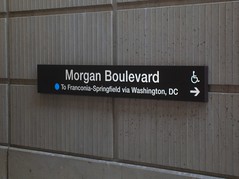 Monday Night Football, the NFL's major prime time network(-cum-basic-cable) broadcast has come to FedEx Field once again. Even more exciting than the normal hyperbole of MNF game is the fact that the 6-2 Redskins are playing the 5-2 Pittsburgh Steelers, a game that lots of people are actually going to care about for a change. Redskins Nation is buzzing.
If you commute on the eastern half of the Beltway, however, your afternoon drive will probably be much slower, as FedEx Field opens the lots four hours before the 9 pm kickoff and tailgaters will likely be jamming exits 15, 16, and 17 during the evening rush, as happens for every weeknight home game at FedEx Field. But Metro is pulling their weight, just like they did for the last Monday Night game at FedEx, the 2006 season opener. The system will be staying open until 1 a.m., with additional personnel at Morgan Boulevard and Largo stations.
Considering that FedEx Field opened in 1997 but Morgan Boulevard and Largo stations did not open until 2004, Metro use during mega-events at the stadium does not make headlines like Nationals Park did when it opened atop a Green Line station this spring. People took notice that Nationals games were not choking the Metro system, even when Nationals games were getting high attendance at the beginning of the season (interest naturally waned by the middle of their dismal 59-102 season).
Of course, FedEx Field has over twice the capacity of Nationals Park. Then again, FedEx Field is suburban, fed by highways, and surrounded by acres of surface parking. Where Navy Yard station is a block from Nats Park, FedEx Field lies almost a mile from Morgan Boulevard. Even if one were to envision a future Purple Line station at FedEx Field, it wouldn't be much closer, and would likely augment rather than replace Morgan Boulevard as the primary stop for the venue. In any event, an awful lot of people would have to give up driving before Metro started to have major issues on game day, even when games impacted the weekday rush hour. For now, the Blue Line is a viable alternative to driving. I'll take walking a four fifths of a mile for free from the Metro over walking two fifths of a mile from a $30 parking space. And it never hurts to take a car off the Beltway, while you're at it.
Wednesday, September 17, 2008
Trains to the Future
I have been working tirelessly on my fantasy WMATA-MTA-MARC-VRE system map, coming soon. I currently lack the graphic design skills of my counterparts at Beyond DC, Track Twenty-Nine, and Greater Greater Washington, but rest assured that as soon as I figure out a half decent manner to present it to you guys, I'll be throwing my hat into the ring.
In the mean time, I encourage you to sign the petition (via GGW) supporting the Purple Line. I'd love to see it get started in New Carrollton and built westward if MoCo doesn't find a way to make it happen soon. Perhaps a successful stretch in PG County will silence the naysayers, perhaps even make a few more people start asking for it once it is build and working somewhere.
If anyone has any tips for making my map, I'm all ears. Until then, I'm still screwing around in Google Earth. If you want a sneak peek, I mentioned some of the basics in an open thread at GGW.

In the mean time, I encourage you to sign the petition (via GGW) supporting the Purple Line. I'd love to see it get started in New Carrollton and built westward if MoCo doesn't find a way to make it happen soon. Perhaps a successful stretch in PG County will silence the naysayers, perhaps even make a few more people start asking for it once it is build and working somewhere.
If anyone has any tips for making my map, I'm all ears. Until then, I'm still screwing around in Google Earth. If you want a sneak peek, I mentioned some of the basics in an open thread at GGW.
Wednesday, September 10, 2008
Town Centers in PG: Ur Doing It Wrong

Prince George's County, Maryland. I've called it home the last five years of my life. It is a county of promise and potential. With an unparalleled demographic of wealthy minorities and a wide ethnic diversity coupled with a 312 year historical heritage, there's no lack of culture here. With a population rapidly approaching one million, there's a quality tax base as well. What the county lacks-- more than any other county that touches Washington, DC-- is a sense of place throughout.
But that's all changing, right? Largo Town Center, Konterra, Bowie Town Center, National Harbor, Woodmore Towne Centre, and other developments are sprouting up all over the county. They are walkable retail districts that create a sense of place. But unfortunately, you only get that sense of place when you hop in the car and drive to those places (with the exception of Largo, which is on the terminus of the Blue Line).
I absolutely despise it when developers throw "Town Center" at the end of an isolated retail development that is completely car oriented and disconnected from the surrounding areas. I especially hate it when it's spelled "Towne Centre". But let's ingore that for a second...
These areas are a good start for PG, I believe. But acres of surface parking and a big box store mar sites like Woodmore Towne Centre. But surface parking can always be built upon, and big box stores can either be integrated into their surroundings (like in DC USA) or transformed into other uses. Most of the surface parking is probably mandated by some horrible parking minimum over which the developers have no control anyway. What I find most disconcerting with the layout here is that there is only one direct street connection with Glenarden, the municipality in which this development lies. To me, this sends a message. It is not integrated into the community. It is its own entity for other people who will drive there from wherever else. Largo Town Center is even worse. Despite it's own Blue Line Metro station, the development is little more than an island of retail in a sea of parking
Glenarden, Woodmore Towne Centre, and the Landover Gateway development area all lie on a corridor that may wind up being a stop on the Purple Line eventually. Largo Town Center came along with a Metro station. What about other greenfield developments in PG? Konterra is built somewhat near a MARC station along Route 1, but the town center is about a mile away from this station and the design on the tract does not engage the MARC station. National Harbor, the bustling upscale community on the Potomac across from Alexandria, is grossly underserved by Metrobus and is grossly isolated from rail service.
This is bad, but it is much worse when considered with the lack of development around Metro and MARC stations in Prince George's County. Walkable, mixed use development is planned and/or starting to trickle in around Greenbelt, Capitol Heights, and a few other stations, but are they really doing it right anywhere? Sort of. Prince George's Plaza ought to be the model around which new developments in PG are modeled. The surface lots are being replaced by towers hosting a diverse demographic. The area is widely connected to the surrounding areas, helping push development in downtown Hyattsville. PG Plaza definitely isn't all the way there yet, but it's closer than anywhere else.
What makes good development even better is interconnectivity. Largo shows us that just a transit stop doesn't give you a truely great sense of place. National Harbor might prove that no matter how mixed-use, walkable, and upscale a place may be, isolation makes it somewhat of a kitschy novelty location. The ingredients are there. The County just needs to take advantage of it.
I am planning to attend Envision Prince George's on October 3rd at University of Maryland University College Inn and Conference Center in Adelphi. Thanks to Richard Layman for highlighting this event. Better days lie ahead for Prince George's, and I'm hoping to get a glimpse of that at this event.
Friday, July 25, 2008
Top 10: Schools that Need Train Stations
Catholic University, Gallaudet University, and University of DC sit atop Red Line stations. Tiny Southeastern University is right outside Waterfront station on the Green Line. Bowie State has its own dedicated MARC station. What's great about this is that it connects these students to a city that can offer experiences and opportunities that add value to any type of education. It creates a higher standard of living for the students, and it makes the campuses more accessible to people who want to learn. It connects communities to the cultural exchanges that occur on college campuses: the concerts, the plays, the sports, the festivals. It better prepares students for the real world, and to some degree, it prepares the real world for them.
Unfortunately, it's a lot easier to go to college around here if you have a car, particularly if it is a school where you can't live in the dorms. We all know a forced bus-to-train transfer automatically decreases the likelihood of ridership, so I compiled my list of colleges and universities that most need train stations.
All figures are from Wikipedia unless otherwise noted.
10. Columbia Union College
This is basically just a commentary on how Takoma Park needs a trolley or something running through that town. Adventist Hospital, the shops at Carroll and Philadelphia Avenues, and the dense-ish areas of the town are a tad isolated from the rail infrastructure. Columbia Union College has only about 1100 students, but I believe the community could benefit from connecting this school to the outside world.
9. University of Maryland, College Park
Hopefully soon this will not be an issue. Flagship University of the State of Maryland, largest employer in Prince George's County, and educating over 36,000 students, This school is underserved by a Metro station miles away from the campus center. The forgotten factor: UMCP also houses University of Maryland University College, which has over 90,000 students. Most of these are online, but several classes are taught on the campus, and plenty of jobs are located at its headquarters near the proposed Purple Line West Campus station.
8. United States Naval Academy
Considering its proximity to the Nation's Capital, the Naval Academy's 4,400 midshipmen do not have a single rail line connecting it with DC. Since it's also part of a military base, there would be dual purpose to have the option to connect it to facilities located around the district.
7. Howard University
Supposedly served by the Shaw station on the Green and Yellow lines, Howard ought to have better rail access. The current station serves the medical center well, however another station on/under Georgia Avenue could also serve the campus a bit better.
6. American University
Similarly to Howard, American is "served" by the Tenleytown station. In practice, it's almost a mile from campus center to Tenleytown station. With over a thousand full-time and adjunct faculty and nearly 10,000 students, and a popular venue like the Bender Arena, transit ought to evenutally be able to come a little closer to this prestigious institution.
5. Prince George's Community College, Largo (no dorms)
The flagship campus of PGCC, the Largo campus could feasibly be served by a Purple Line that connected from New Carrollton through Largo Town Center. 37,000 students attend PGCC, mostly at the Largo campus. As PG County begins its renaissance, educating the community is of utmost importance. Rail access to the community college will make this happen.
4. George Mason
I have no idea how this campus got it's name on the Vienna Metro station. It has to be two to three miles away. The Fairfax Campus is home to the majority of the school's 30,000 undergrad and graduate students, as well as the Patriot Center, a popular concert and sports venue. But don't take the Metro unless you are wearing your hiking boots. It's a pedestrian-unfriendly trek.
3. Northern Virginia Community College, Annandale (no dorms)
Serving over 63,000 credit and a quarter of a million non-credit students, NVCC is the second largest multi-campus community college in the nation, and the largest educational institution in Virginia. Unfortunately the headquarters is in Annandale, with nary a train station to be found. The Annandale campus serves the most of the eight campuses, 23,000 students according to NVCC's website. One look at the giant parking lot on the campus and you can guess the preferred method of reaching the campus.
2. Georgetown University
Here's a campus where the students don't even have a fixed transit service to watch their beloved Hoyas basketball team play at the Verizon Center! Set in a very walkable part of town, the closest Metro station is across the Potomac in Rosslyn. Perhaps the city's most prestigious institution of higher learning, Georgetown holds over 6,800 undergrads and almost 7,300 graduate students, as well as a hospital. The Blue Line may eventually be diverted from Rosslyn to run under M Street, which would serve the school and the hospital. Right now, students and faculty will have to settle for the walk across the Key Bridge.
1. Montgomery College, Rockville (no dorms)
Nearly 60,000 students from all 50 states and 170+ countries (more than any Ivy League school) attend what is certainly amongst the world's most diverse institutions of higher learning. Over half of them attend the Rockville Campus, which, like the other MC campuses, has no housing. The critical flaw is that the campus is situated in the middle of a three mile dead zone along the Red Line between Rockville and Shady Grove stations. An infill station at Montgomery College would likely have high ridership, and make the Rockville Campus more accessible to the Takoma Park Campus (the second largest campus, Germantown is the smallest of the three Montgomery College campuses.) Considering the array of demographics that attend Montgomery College, this would greatly assist in educating the lower socio-economic groups, which is good for them and great for the region as a whole. And all we have to do is build a station on the existing track right across the street.
Educating the region is important. Educated people are good for the economy. They are less likely to commit crimes. They are more likely to embrace the abundance of diversity that this region boasts. Unfortunately, school is expensive. It's even worse if you have to own a car to get there. Additionally, college campuses are a great place to breed a culture that releases itself from car ownership. People are walking everywhere; to school, to work, to leisure activities. With a transit connection, we're not only linking students to opportunities to learn, we're teaching them the value of getting out of their cars. What could be better for the urban environment?
Did I leave anyone out?
Unfortunately, it's a lot easier to go to college around here if you have a car, particularly if it is a school where you can't live in the dorms. We all know a forced bus-to-train transfer automatically decreases the likelihood of ridership, so I compiled my list of colleges and universities that most need train stations.
All figures are from Wikipedia unless otherwise noted.
10. Columbia Union College
This is basically just a commentary on how Takoma Park needs a trolley or something running through that town. Adventist Hospital, the shops at Carroll and Philadelphia Avenues, and the dense-ish areas of the town are a tad isolated from the rail infrastructure. Columbia Union College has only about 1100 students, but I believe the community could benefit from connecting this school to the outside world.
9. University of Maryland, College Park
Hopefully soon this will not be an issue. Flagship University of the State of Maryland, largest employer in Prince George's County, and educating over 36,000 students, This school is underserved by a Metro station miles away from the campus center. The forgotten factor: UMCP also houses University of Maryland University College, which has over 90,000 students. Most of these are online, but several classes are taught on the campus, and plenty of jobs are located at its headquarters near the proposed Purple Line West Campus station.
8. United States Naval Academy
Considering its proximity to the Nation's Capital, the Naval Academy's 4,400 midshipmen do not have a single rail line connecting it with DC. Since it's also part of a military base, there would be dual purpose to have the option to connect it to facilities located around the district.
7. Howard University
Supposedly served by the Shaw station on the Green and Yellow lines, Howard ought to have better rail access. The current station serves the medical center well, however another station on/under Georgia Avenue could also serve the campus a bit better.
6. American University
Similarly to Howard, American is "served" by the Tenleytown station. In practice, it's almost a mile from campus center to Tenleytown station. With over a thousand full-time and adjunct faculty and nearly 10,000 students, and a popular venue like the Bender Arena, transit ought to evenutally be able to come a little closer to this prestigious institution.
5. Prince George's Community College, Largo (no dorms)
The flagship campus of PGCC, the Largo campus could feasibly be served by a Purple Line that connected from New Carrollton through Largo Town Center. 37,000 students attend PGCC, mostly at the Largo campus. As PG County begins its renaissance, educating the community is of utmost importance. Rail access to the community college will make this happen.
4. George Mason
I have no idea how this campus got it's name on the Vienna Metro station. It has to be two to three miles away. The Fairfax Campus is home to the majority of the school's 30,000 undergrad and graduate students, as well as the Patriot Center, a popular concert and sports venue. But don't take the Metro unless you are wearing your hiking boots. It's a pedestrian-unfriendly trek.
3. Northern Virginia Community College, Annandale (no dorms)
Serving over 63,000 credit and a quarter of a million non-credit students, NVCC is the second largest multi-campus community college in the nation, and the largest educational institution in Virginia. Unfortunately the headquarters is in Annandale, with nary a train station to be found. The Annandale campus serves the most of the eight campuses, 23,000 students according to NVCC's website. One look at the giant parking lot on the campus and you can guess the preferred method of reaching the campus.
2. Georgetown University
Here's a campus where the students don't even have a fixed transit service to watch their beloved Hoyas basketball team play at the Verizon Center! Set in a very walkable part of town, the closest Metro station is across the Potomac in Rosslyn. Perhaps the city's most prestigious institution of higher learning, Georgetown holds over 6,800 undergrads and almost 7,300 graduate students, as well as a hospital. The Blue Line may eventually be diverted from Rosslyn to run under M Street, which would serve the school and the hospital. Right now, students and faculty will have to settle for the walk across the Key Bridge.
1. Montgomery College, Rockville (no dorms)
Nearly 60,000 students from all 50 states and 170+ countries (more than any Ivy League school) attend what is certainly amongst the world's most diverse institutions of higher learning. Over half of them attend the Rockville Campus, which, like the other MC campuses, has no housing. The critical flaw is that the campus is situated in the middle of a three mile dead zone along the Red Line between Rockville and Shady Grove stations. An infill station at Montgomery College would likely have high ridership, and make the Rockville Campus more accessible to the Takoma Park Campus (the second largest campus, Germantown is the smallest of the three Montgomery College campuses.) Considering the array of demographics that attend Montgomery College, this would greatly assist in educating the lower socio-economic groups, which is good for them and great for the region as a whole. And all we have to do is build a station on the existing track right across the street.
Educating the region is important. Educated people are good for the economy. They are less likely to commit crimes. They are more likely to embrace the abundance of diversity that this region boasts. Unfortunately, school is expensive. It's even worse if you have to own a car to get there. Additionally, college campuses are a great place to breed a culture that releases itself from car ownership. People are walking everywhere; to school, to work, to leisure activities. With a transit connection, we're not only linking students to opportunities to learn, we're teaching them the value of getting out of their cars. What could be better for the urban environment?
Did I leave anyone out?
Tuesday, July 22, 2008
BRAC: A Transit Nightmare
So there's this Base Realignment and Closure (BRAC) thing going on, moving tons of jobs to bases that can't possibly handle the increased population, and it's going on all over our area. What's affected? Fort Meade, Fort Belvoir, Quantico, and Andrews AFB, for starters, are all juuuust far enough outside the city that they have no Metro connection and absolutely disgraceful transit options. Then there's Bethesda Naval Medical Center, which has its very own Red Line stop but chokes off the MD 355 corridor creating perennial traffic issues. Though fiscally I imagine it makes plenty of sense to consolidate military jobs, it's going to take a lot of growing pains for this gigantic realignment, which was initially announced in September of 2005.
Having served four years in the United States Army, I can assure all of you that I find most military bases damn near impossible to get to and get around without a car. Absolutely horrible. Why do think so many bases are surrounded by car dealerships? Every soldier needs a car. And every base at which I've been stationed, sergeants and petty officers warn their troops about getting ripped off by said car salesmen. I was once in a battalion where I was required to attend a briefing specific to this matter!
Let's start with getting TO the base. Fort Meade, which houses the National Security Agency, is getting approximately 5,000 new jobs. there are two MARC stations that "serve" Fort Meade, Odenton and Savage. In practice, both are miles from a base entrance, and there is virtually zero pedestrian access. There are shuttles that operate from the MARC stations, but this system is far more time consuming than driving and I don't believe that it encourages ridership much at all. If there is any kind of bus service, I didn't hear about it the four years I was stationed there. I know that Corridor Transit offers a bus to the NSA twice in the morning and twice in the evening. Yeah, that ought to handle the 30,000+ commuters there. I can't speak to Andrews, Quantico, or Belvoir, but I imagine the problems are similar to some degree of those at Fort Meade. But instead of bringing transit to these areas, the big lobby is to bring the Purple Line to Bethesda Medical Center even though it would better serve Bethesda's central business district. Priorities!
Next let's talk getting AROUND these bases. So great, a bus/train/shuttle dumps you off at the main gate to Fort Meade. You are likely miles from your office. Military bases, in my experience, exercise little to no land use economy whatsoever. For a military service that prides "beating feet" I did an awful lot of driving around Fort Meade when I was stationed there. The only thing centrally located on that base is the golf course! Wasted land and few sidewalks between buildings, much of it nowhere near the main entrance. No regular base shuttles. It was not uncommon for me to make 20+ car trips a day while I was stationed there.
Working for the Department of Defense at most facilities demands that you own a car. For me, the cost of owning a car (car payment + insurance + maintenance + gas to and from work only) is 20% of my take home salary. And I'm not exactly driving a Lexus.
Which is why I was not surprised when someone in my office confided in me that his electricity had been shut off because he had recently spent a great deal of money on some car troubles. He literally had to choose between getting to work and powering his home. And this is a GS-11 with a very modest mortgage who lives less than 5 miles from Fort Meade. The DoD doesn't fathom any other method of commuting besides the automobile. This is evident by looking at the amount of parking at the Pentagon, which has its own Metro Station served by two lines.
I have a couple ideas. Extend the Yellow Line to Fort Belvoir. Extend the Green Line from Branch Avenue to Andrews AFB, or perhaps the Purple Line. Bring Metro up from Greenbelt to BWI with a stop at Fort Meade or the NSA. How about programs that encourage people moving to BRAC jobs to purchazse houses near transit lines that lead to their jobs? Developing the bases so that they can sustain a level of walkability from the main gates to the job centers? Imagine how fewer cars at checkpoints could be a good thing for bases. Hell, I even think military bases are good places to experiment with PRT to get people from transit to and around job centers on post. At this point, anything is better than the meager road widenings that have been announced.
Having served four years in the United States Army, I can assure all of you that I find most military bases damn near impossible to get to and get around without a car. Absolutely horrible. Why do think so many bases are surrounded by car dealerships? Every soldier needs a car. And every base at which I've been stationed, sergeants and petty officers warn their troops about getting ripped off by said car salesmen. I was once in a battalion where I was required to attend a briefing specific to this matter!
Let's start with getting TO the base. Fort Meade, which houses the National Security Agency, is getting approximately 5,000 new jobs. there are two MARC stations that "serve" Fort Meade, Odenton and Savage. In practice, both are miles from a base entrance, and there is virtually zero pedestrian access. There are shuttles that operate from the MARC stations, but this system is far more time consuming than driving and I don't believe that it encourages ridership much at all. If there is any kind of bus service, I didn't hear about it the four years I was stationed there. I know that Corridor Transit offers a bus to the NSA twice in the morning and twice in the evening. Yeah, that ought to handle the 30,000+ commuters there. I can't speak to Andrews, Quantico, or Belvoir, but I imagine the problems are similar to some degree of those at Fort Meade. But instead of bringing transit to these areas, the big lobby is to bring the Purple Line to Bethesda Medical Center even though it would better serve Bethesda's central business district. Priorities!
Next let's talk getting AROUND these bases. So great, a bus/train/shuttle dumps you off at the main gate to Fort Meade. You are likely miles from your office. Military bases, in my experience, exercise little to no land use economy whatsoever. For a military service that prides "beating feet" I did an awful lot of driving around Fort Meade when I was stationed there. The only thing centrally located on that base is the golf course! Wasted land and few sidewalks between buildings, much of it nowhere near the main entrance. No regular base shuttles. It was not uncommon for me to make 20+ car trips a day while I was stationed there.
Working for the Department of Defense at most facilities demands that you own a car. For me, the cost of owning a car (car payment + insurance + maintenance + gas to and from work only) is 20% of my take home salary. And I'm not exactly driving a Lexus.
Which is why I was not surprised when someone in my office confided in me that his electricity had been shut off because he had recently spent a great deal of money on some car troubles. He literally had to choose between getting to work and powering his home. And this is a GS-11 with a very modest mortgage who lives less than 5 miles from Fort Meade. The DoD doesn't fathom any other method of commuting besides the automobile. This is evident by looking at the amount of parking at the Pentagon, which has its own Metro Station served by two lines.
I have a couple ideas. Extend the Yellow Line to Fort Belvoir. Extend the Green Line from Branch Avenue to Andrews AFB, or perhaps the Purple Line. Bring Metro up from Greenbelt to BWI with a stop at Fort Meade or the NSA. How about programs that encourage people moving to BRAC jobs to purchazse houses near transit lines that lead to their jobs? Developing the bases so that they can sustain a level of walkability from the main gates to the job centers? Imagine how fewer cars at checkpoints could be a good thing for bases. Hell, I even think military bases are good places to experiment with PRT to get people from transit to and around job centers on post. At this point, anything is better than the meager road widenings that have been announced.
Sunday, July 20, 2008
Imagine West Silver Spring
By this point, I think I've made it clear that I'm a fan of Silver Spring. Transit-oriented works there. You've got your Metro, MARC, Metrobus, Ride-On, bike paths, and access to the Beltway. There's a night life, jobs, lots of culture, a fantastic community college, and a very eclectic mix of people, arts, and knowledge. But that doesn't mean I don't think it's under-utilized.
It blows my mind that there are large swaths of land between downtown Silver Spring and downtown Bethesda abutting Rock Creek Park that are veritable industrial dross-scapes. Wasted land along Brookeville Road, secluded by poor road connectivity, in what could be a very high end mixed use heartbeat connecting two of suburban Maryland's most important urban cores. Greater Greater Washington did a nice post on TOD zoning in Montgomery County, and I couldn't resist after I read that.
So I wanted to disrupt the low density feel of those neighborhoods in West Silver Spring; Lyttonsville, Seminary, and Woodside. Create more of an urban gateway between the two central business districts, bringing density down towards the city away from the hinterlands. I imagined West Silver Spring, and this is what I saw:
 Made with Google Maps.
Pink- road network
Red- residential redevelopment
Blue- commercial redevelopment
Orange- transit stations
Purple- deck over rail
For starters, let me talk transit. I envisioned an extension of the Yellow Line that splits from the Green Line at the Petworth station running under Georgia Avenue to Silver Spring, then following the MARC/CSX right-of-way towards Rockville. This led to a station in the Seminary and Woodside neighborhoods as well as the planned Paul Sarbanes Transit Center at Silver Spring Metro. For the Purple Line I assumed the high investment light rail alternative with stations at Lyttonsville, Woodside, and of course the Silver Spring transit center.
These three new stations would be the epicenters of transit-oriented funcsionality with minimum direct impact on the low-density residential infrastructure in existing neighborhoods. Four stations that one could easily walk between, but are far enough apart that are far enough apart to efficiently serve the community. Served by only one line, Lyttonsville and Seminary would not be as dense as Woodside (served by two) or Silver Spring (in my transit vision, served by four lines of Metro plus MARC). Those overwhelmed by the growing density of downtown Silver Spring would have the alternative of moving to a dense-but-not-too-dense TOD not to far away.
And though I'm sure wholesale redevelopment of the Brookville Road corridor and the Walter Reed Annex would garner a great deal of NIMBYism, they are areas that are not exactly pleasant in their current state. The north view from the apartments on Lyttonsville place is a car salvage yard.
Major changes to the road network are mostly in Woodside. I strongly believe that the Summit Hills development at the corner of 16th and East-West Highway ought to be razed and redeveloped from the ground up. Here, I've changed the intersection of Spring and 16th streets so that 16th ends on Spring on a deck over the trains. Spring Street then connects to Porter Road, which runs to Lyttonsville. The northern end of 16th Street could be redesignated Columbia Boulevard. Summit Hills and Rosemary Hills complexes would be redeveloped to compliment the new grid street network, with row houses in the residential areas and condos over retail in the commercial areas. Perhaps the steep grade of this neighborhood might accommodate residential over retail in this manner.
Perhaps my least popular more here: I connected Jones Bridge Road across Rock Creek Park so that Jones Bridge Road, Brookeville Road, and Grubb Road all come together, perhaps in a traffic circle just west of the Lyttonsville station. Though this would mean more traffic through the park, and through those Chevy Chase neighborhoods, the stronger street grid would have a very positive impact on traffic and probably encourage more walking and bike use. I have very little sympathy for Chevy Chase residents, anyway. That town is just going to have to deal with the fact that southern Montgomery County is only going to get denser and denser.
As for the Seminary neighborhood, I imagine the closure of the Walter Reed Annex would lead to some medium-density development on that property. It would compliment the apartments that are now up for rent at National Park Seminary. So here we have a neighborhood with a very eclectic charm in a densely wooded area where existing development is/would be utilized, minimizing the impact on the wealth of mature trees. What a cool place for a transit-based community!
I once again caveat that I am not an urban planner (though I hope to be one day), nor am I an engineer. Please point out any obvious design flaws you might spot. And please, if you have any suggestions for West Silver Spring, I'd love to hear them. I'm not saying this is feasible, but I believe that West Silver Spring could benefit the region heavily if it were developed in such a manner.
It blows my mind that there are large swaths of land between downtown Silver Spring and downtown Bethesda abutting Rock Creek Park that are veritable industrial dross-scapes. Wasted land along Brookeville Road, secluded by poor road connectivity, in what could be a very high end mixed use heartbeat connecting two of suburban Maryland's most important urban cores. Greater Greater Washington did a nice post on TOD zoning in Montgomery County, and I couldn't resist after I read that.
So I wanted to disrupt the low density feel of those neighborhoods in West Silver Spring; Lyttonsville, Seminary, and Woodside. Create more of an urban gateway between the two central business districts, bringing density down towards the city away from the hinterlands. I imagined West Silver Spring, and this is what I saw:
 Made with Google Maps.
Pink- road network
Red- residential redevelopment
Blue- commercial redevelopment
Orange- transit stations
Purple- deck over rail
For starters, let me talk transit. I envisioned an extension of the Yellow Line that splits from the Green Line at the Petworth station running under Georgia Avenue to Silver Spring, then following the MARC/CSX right-of-way towards Rockville. This led to a station in the Seminary and Woodside neighborhoods as well as the planned Paul Sarbanes Transit Center at Silver Spring Metro. For the Purple Line I assumed the high investment light rail alternative with stations at Lyttonsville, Woodside, and of course the Silver Spring transit center.
These three new stations would be the epicenters of transit-oriented funcsionality with minimum direct impact on the low-density residential infrastructure in existing neighborhoods. Four stations that one could easily walk between, but are far enough apart that are far enough apart to efficiently serve the community. Served by only one line, Lyttonsville and Seminary would not be as dense as Woodside (served by two) or Silver Spring (in my transit vision, served by four lines of Metro plus MARC). Those overwhelmed by the growing density of downtown Silver Spring would have the alternative of moving to a dense-but-not-too-dense TOD not to far away.
And though I'm sure wholesale redevelopment of the Brookville Road corridor and the Walter Reed Annex would garner a great deal of NIMBYism, they are areas that are not exactly pleasant in their current state. The north view from the apartments on Lyttonsville place is a car salvage yard.
Major changes to the road network are mostly in Woodside. I strongly believe that the Summit Hills development at the corner of 16th and East-West Highway ought to be razed and redeveloped from the ground up. Here, I've changed the intersection of Spring and 16th streets so that 16th ends on Spring on a deck over the trains. Spring Street then connects to Porter Road, which runs to Lyttonsville. The northern end of 16th Street could be redesignated Columbia Boulevard. Summit Hills and Rosemary Hills complexes would be redeveloped to compliment the new grid street network, with row houses in the residential areas and condos over retail in the commercial areas. Perhaps the steep grade of this neighborhood might accommodate residential over retail in this manner.
Perhaps my least popular more here: I connected Jones Bridge Road across Rock Creek Park so that Jones Bridge Road, Brookeville Road, and Grubb Road all come together, perhaps in a traffic circle just west of the Lyttonsville station. Though this would mean more traffic through the park, and through those Chevy Chase neighborhoods, the stronger street grid would have a very positive impact on traffic and probably encourage more walking and bike use. I have very little sympathy for Chevy Chase residents, anyway. That town is just going to have to deal with the fact that southern Montgomery County is only going to get denser and denser.
As for the Seminary neighborhood, I imagine the closure of the Walter Reed Annex would lead to some medium-density development on that property. It would compliment the apartments that are now up for rent at National Park Seminary. So here we have a neighborhood with a very eclectic charm in a densely wooded area where existing development is/would be utilized, minimizing the impact on the wealth of mature trees. What a cool place for a transit-based community!
I once again caveat that I am not an urban planner (though I hope to be one day), nor am I an engineer. Please point out any obvious design flaws you might spot. And please, if you have any suggestions for West Silver Spring, I'd love to hear them. I'm not saying this is feasible, but I believe that West Silver Spring could benefit the region heavily if it were developed in such a manner.
Tuesday, July 15, 2008
Convince Me To Support the Purple Line
I like the idea of connecting all the Metro Lines in Maryland. I think it's a brilliant idea that will serve smart growth well, greatly reduce automobile reliance, and I think it will economically benefit the city as well as the suburbs.
But are we doing it right?
I haven't heard anyone from Langley Park or Riverdale complain like the whiny NIMBYs of Chevy Chase and Bethesda, who, in my opinion, are doing the entire region a disservice by allowing a Country Club to exist in an area that could be more served with some sort of denser development that serves the larger community and not just a few wealthy people that are accepted by this private club. Move that nonsense out into the country. Or better yet, get rid of Columbia Country Club. We have plenty of golf courses in Montgomery County. At the very least, the club needs to relinquish the 84' of 100' right-of-way that it currently fences off from the general public.
Those whining about the Capital Crescent Trail being harmed are in my opinion selfish. This project will undoubtedly change the character of portions the CCT, but it will extend the path into Silver Spring, connecting it to other hiker biker trails in Montgomery County. Furthermore, this rail right-of-way was purchased to serve the needs of the county, not to serve as a park for the residents of affluent Chevy Chase. I fail to see how the decreased aesthetics of the trail outweigh the increased functionality of the trail.
Then there's the occasional "I won't want a train that close to my house" by people who perhaps aren't familiar with light rail, in which case I can understand their concerns but don't believe their argument has the clout to block the initiative. In my experience, light rail is quieter, cleaner, and safer than buses running up and down the street. The only thing they lose is street parking, which ought not be a birth right in denser areas anyway.
This proposal has a lot of support, and it's generally more organized and informed than the opposition. So I'm not in anyway a NIMBY here. I think this transit link needs to happen. But I want the good people out there who read Imagine, DC to convince me that the current plan is a good idea. I'm leaning that way, but I want more information.
How is this line going to be integrated with the Metro Rail? Sure, it's going to drop people off at Bethesda, Silver Spring, College Park, and New Carrollton... but what's the deal? Is it going to be like a bus route? Or is it going to be fully integrated into Metro with seamless transfers? I've heard that it will be integrated with SmarTrip. That's good, but it's not good enough if it is not treated as part of the existing heavy rail system. It seems to me that would just be a glorified bus route, especially if it winds up as a BRT. Convince me otherwise. Otherwise, change the name, because "Purple Line" implies a seamless integration with Metro that won't exist.
I am not a statistician. But even the most optimistic ridership numbers seem painfully low to me. Gas isn't getting any cheaper. I would use that line 3-4 times a week if it existed, and I don't even commute along that route. 67,000? No way. I think ridership will be much, much higher than that if the line gets built, and that's before the ensuing transit oriented development pops up around Langley Park and wherever else. Is a light rail going to be able to handle those numbers? 5 years after it opens, will it be able to handle double those numbers? Triple?
Considering the large percentage of the route that will be sharing traffic lanes, how do we know it's not going to get stuck in gridlock along Wayne Avenue, University Boulevard, Kenilworth Avenue, or Riverdale Road? Will it have dedicated lanes on those corridors? Will those roads be losing traffic lanes or will additional right-of-way be constructed?
What incentives does the region have to continue this line? I know there have been talks about pushing it further in PG County to Largo. What about Branch Avenue? Will it serve FedEx Field?Andrews Air Force Base? National Harbor? I think a Purple Line ought to be a full loop running all around the city. Eventually, it ought to run through Tyson's Corner, Annandale, Bailey's Crossroads, and Alexandria. Is this feasible with this project?
Trolleys are a great idea. I think they ought to blanket this region by the time I retire, or sooner. But the Purple Line ought to be more than just a simple trolley. Montgomery and Prince George's counties' combined population is pushing two million, mostly concentrated around the regions where this vital transitway will be constructed. Whatever gets build should have been built 10 years ago, and this region has failed us terribly by not providing this transit link.
Again, I WANT fixed rail along this corridor, whatever it takes. I think the only reason I'm not a full fledged Purple Line supporter is because I don't know where to find the answers to these questions. Help me and any passers-by who want more information understand why this proposal should be supported.
I'm asking every pro-transit reader to convince me to come down off the fence onto the side of pro-Purple Line. Don't tell me this is the best idea for the money that has been alotted for this project; tell me this is the best idea for the people of the DC region who want to get around the dense built up (and up-and-coming) towns hugging our Nation's Capital. If there's not enough money for what we ought to have, let's find more. We need the Purple Line, and we need it done right.
But are we doing it right?
I haven't heard anyone from Langley Park or Riverdale complain like the whiny NIMBYs of Chevy Chase and Bethesda, who, in my opinion, are doing the entire region a disservice by allowing a Country Club to exist in an area that could be more served with some sort of denser development that serves the larger community and not just a few wealthy people that are accepted by this private club. Move that nonsense out into the country. Or better yet, get rid of Columbia Country Club. We have plenty of golf courses in Montgomery County. At the very least, the club needs to relinquish the 84' of 100' right-of-way that it currently fences off from the general public.
Those whining about the Capital Crescent Trail being harmed are in my opinion selfish. This project will undoubtedly change the character of portions the CCT, but it will extend the path into Silver Spring, connecting it to other hiker biker trails in Montgomery County. Furthermore, this rail right-of-way was purchased to serve the needs of the county, not to serve as a park for the residents of affluent Chevy Chase. I fail to see how the decreased aesthetics of the trail outweigh the increased functionality of the trail.
Then there's the occasional "I won't want a train that close to my house" by people who perhaps aren't familiar with light rail, in which case I can understand their concerns but don't believe their argument has the clout to block the initiative. In my experience, light rail is quieter, cleaner, and safer than buses running up and down the street. The only thing they lose is street parking, which ought not be a birth right in denser areas anyway.
This proposal has a lot of support, and it's generally more organized and informed than the opposition. So I'm not in anyway a NIMBY here. I think this transit link needs to happen. But I want the good people out there who read Imagine, DC to convince me that the current plan is a good idea. I'm leaning that way, but I want more information.
How is this line going to be integrated with the Metro Rail? Sure, it's going to drop people off at Bethesda, Silver Spring, College Park, and New Carrollton... but what's the deal? Is it going to be like a bus route? Or is it going to be fully integrated into Metro with seamless transfers? I've heard that it will be integrated with SmarTrip. That's good, but it's not good enough if it is not treated as part of the existing heavy rail system. It seems to me that would just be a glorified bus route, especially if it winds up as a BRT. Convince me otherwise. Otherwise, change the name, because "Purple Line" implies a seamless integration with Metro that won't exist.
I am not a statistician. But even the most optimistic ridership numbers seem painfully low to me. Gas isn't getting any cheaper. I would use that line 3-4 times a week if it existed, and I don't even commute along that route. 67,000? No way. I think ridership will be much, much higher than that if the line gets built, and that's before the ensuing transit oriented development pops up around Langley Park and wherever else. Is a light rail going to be able to handle those numbers? 5 years after it opens, will it be able to handle double those numbers? Triple?
Considering the large percentage of the route that will be sharing traffic lanes, how do we know it's not going to get stuck in gridlock along Wayne Avenue, University Boulevard, Kenilworth Avenue, or Riverdale Road? Will it have dedicated lanes on those corridors? Will those roads be losing traffic lanes or will additional right-of-way be constructed?
What incentives does the region have to continue this line? I know there have been talks about pushing it further in PG County to Largo. What about Branch Avenue? Will it serve FedEx Field?Andrews Air Force Base? National Harbor? I think a Purple Line ought to be a full loop running all around the city. Eventually, it ought to run through Tyson's Corner, Annandale, Bailey's Crossroads, and Alexandria. Is this feasible with this project?
Trolleys are a great idea. I think they ought to blanket this region by the time I retire, or sooner. But the Purple Line ought to be more than just a simple trolley. Montgomery and Prince George's counties' combined population is pushing two million, mostly concentrated around the regions where this vital transitway will be constructed. Whatever gets build should have been built 10 years ago, and this region has failed us terribly by not providing this transit link.
Again, I WANT fixed rail along this corridor, whatever it takes. I think the only reason I'm not a full fledged Purple Line supporter is because I don't know where to find the answers to these questions. Help me and any passers-by who want more information understand why this proposal should be supported.
I'm asking every pro-transit reader to convince me to come down off the fence onto the side of pro-Purple Line. Don't tell me this is the best idea for the money that has been alotted for this project; tell me this is the best idea for the people of the DC region who want to get around the dense built up (and up-and-coming) towns hugging our Nation's Capital. If there's not enough money for what we ought to have, let's find more. We need the Purple Line, and we need it done right.
Wednesday, July 2, 2008
Imagine the Purple Line
It's everyone's favorite light rail debate. Few people argue we don't need an east-west transit link through suburban Maryland. Most people just disagree on how and where it ought to be build. I personally think it ought to be a heavy rail. largely underground. I think that once the light rail is built, the immediate need for more capacity will be very apparent, $200 barrels of oil aside.
I'm not opposed to the light rail idea. I think it would be very successful, other than a few NIMBYs sponsored by Columbia Country Club (who is illegally using much of the county's right-of-way) and a couple of crybabies in Silver Spring who don't want the train to run down their street. I can live with the line being light rail. I can't live with the limitations of the current proposal, however.
So long as this train is MTA and not WMATA, it will, of course, stay in Maryland. but what if it went all the way around the Beltway, plenty of others think it should? What if, instead of just being a glorified bus, it was fully integrated with the Metro system? Sure that would require an enclosed station for every stop, but why not? This is fantasy. A fully integrated rail circumnavigating Washington DC!
Ladies and Gentlemen, I give you my Purple Line:
View Larger Map
A quick rundown of the stations, with the path to the next station in parentheses follows. Mind you that these are just what I would name the stations, and the routes I would use.
Bethesda Metro (follows Georgetown Branch Trail)
Chevy Chase Lake: Connecticut Av at Manor Rd (Georgetown Branch Trail)
Lyttonsville: Brookeville Rd at Lyttonsville Pl (Metropolitain Branch ROW)
Woodside: 16th St north of East-West Hwy (Red Line ROW)
Silver Spring Metro (Wayne Av)
Sligo-Manchester: Wayne Av at Manchester Pl (tunnel)
Long Branch: Arliss St at Garland Av (Piney Branch Rd)
Piney Branch: Piney Branch Rd at University Blvd (Univ Blvd)
Takoma-Langley: Univ Blvd at New Hampshire Av (Univ Blvd)
Langley Park: Univ Blvd at Riggs Rd (Univ Blvd)
West Campus/UMUC: Univ Blvd at Adelphi Rd (Campus Dr)
Student Union: Campus Drive near Regents Drive (Campus Dr)
East Campus: Rossborough La at Route 1 (Paint Branch Parkway)
College Park Metro (River Rd)
Calvert Park: River Rd at Rivertech Ct (River Rd and Kenilworth Av)
East Riverdale: Riverdale Rd at Kenilworth Avenue (Riverdale Rd)
Veterans Parkway: Riverdale Rd at Veterans Pkwy (Veterans Pkwy)
Landover Hills: Veterans Pkwy at Annapolis Rd (Annapolis Rd to Harkins Rd)
New Carrollton Metro...
...here's where I start taking some creative liberties...
...(Ardwick-Ardmore Rd)
Glenarden: Ardwick-Ardmore Rd at MLK Highway (Brightseat Rd)
FedEx Field (Arena Drive)
Largo Metro (Harry S Truman Dr)
Kettering/PGCC: Truman Dr at Campus Dr (Truman Dr to at-grade-ROW to Ritchie Rd)
District Heights: Ritchie Rd at Walker Mill Rd (Ritchie Rd)
Forestville: Forestville Rd at Pennsylvania Av (Forestville Rd to Beltway)
Morningside/Andrews AFB: Suitland Rd at Allentown Rd (Beltway)
Temple Hills: Beltway near St Barnabas Rd (Oxon Hill Rd)
Oxon Hill: Livingston Rd at Oxon Hill Rd (Oxon Hill Rd to Harborview Av)
National Harbor: Nat'l Harbor Blvd at Waterfront St (Wilson Bridge)
Alexandria South: Washington St at South St (Washington St)
Old Town Alexandria: Washington St at King St (King St)
King Street Metro (Duke Street)
Landmark: Duke St at Van Dorn St (Duke St)
Lincolnia: Little River Tpk at Beauregard St (Little River Tpk)
Pinecrest: Little River Tpk at Braddock Rd (Little River Tpk)
Annandale: Little River Tpk at Columbia Pike (Beltway to Gallows Rd)
Merrifield: Gallows Rd at Arlington Blvd (Gallows Rd)
Lee Highway: Gallows Rd at Lee Hwy (Gallows Rd)
Dunn Loring Metro (Gallows Rd)
Tyson's South: Gallows Rd at Old Courthouse Rd (Tyson's Corner Center Parking)
Tyson's Central 123 Metro (Tyson's Blvd)
Tyson's North: Westbranch Dr at Jones Branch Dr (Beltway)
Great Falls: Beltway at Georgetown Pike (Beltway to Clara Barton Pkwy)
Cabin John: MacArthur Blvd at 7 Locks Rd (MacArthur Blvd)
Glen Echo: MarArthur Blvd at Goldsboro Rd (Goldsboro to River Rd)
Somerset/Kenwood: River Rd at Dorsey Lane (Little Falls Pkwy to Arlington Rd to Edgemoor Lane to Bethesda Metro
I'm sure there will be plenty of suggestions as to what you folks think the alignment should be. Please share. However, like plenty before me, I have a vision of a vastly expanded Metro system into which this alignment fits perfectly. As soon as I find a suitable manner to illustrate it, I'll share the whole thing with the world. But I'm just starting this blog. I don't want to overwhelm the world quite yet.
I'm not opposed to the light rail idea. I think it would be very successful, other than a few NIMBYs sponsored by Columbia Country Club (who is illegally using much of the county's right-of-way) and a couple of crybabies in Silver Spring who don't want the train to run down their street. I can live with the line being light rail. I can't live with the limitations of the current proposal, however.
So long as this train is MTA and not WMATA, it will, of course, stay in Maryland. but what if it went all the way around the Beltway, plenty of others think it should? What if, instead of just being a glorified bus, it was fully integrated with the Metro system? Sure that would require an enclosed station for every stop, but why not? This is fantasy. A fully integrated rail circumnavigating Washington DC!
Ladies and Gentlemen, I give you my Purple Line:
View Larger Map
A quick rundown of the stations, with the path to the next station in parentheses follows. Mind you that these are just what I would name the stations, and the routes I would use.
Bethesda Metro (follows Georgetown Branch Trail)
Chevy Chase Lake: Connecticut Av at Manor Rd (Georgetown Branch Trail)
Lyttonsville: Brookeville Rd at Lyttonsville Pl (Metropolitain Branch ROW)
Woodside: 16th St north of East-West Hwy (Red Line ROW)
Silver Spring Metro (Wayne Av)
Sligo-Manchester: Wayne Av at Manchester Pl (tunnel)
Long Branch: Arliss St at Garland Av (Piney Branch Rd)
Piney Branch: Piney Branch Rd at University Blvd (Univ Blvd)
Takoma-Langley: Univ Blvd at New Hampshire Av (Univ Blvd)
Langley Park: Univ Blvd at Riggs Rd (Univ Blvd)
West Campus/UMUC: Univ Blvd at Adelphi Rd (Campus Dr)
Student Union: Campus Drive near Regents Drive (Campus Dr)
East Campus: Rossborough La at Route 1 (Paint Branch Parkway)
College Park Metro (River Rd)
Calvert Park: River Rd at Rivertech Ct (River Rd and Kenilworth Av)
East Riverdale: Riverdale Rd at Kenilworth Avenue (Riverdale Rd)
Veterans Parkway: Riverdale Rd at Veterans Pkwy (Veterans Pkwy)
Landover Hills: Veterans Pkwy at Annapolis Rd (Annapolis Rd to Harkins Rd)
New Carrollton Metro...
...here's where I start taking some creative liberties...
...(Ardwick-Ardmore Rd)
Glenarden: Ardwick-Ardmore Rd at MLK Highway (Brightseat Rd)
FedEx Field (Arena Drive)
Largo Metro (Harry S Truman Dr)
Kettering/PGCC: Truman Dr at Campus Dr (Truman Dr to at-grade-ROW to Ritchie Rd)
District Heights: Ritchie Rd at Walker Mill Rd (Ritchie Rd)
Forestville: Forestville Rd at Pennsylvania Av (Forestville Rd to Beltway)
Morningside/Andrews AFB: Suitland Rd at Allentown Rd (Beltway)
Temple Hills: Beltway near St Barnabas Rd (Oxon Hill Rd)
Oxon Hill: Livingston Rd at Oxon Hill Rd (Oxon Hill Rd to Harborview Av)
National Harbor: Nat'l Harbor Blvd at Waterfront St (Wilson Bridge)
Alexandria South: Washington St at South St (Washington St)
Old Town Alexandria: Washington St at King St (King St)
King Street Metro (Duke Street)
Landmark: Duke St at Van Dorn St (Duke St)
Lincolnia: Little River Tpk at Beauregard St (Little River Tpk)
Pinecrest: Little River Tpk at Braddock Rd (Little River Tpk)
Annandale: Little River Tpk at Columbia Pike (Beltway to Gallows Rd)
Merrifield: Gallows Rd at Arlington Blvd (Gallows Rd)
Lee Highway: Gallows Rd at Lee Hwy (Gallows Rd)
Dunn Loring Metro (Gallows Rd)
Tyson's South: Gallows Rd at Old Courthouse Rd (Tyson's Corner Center Parking)
Tyson's Central 123 Metro (Tyson's Blvd)
Tyson's North: Westbranch Dr at Jones Branch Dr (Beltway)
Great Falls: Beltway at Georgetown Pike (Beltway to Clara Barton Pkwy)
Cabin John: MacArthur Blvd at 7 Locks Rd (MacArthur Blvd)
Glen Echo: MarArthur Blvd at Goldsboro Rd (Goldsboro to River Rd)
Somerset/Kenwood: River Rd at Dorsey Lane (Little Falls Pkwy to Arlington Rd to Edgemoor Lane to Bethesda Metro
I'm sure there will be plenty of suggestions as to what you folks think the alignment should be. Please share. However, like plenty before me, I have a vision of a vastly expanded Metro system into which this alignment fits perfectly. As soon as I find a suitable manner to illustrate it, I'll share the whole thing with the world. But I'm just starting this blog. I don't want to overwhelm the world quite yet.
Subscribe to:
Posts (Atom)

 Posts
Posts


