
Further explanation forthcoming, but at the GGW meet-up in Silver Spring tonight, a couple folks asked me about it, so here it is
What is on it?
-Potential extension of existing and under construction Metro Lines (including Silver), separated from each other to maximize capacity
-Two Metro Light Rail lines, the Purple Line (proposed) and the Black or "Columbia" Line (which hits Columbia Pike in MoCo, Columbia Heights, and Columbia Pike in VA)
-A vision for DC streetcars (red), Ride-On streetcars (light blue), streetcars for municipalities in Prince George's (various blues and purples), ART/DART (light green) and Fairfax Connector (white)
-Southern Maryland Area Rail Transport (SMART light rail, in yellow)
What's not on here yet:
-Corridor Cities Transitway
-MARC/VRE
-Baltimore Transit
-A "Pink Line" heavy rail inner loop
-A "Brown Line" crosstown light rail
I probably won't add these, it doesn't mean I don't think we should have them:
-Tram/Streetcar stations
-Intercity/HSR/MagLev
-Rapid/express bus (vision supplants most of this with rail anyway)
-Redevelopment and suburban ruralization that would ideally accompany this sort of plan
-Bicycle facilities (not my wheelhouse... yet)
-New/changed/removed freeways, parkways, and interchanges, as well as newly tolled roads
Here's a disclaimer: I am not under the delusion that this vision is feasible, politically expedient, affordable, cost effective, or in any other way possible. But I imagine it would be able to quickly and safely transport most of the area's growing population after gas prices breach the threshold of affordability.
Sorry I am currently incapable of putting together a beautiful graphic like many of my fellow transit nerds at BeyondDC, Track Twenty-Nine, or Greater Greater Washington, but hopefully the arrangement I have thrown together on GoogleMaps will give people an idea of what I'm going for here.
Showing posts with label core capacity. Show all posts
Showing posts with label core capacity. Show all posts
Wednesday, February 17, 2010

Sunday, January 3, 2010
Imagine a streetcar on Alabama Avenue
When DDOT unveiled its Streetcar vision in October, I was little disappointed by the amount of service in River East. Indeed, the area's reputation has been mired in negativity for quite some time, which has lead to, for better or worse, a very different kind of land and economic development in Wards 7 and 8. This is evident in the distribution of services proposed by DDOT.
River East has experienced a great deal of suburban style development. Wickedly suburban. Affordable housing is often not accessible to the six Metro stations that serve this third of the city. Isolated affordable housing can often turn out to be frighteningly similar to ill-fated housing projects. Requiring people of lower income to rely on automobile transport greatly increases their cost of living, further exacerbating the poverty. But shiny new developments in River East, for all their efforts at civic improvement, are still focused around the automobile.
What really disappointed me about DDOT's plan is that all the streetcar lines appear to run THROUGH River East. Along the Anacostia River, perhaps, but they fail to connect many of the neighborhoods to the system, including several that are not very accessible to Metro. This plan would lead me to infer that Congress Heights and Fairlawn are and will be for the foreseeable future dependent on the rest of the city to be a viable place to live. The lines connect River East to the rest of the city, but they don't connect River East to River East. Not as much as it could, at least.
With DC's population rocketing past 600,000 and developers running out of "River West" real estate to develop, Benning, Deanwood, Anacostia, Washington Highlands, Hillcrest, Fort Dupont, and the rest of River East's many neighborhoods will becoming increasingly attractive for development. But the same type of dense, walkable, transit-oriented, traditional neighborhood design is not possible if River East goes as underserved by streetcar as it is by Metro (6 stations versus 31 in the rest of DC and not transfer stations). So I conceived a line that would make it feasible to live in Congress Heights and work in Capitol Heights without taking Metro all the way to L'Enfant Plaza first. I give you a proposal for a ninth streetcar line, the Alabama Avenue line:
View River East Streetcars in a larger map
Blue indicates lines laid out in the DDOT plan, purple indicates possible future streetcar extension laid out in the plan, and red is the Alabama Avenue line. Obviously, significant portions of the line also run along Southern Avenue and Nannie Helen Burroughs Avenue. It connects prominent neighborhoods to Metro stations and other streetcar lines. It puts more of the rail transit infrastructure within walking distance for District residents who will benefit most from its service and economic development. It is intended to interact with the neighborhoods as places where a significant portion of the District now lives and could potentially work in the future.
Where the city will ultimately have a streetcar network, River East will only have lines. The Alabama Avenue line would create a network that would compliment the existing Metro stations and the already-planned streetcar lines. It may not generate enormous ridership projections right now, but it would certainly draw more walkable urban development to Alabama Avenue and the other proposed corridors. We plan roads in anticipation of future development. Why can't we make that same investment with our streetcar network?
Cross-posted on Imagine, DC
River East has experienced a great deal of suburban style development. Wickedly suburban. Affordable housing is often not accessible to the six Metro stations that serve this third of the city. Isolated affordable housing can often turn out to be frighteningly similar to ill-fated housing projects. Requiring people of lower income to rely on automobile transport greatly increases their cost of living, further exacerbating the poverty. But shiny new developments in River East, for all their efforts at civic improvement, are still focused around the automobile.
What really disappointed me about DDOT's plan is that all the streetcar lines appear to run THROUGH River East. Along the Anacostia River, perhaps, but they fail to connect many of the neighborhoods to the system, including several that are not very accessible to Metro. This plan would lead me to infer that Congress Heights and Fairlawn are and will be for the foreseeable future dependent on the rest of the city to be a viable place to live. The lines connect River East to the rest of the city, but they don't connect River East to River East. Not as much as it could, at least.
With DC's population rocketing past 600,000 and developers running out of "River West" real estate to develop, Benning, Deanwood, Anacostia, Washington Highlands, Hillcrest, Fort Dupont, and the rest of River East's many neighborhoods will becoming increasingly attractive for development. But the same type of dense, walkable, transit-oriented, traditional neighborhood design is not possible if River East goes as underserved by streetcar as it is by Metro (6 stations versus 31 in the rest of DC and not transfer stations). So I conceived a line that would make it feasible to live in Congress Heights and work in Capitol Heights without taking Metro all the way to L'Enfant Plaza first. I give you a proposal for a ninth streetcar line, the Alabama Avenue line:
View River East Streetcars in a larger map
Blue indicates lines laid out in the DDOT plan, purple indicates possible future streetcar extension laid out in the plan, and red is the Alabama Avenue line. Obviously, significant portions of the line also run along Southern Avenue and Nannie Helen Burroughs Avenue. It connects prominent neighborhoods to Metro stations and other streetcar lines. It puts more of the rail transit infrastructure within walking distance for District residents who will benefit most from its service and economic development. It is intended to interact with the neighborhoods as places where a significant portion of the District now lives and could potentially work in the future.
Where the city will ultimately have a streetcar network, River East will only have lines. The Alabama Avenue line would create a network that would compliment the existing Metro stations and the already-planned streetcar lines. It may not generate enormous ridership projections right now, but it would certainly draw more walkable urban development to Alabama Avenue and the other proposed corridors. We plan roads in anticipation of future development. Why can't we make that same investment with our streetcar network?
Cross-posted on Imagine, DC
Saturday, November 21, 2009
Core Capacity & Freemark's Pink Line
The Transport Politic often showcases unique and clever transit solutions visualized by the site's author, Yonah Freemark. Recently he looked into the WMATA system and made an interesting proposal: a separated Blue Line, and running along it, another investment, a so-called Pink Line. Though Freemark's plan would add invaluable capacity and connectivity to our system, I believe a similar vision could be achieved without building another costly Potomac Crossing. That's not to say we shouldn't, but perhaps a closer term solution might look more like this:
View Pink Line in a larger map
The existing Potomac crossing where the Yellow Line connects Downtown and Pentagon City is underutilized and ought to have it's capacity increased before another crossing is built. This alternative combines the cross-Arlington connectivity that Freemark envisions without the circuitous route back through Rosslyn. This investment could be increased even more if the Green and Yellow Lines could be separated downtown, which might prove cheaper than the Blue Line separation. Another advantage would be that this line could just be an extension of the Silver Line, which would eliminate the need for a new line color.
New track miles are most valuable in the core. Unfortunately, they're also generally the most expensive new track miles. But the benefits to the entire region are huge across the entire system, making it a worthwhile investment. And it's about time we started considering "the rest of Arlington" more a part of the core.
View Pink Line in a larger map
The existing Potomac crossing where the Yellow Line connects Downtown and Pentagon City is underutilized and ought to have it's capacity increased before another crossing is built. This alternative combines the cross-Arlington connectivity that Freemark envisions without the circuitous route back through Rosslyn. This investment could be increased even more if the Green and Yellow Lines could be separated downtown, which might prove cheaper than the Blue Line separation. Another advantage would be that this line could just be an extension of the Silver Line, which would eliminate the need for a new line color.
New track miles are most valuable in the core. Unfortunately, they're also generally the most expensive new track miles. But the benefits to the entire region are huge across the entire system, making it a worthwhile investment. And it's about time we started considering "the rest of Arlington" more a part of the core.
Monday, October 19, 2009
Transit Capacity
Last month I criticized the plan to scale back Tysons Corner because of the need for increased freeway capacity. The more I think about it, the more merit I see in the notion that a revamped Tysons Corner will be desperately transit-starved. Freeways, however, are not the panacea. The plan to urbanize the region's most prominent edge city will bring thousands more jobs and residents to the area. Even if the area becomes more self contained, it will require much greater capacity for transportation in and out of the area's densest job center.
 Downtown Silver Spring from the Metro station. Photo by mindgutter
Tysons will have 4 stations, but they will only be able to handle about 40% of the rides of stations at Silver Spring, Bethesda, Rosslyn, and King Street. Matt Johnson at Track Twenty-Nine created an excellent diagram showing how track sharing by Metro lines closer in to the city prevent the same capacities on the outer spokes of the system (except on the Red Line, which does not share tracks with any other line). Even with four stations, the capacity of the line does not stack up to urbanizations in Montgomery County, Arlington, and Alexandria. Can it support an even larger development with less system capacity? Can the already-clogged North Arlington Orange Line corridor support the additional riders with its finite capacity? Optimal success of the Tysons plan would require more Metro capacity such as a separated Blue Line on a new Potomac crossing.
I'm also lead to wonder if this has not contributed to the overall inferior urbanization in Prince George's County. No station in Prince George's has more than 60% capacity because the Green, Blue, and Orange lines all share track inside the District (though the northern section of the Green Line as the potential to do so if the Yellow Line ever runs all the way to Greenbelt regularly). Certainly the County's poor planning policies have contributed to the lack of urban development around virtually all 14 Metro stations, often egregiously, but perhaps lack of capacity has contributed as well.
The stretch of Metro in Prince George's County with the most service, the northern Green(/sometimes Yellow) Line has experienced the most development. Prince George's Plaza Station has probably seen the most. Though not exactly Downtown Silver Spring yet, University Town Center is probably the best example of urban development around a Metro station in Prince George's. Much has been planned for West Hyattsville, College Park, and Greenbelt, though little has come to fruition. New Carrollton, which will have added capacity once the Purple Line comes to town, also has grand plans for development. Stops on the Blue and lower Green Lines, however, are not experiencing as much planning buzz.
I have never heard of any study that implies the impact of station capacity versus development around stations, but it stands to reason that the more capacity, the more successful and robust development can be. The Orange Line corridor might be somewhat of an exception. West of Rosslyn, the Orange line can handle about 60% of the trips Silver Spring or Bethesda can handle. The strip is anchored, however, by Rosslyn, which has the same capacity as Silver Spring and Bethesda.
David Alpert suggested some innovative ways to create more system capacity by separating the Green and Yellow lines and rerouting some of the Silver Line trains. This would help Prince George's County, Tysons Corner, and other locations in Virginia and still be cheaper (in theory) than a separated Blue Line. If Silver Spring, Bethesda, and Rosslyn are models we seek to emulate, station capacity ought to be equivalent of those successful areas.
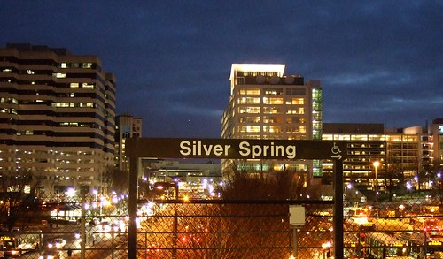 Downtown Silver Spring from the Metro station. Photo by mindgutter
Tysons will have 4 stations, but they will only be able to handle about 40% of the rides of stations at Silver Spring, Bethesda, Rosslyn, and King Street. Matt Johnson at Track Twenty-Nine created an excellent diagram showing how track sharing by Metro lines closer in to the city prevent the same capacities on the outer spokes of the system (except on the Red Line, which does not share tracks with any other line). Even with four stations, the capacity of the line does not stack up to urbanizations in Montgomery County, Arlington, and Alexandria. Can it support an even larger development with less system capacity? Can the already-clogged North Arlington Orange Line corridor support the additional riders with its finite capacity? Optimal success of the Tysons plan would require more Metro capacity such as a separated Blue Line on a new Potomac crossing.
I'm also lead to wonder if this has not contributed to the overall inferior urbanization in Prince George's County. No station in Prince George's has more than 60% capacity because the Green, Blue, and Orange lines all share track inside the District (though the northern section of the Green Line as the potential to do so if the Yellow Line ever runs all the way to Greenbelt regularly). Certainly the County's poor planning policies have contributed to the lack of urban development around virtually all 14 Metro stations, often egregiously, but perhaps lack of capacity has contributed as well.
The stretch of Metro in Prince George's County with the most service, the northern Green(/sometimes Yellow) Line has experienced the most development. Prince George's Plaza Station has probably seen the most. Though not exactly Downtown Silver Spring yet, University Town Center is probably the best example of urban development around a Metro station in Prince George's. Much has been planned for West Hyattsville, College Park, and Greenbelt, though little has come to fruition. New Carrollton, which will have added capacity once the Purple Line comes to town, also has grand plans for development. Stops on the Blue and lower Green Lines, however, are not experiencing as much planning buzz.
I have never heard of any study that implies the impact of station capacity versus development around stations, but it stands to reason that the more capacity, the more successful and robust development can be. The Orange Line corridor might be somewhat of an exception. West of Rosslyn, the Orange line can handle about 60% of the trips Silver Spring or Bethesda can handle. The strip is anchored, however, by Rosslyn, which has the same capacity as Silver Spring and Bethesda.
David Alpert suggested some innovative ways to create more system capacity by separating the Green and Yellow lines and rerouting some of the Silver Line trains. This would help Prince George's County, Tysons Corner, and other locations in Virginia and still be cheaper (in theory) than a separated Blue Line. If Silver Spring, Bethesda, and Rosslyn are models we seek to emulate, station capacity ought to be equivalent of those successful areas.
Subscribe to:
Posts (Atom)

 Posts
Posts


