Search This Blog

Showing posts with label Prince George's. Show all posts

Saturday, December 19, 2009

Snow Emergency: Don't Walk

Having experienced many of my Christmases as a youth in Buffalo, I'm generally nonplussed by big snow storms. This one has confined me to my house, however, and I've been watching the madness unfold on News Channel 8, where they are warning us not to venture outside our houses if we don't have to do so.


Route 1 in Laurel, taken from the front of the Greene Turtle. Plenty of cars were out despite warnings, making pedestrian conditions hazardous. Photo by the author.

Generally, that's very good advice. However, they were showing footage of pedestrians crossing streets and dismissing it as wildly dangerous behavior because, hey, cars gotta use those streets! Certainly driving conditions merit warnings, but why are we chiding the pedestrians instead of the people driving non-emergency vehicles? How are pedestrians expected to stay out of the streets when public services are focusing efforts on clearing roadways while ignoring sidewalks?

Prince George's County Executive Jack Johnson declared a state of emergency because so many county residents failed to heed warnings not to drive. I saw a few of those obstinate drivers on my walk to the Safeway in my neighborhood... which of course was closed. In fact, the only things open in Laurel Lakes Shopping Center were a nail salon (?) and a liquor store. Eventually I found an open 7-11, but suffice to say there was a lack of healthy diet staples. The proprietor, Pankaj, had walked to his store this morning to make sure Laurel Lakes could at least purchase Hot Pockets and yogurt smoothies if nothing else. This really made me wish my neighborhood had live-work units. Not to mention sidewalks.

Despite my lack of healthy food, open shops, and decent pedestrian facilities, at least I wasn't threatened with a gun during a snowball fight. A public gathering in the public realm at 14th and U NW was broken up because... wait for it... a car was hit by a couple of snowballs. The man brandishing the weapon was an off-duty policeman. The message: People don't matter in a snow emergency. Cars do.

Saturday, December 5, 2009

PG Stands for Poor Growth

Now, I like to stick up for my county. I believe that in many ways, Prince George's County has been dealt the short end of the smart growth stick. But the fact is that the county government isn't even trying, and it seems that any smart, transit oriented growth that does occur happens by accident or coincidence.


What puts me over the edge was this Washington Post article in Greater Greater Washington's Breakfast Links. A concrete plant has been approved near Sheriff and Cabin Branch Roads near Fairmount Heights.The Post article points out the multitude of other industrial plants near this site, surrounded on all sides by middle class residential zoning. GGW highlights this concentration, pointing out that the region in majority black. Pushing around non-wealthy minorities is not a new thing Prince George's County.

Cheverly Metro Station. Photo by Genista from Flickr

But what the Post doesn't point out is that the site where this concrete plant has been approved is less than a mile from Cheverly Metro station, one of the most underused stations on Metro. And it's on the same side of US-50 as the Metro station, meaning that useful growth could potentially occur in that area if Prince George's County wasn't treating it as a dumping ground for undesirable industry. It's a location inside the Beltway with easy access to the city and multiple forms of transit, including two Metrobuses that directly serve the site, five Metro stations within two miles (Cheverly, Landover, Deanwood, and Capitol Heights, and Addison Road-Seat Pleasant), and an Amtrak and MARC station at New Carrollton under three miles from the site. This is not the first, but only the latest controversy where PG County has throw its citizens under the bus and tried to drop an industrial plant in residential areas near Metro stations.

This site could be used for transit-oriented development at Cheverly station. It could be a crossroads between Cheverly and Capitol Heights. Instead it is home to an asphalt plant, a recycling transfer station, and a clay mine. And now, coming soon, a concrete plant. These uses would be far more suitably placed along US 50 outside the Beltway just a few short miles away, alas those areas have been blanketed with very low density McMansion developments. Byzantine laws promoting sprawl in PG will continue to force industrial growth in inappropriate places, including Fairmount Heights, one of the oldest black settlements in Maryland.

Prince George's County will not continue to prosper as it runs out of agricultural land while continuing to neglect its valuable inner ring suburbs. Transit investment will continue to be difficult to justify, making it more difficult to fund. And PG will continue to mean poor growth until the county's planning begins to take a look towards the future with regard to land use economy.

Monday, October 19, 2009

Transit Capacity

Last month I criticized the plan to scale back Tysons Corner because of the need for increased freeway capacity. The more I think about it, the more merit I see in the notion that a revamped Tysons Corner will be desperately transit-starved. Freeways, however, are not the panacea. The plan to urbanize the region's most prominent edge city will bring thousands more jobs and residents to the area. Even if the area becomes more self contained, it will require much greater capacity for transportation in and out of the area's densest job center.

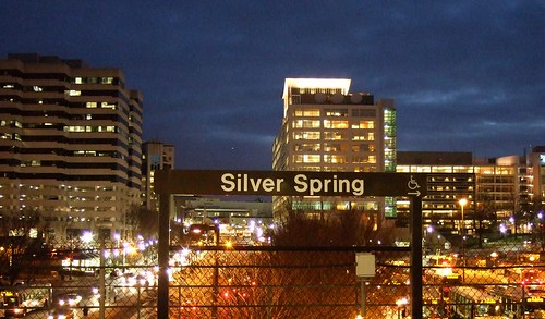
Downtown Silver Spring from the Metro station. Photo by mindgutter

Tysons will have 4 stations, but they will only be able to handle about 40% of the rides of stations at Silver Spring, Bethesda, Rosslyn, and King Street. Matt Johnson at Track Twenty-Nine created an excellent diagram showing how track sharing by Metro lines closer in to the city prevent the same capacities on the outer spokes of the system (except on the Red Line, which does not share tracks with any other line). Even with four stations, the capacity of the line does not stack up to urbanizations in Montgomery County, Arlington, and Alexandria. Can it support an even larger development with less system capacity? Can the already-clogged North Arlington Orange Line corridor support the additional riders with its finite capacity? Optimal success of the Tysons plan would require more Metro capacity such as a separated Blue Line on a new Potomac crossing.

I'm also lead to wonder if this has not contributed to the overall inferior urbanization in Prince George's County. No station in Prince George's has more than 60% capacity because the Green, Blue, and Orange lines all share track inside the District (though the northern section of the Green Line as the potential to do so if the Yellow Line ever runs all the way to Greenbelt regularly). Certainly the County's poor planning policies have contributed to the lack of urban development around virtually all 14 Metro stations, often egregiously, but perhaps lack of capacity has contributed as well.

The stretch of Metro in Prince George's County with the most service, the northern Green(/sometimes Yellow) Line has experienced the most development. Prince George's Plaza Station has probably seen the most. Though not exactly Downtown Silver Spring yet, University Town Center is probably the best example of urban development around a Metro station in Prince George's. Much has been planned for West Hyattsville, College Park, and Greenbelt, though little has come to fruition. New Carrollton, which will have added capacity once the Purple Line comes to town, also has grand plans for development. Stops on the Blue and lower Green Lines, however, are not experiencing as much planning buzz.

I have never heard of any study that implies the impact of station capacity versus development around stations, but it stands to reason that the more capacity, the more successful and robust development can be. The Orange Line corridor might be somewhat of an exception. West of Rosslyn, the Orange line can handle about 60% of the trips Silver Spring or Bethesda can handle. The strip is anchored, however, by Rosslyn, which has the same capacity as Silver Spring and Bethesda.

David Alpert suggested some innovative ways to create more system capacity by separating the Green and Yellow lines and rerouting some of the Silver Line trains. This would help Prince George's County, Tysons Corner, and other locations in Virginia and still be cheaper (in theory) than a separated Blue Line. If Silver Spring, Bethesda, and Rosslyn are models we seek to emulate, station capacity ought to be equivalent of those successful areas.

Thursday, February 26, 2009

Imagine Prince George's Plaza

Though nowhere near up to par with Arlington's Rosslyn-Ballston Corridor, Old Town Alexandria, or the central business districts of Bethesda and Silver Spring, Prince George's Plaza might be the best example of transit-oriented development in Prince George's County. It combines a Metro station with heavy retail, medium density housing, and a walkable street grid. Unfortunately, those things are not integrated with each other.

I love the City of Hyattsville. As soon as I can afford to do so, I plan on moving there. It has a ton of potential. Potential, however, means room for improvement.

Anecdotally, I was told by a Hyattsville Police officer that the city plans to annex and redevelop the suburban style medium-density apartment complexes north and west of the mall. In this same conversation, the officer, who was advising me on where the city experienced most crime, cited garden style apartment complexes like these (like Kirkwood near West Hyattsville station or the apartments on the southwest corner of University and Adelphi) as the worst offenders. I can only assume the isolation of the buildings behind PG Plaza makes them ideal places to engage in criminal activity.

Generally, I don't like the idea of putting heavy transit near a mall. Malls are inherently car-oriented, and over the past decade they have experienced severe decline in image and practicality. The Mall at Prince George's (which I will forever call PG Plaza despite its new name and this newfangled civic movement against saying "PG" in favor of "Prince George's") might be able to take advantage of the Metro station across the street.

Many of the larger development projects in Prince George's County have been greenfield developments outside the Beltway and far from transit taking on a semi-new urbanist format, but are far from transit and isolated from the better urban design closer in. Bowie Town Center and National Harbor are good yardsticks for what we can expect out of planned developments at Brandywine, Westphalia(pdf), Konterra, and Woodmore Town Center (pdf): far from existing transit, isolated pockets of walkable mixed use surrounded by parking. PG Plaza, if redeveloped, can present a retail design similar to that of Bowie Town Center with the added advantage of being across the street from a Metro station in an area that can easily be reticulated into the surrounding street grid.

Remove the roof, which PG Plaza didn't always have anyway, and lay down the grid. I give you new Hyattsville:


View Larger Map

With this, perhaps more pedestrian friendly changes will occur as well. East-West Highway has three shockingly bad design flaws on that stretch. First, the median fences. Anytime a street has a fenced median to discourage jaywalking, it's a sure sign of poor design. Pedestrian traffic is like water flow. It will find the path of least resistance from origin to destination, and will creatively by-pass obstacles. Instead of trying to force pedestrians to go out of their way to cross East-West, embrace the foot traffic with more crossings, traffic signals, and a parallel street to spread out the traffic.

Next, the pedestrian bridge from the Metro station to the mall parking lot has to go. Parking ought to be consolidated into a garage, and the street frontage should be developed. pedestrian bridges over suburban arteries like this are not functional, they encourage speeding on the road, they kills street life, and they are unbearably tacky. Perhaps if the street frontage has an arcade with an upper level of shops and whatnot, it could stay, but generally it looks horrible and it proves to be cumbersome for access to the Metro station.

Third, rename the damn road. East-West Highway (MD route 410) is a title unbecoming for a road passing through the CBD's of Bethesda, Silver Spring, Takoma Park, and Hyattsville. In Takoma Park, 410 is actually called Ethan Allen Avenue. Perhaps Hyattsville could follow suit and rename it something like "John Clark Hyatt Avenue" after the town's founder. Apt, historical, and far less generic.

Hyattsville is evolving as a city. It has come a very, very long way in the last decade, and it continues to grow and improve. PG Plaza will undoubtedly emerge as a hot spot for good urbanism. Eyesores like the pedestrian bridge will be replaced by more of what we're seeing in the nearby Hyattsville Arts District, and instead of an island of good urbanism, it will grow into the fabric of the surrounding areas.

Thursday, February 12, 2009

Imagine West Hyattsville

West Hyattsville Metro Station is one of the most underutilized stations on the Metro system, standing out even in TOD-beleaguered Prince George's County. It stands seemingly in a large field, discouraging the station's use as anything but a commuter stop. The County has plans (pdf) for vitalizing the area around the station, but I thought I might take a crack at it myself with some street connectivity.


View Larger Map

Queens Chapel Town Center has a great deal of potential to anchor a strong retail district. The area, at the intersection of Chillum, Mount Rainier, and Hyattsville, has the population to support retail progress. The success of the nearby Hyattsville Arts District has changed the image of the area. West Hyattsville, connected to the Arts District by a traditional suburban street grid, is poised to parlay the success of one of Prince George's County's most popular real estate ventures into success of its own. Only the presence of a Metro station,

The Northwest Branch runs just to the south of the station, but instead of serving as a barrier, I believe this watercourse can be embraced by development with small waterside paths. I included several new bridges over it, connecting potential new developments to the Metro station. The key element, in this case, is adding parallel roads. As I have stated time and time again (as with many before me), a street grid reduces traffic, lessens vehicle miles traffic, and eliminates car trips as the area becomes more walkable. Hopefully a developer with the vision will take advantage of the opportunity, and hopefully the County won't block any progressive efforts. Hyattsville could become the new Bethesda, it just takes some progressive leadership to make it happen.

Monday, December 29, 2008

More Freeways = Worse Urbanism

An ironic fact about freeways is that while they are designed to connect towns, they effectively partition them as well. A look at the south suburbs of Baltimore tell the story. The area between I-95, MD-100, and the Chesapeake Bay is criss-crossed with eight interstate-standard freeways. Interstates 95, 195, 695, 895, and 97, along with Maryland routes 10, 100, and 295.


View Larger Map

The area is served by MARC and the MTA Light Rail, however the stations in this area are predominantly park-and-ride. Home prices in these neighborhoods are significantly lower than in other parts of Howard and Anne Arundel Counties. And crime is not uncommon in these suburbs.

Further south, 95 and 295 cut through DC suburbs in Prince George's, but are currently only crossed by the Capital Beltway. Though this area is of similar size and similar geography, the population is much higher than northern Anne Arundel and eastern Howard counties. House prices are comparable, but they have been rising lately, particularly around the Metro stations.

I blame much of this on street connectivity. When the landscape is drawn and quartered like it has been in Baltimore's southern suburbs, it naturally has a negative effect on street connectivity. Lack of street connectivity can lead to higher incidence of traffic accidents, longer response times for emergency vehicles, and greater traffic jams.

Of course, this is a very unscientific and opinion based overview of how lots of highways can ruin an area. I'm sure there are lots of people who think Glen Burnie is a much better town than Hyattsville, so I encourage comments here.

Monday, November 3, 2008

Are You Ready For Some Metro

Monday Night Football, the NFL's major prime time network(-cum-basic-cable) broadcast has come to FedEx Field once again. Even more exciting than the normal hyperbole of MNF game is the fact that the 6-2 Redskins are playing the 5-2 Pittsburgh Steelers, a game that lots of people are actually going to care about for a change. Redskins Nation is buzzing.

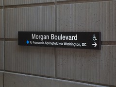
If you commute on the eastern half of the Beltway, however, your afternoon drive will probably be much slower, as FedEx Field opens the lots four hours before the 9 pm kickoff and tailgaters will likely be jamming exits 15, 16, and 17 during the evening rush, as happens for every weeknight home game at FedEx Field. But Metro is pulling their weight, just like they did for the last Monday Night game at FedEx, the 2006 season opener. The system will be staying open until 1 a.m., with additional personnel at Morgan Boulevard and Largo stations.

Considering that FedEx Field opened in 1997 but Morgan Boulevard and Largo stations did not open until 2004, Metro use during mega-events at the stadium does not make headlines like Nationals Park did when it opened atop a Green Line station this spring. People took notice that Nationals games were not choking the Metro system, even when Nationals games were getting high attendance at the beginning of the season (interest naturally waned by the middle of their dismal 59-102 season).

Of course, FedEx Field has over twice the capacity of Nationals Park. Then again, FedEx Field is suburban, fed by highways, and surrounded by acres of surface parking. Where Navy Yard station is a block from Nats Park, FedEx Field lies almost a mile from Morgan Boulevard. Even if one were to envision a future Purple Line station at FedEx Field, it wouldn't be much closer, and would likely augment rather than replace Morgan Boulevard as the primary stop for the venue. In any event, an awful lot of people would have to give up driving before Metro started to have major issues on game day, even when games impacted the weekday rush hour. For now, the Blue Line is a viable alternative to driving. I'll take walking a four fifths of a mile for free from the Metro over walking two fifths of a mile from a $30 parking space. And it never hurts to take a car off the Beltway, while you're at it.

Wednesday, October 15, 2008

...Fight For Ol' DC

Talk of bringing the Redskins back inside District lines is abound lately. Cost estimates for a domed stadium are roughly in the $1 billion range. The stadium would be designed to host all the Redskins' home games with hopes of bringing the Super Bowl or the NCAA final four to Washington, DC in the future.

Let me start off by saying that I am the biggest Redskins fan around. Apart from military a few obligations, I haven't missed watching a Redskins game since the 80's. One of my goals in life is to be well-off enough to get season tickets. I have accumulated a very extensive memorabilia collection. You get the idea.

It is important to point out that the Washington Redskins have been a part of this city since 1937. The team has set NFL attendance records eight years in a row, and it is the third most valuable sports franchise in the world. The team has sold out every home game since 1967. The NFL is by far the most prominent professional sports league today, and the Redskins are the second most valuable franchise in the league.

Which was why I was a little troubled by something I read on Richard Layman's blog regarding the notion of relocating the Redskins' stadium back into the District:
"SPENDING MONEY ON SPORTS STADIUMS IS A WASTE OF TIME....

...NOW IS THE TIME FOR LEADERSHIP.

NOT PANDERING ON RIDICULOUS STUPID THINGS LIKE GUYS RUNNING AROUND IN COLORED UNDERWEAR AND SIMILAR STUFF."
(Emphasis was in the original text)
There are an endless stream of reasons that building a new Redskins stadium in the District would be a bad idea, but I must strongly object to this language when approaching this topic. Professional sports are a very, very important cultural institutions for the cities where they exist. Sports institutions are just as large a part of the culture of a city as its cuisine, art, music, and theater. Spending money on sports venues is just as important as spending money on other cultural venues like the Kennedy Center or the Corcoran Galleries.

I was for the Verizon Center. I was for Nationals Park. and I am for DC United Stadium. But as much as I love the Redskins, I cannot foresee any parcel of land where a new Redskins stadium would be a good thing for the city. For starters, this new stadium is going to be larger than FedEx Field, the Redskins current home, a 92,000-seat stadium in Landover. It will also likely be larger than the new Dallas Cowboys Stadium, a 100,000+ monstrosity. Even the most casual football fan knows that the Redskins and the Cowboys are constantly one-upping each other.

So now we are talking about a stadium with almost DOUBLE the capacity of RFK's 57,000. RFK didn't have too much more capacity than National's Park, and Metro could handle the game day rush. I'm not so sure that this would be true if the numbers were doubled. Assuming three quarters of ticket holders (75,000) live outside the District (which I feel may be conservative, but I don't know where to get the numbers on that), that means that on game day, the population of the city swells by about one eighth. This project has absolutely no chance of getting rid of the surface parking that plagues the area, especially considering the significantly larger footprint of the stadium structure.

Football fans are going to drive because football fans are going to tailgate before and probably after the game. This is why they open up parking five hours before kickoff. When I go to a Redskins game, it usually winds up being a 10 hour ordeal. Most of the folks I know have rather elaborate tailgating set-ups. This phenomenon certainly is not unique to the Redskins. Any team, any city, any weather, there will be tailgating. And why not? At $8 a beer and $5 for a bratwurst, may as well have a party outside the stadium in the parking lot. I imagine this also has to do with the fact that venues as large as football stadiums would flood local businesses on gamedays, and therefore you don't see too many NFL stadiums surrounded by commerce like the Verizon Center. The difference between 17,000 fans and 91,000 fans is... well, do the math. Then imagine five or six times as many people cramming into RFD and Fido in Chinatown on game night.

I poked around, and I can't seem to find an inner-city NFL stadium that appears to have a positive impact on the surrounding area. Soldier Field in Chicago appeared to be among the best:


View Larger Map

Lambeau Field
in Green Bay didn't appear to have any surface parking around the stadium, but Green Bay is the smallest American city with a major pro sports team. However, if it were possible to build a stadium with that small of a relative footprint, I'm all for it. Unfortunately, the majority of NFL stadiums wind up looking more like Detroit's Ford Field, vast expanses of surface parking in the downtown. Just like FedEx Field, only FedEx Field's parking is effectively in the middle of nowhere.

This raises the question, is the payoff from the stadium worth the bad urbanism? Well, Ryan Avent doesn't think it's such a good deal to begin with. This enormous chunk of land will host 10 football games a year, eight regular season and two preseason. Best case scenario, another two if my Skins suddenly make a run at the Super Bowl. There may be a Super Bowl or two held there, plus a couple of NCAA tournament games every couple of years. Let's also throw in a major concert, like the HFStival once a year. Maybe another major event or two a year that I'm not considering. My most generous estimation gives fifteen events at this venue in one year. Nationals Park hosts 81 Nats games alone every year. As for the Phone Booth, I've seen the Capitals, Wizards, Georgetown Hoyas, multiple concerts, and a three ring circus there. every other day there is a major event at that place.

GreaterGreaterWashington argues that if all this venue will bring is civic pride, $1 billion is too too costly. This place is going to be sitting vacant for 350+ days a year, occupying riverfront property and containing surface parking that will no doubt contribute to pollution in the Anacostia River. GGW points out the National Capital Framework Plan would have a much more positive economic impact on the city. I tend to agree.

Fedex Field is only 12 years old. It is currently the largest stadium in the NFL. It has sufficient parking, it is convenient to highways, it is served by Morgan Boulevard Metro station, and it is at a location close in and relevant to the city. It may not be inside the District, but it is at least inside the Beltway. As I mentioned in the post linked above, the stadium (and the Metro station, for that matter) have not led to any fantastic economic development in Landover, why on earth would it lead to such progress in East End? RFK Stadium never did.

So here it is, coming out of the mouth of the most die-hard Redskins fan on earth: There is no place for a new stadium in the District of Columbia. Perhaps an adjacent site in Landover or elsewhere in Pringe George's County (hopefully a little more convenient to Metro), maybe something in Virginia along the Silver Line, but certainly not anywhere in DC. I'd love to see this town host a Super Bowl. But not at the expense of acres of some of the city's most valuable real estate.

PS- if you're at the game on Sunday, I will be tailgating in Green Lot F60. Look for the eccentric guy with the knit cap with the ball on top.

Friday, October 10, 2008

Help a Fledgeling Blogger + Morgan Boulevard

I always appreciate the input of all my readers, especially the ones who disagree with me. It makes this project a little more interesting, and it allows me to experiment with some new ideas that might otherwise go unsaid. So I appreciate everyone who (respectfully) shares their opinion, whether they agree with me or disagree.

I have had an interest in urban planning since before I knew what it was. I used to draw maps of neighborhoods when I was a kid as young as six. Unfortunately, I never found the field of study until after I'd already settled into another career. Now I'm trying to position myself for a career switch, so of course I am using Imagine, DC to help me figure out where my interests lie.

Unfortunately, I'm a relative newcomer to blogspot, and I'm having trouble with a few things... my captions, particularly on Flickr pictures (you know, the part where I give credit to the photographer?) keep disappearing once I post the blog. Anyone know how to fix that?

***

So this weekend I had my first experience with Morgan Boulevard Metro Station on the Blue Line. Normally, I'm a tailgater, but this weekend I didn't have a parking pass to the Redskins-Rams (a very frustrating loss, unfortunately) game so I decided to try Metroing it with my friend Walter. Our jumping point was Takoma, a ten minute walk from Walter's house. The ride is about a 45 minute trip with one transfer at Metro Center.

Frankly, I was a little disappointed at how few Redskins fans take the Metro, but I have a couple of guesses as to why. For starters, it is almost a mile walk down Summerfield/Garrett A. Morgan Boulevard. The sidewalks weren't exactly designed to usher tens of thousands of people down to the stadium. The road is fronted by townhouses in a remarkably car-oriented community with no visible retail, astonishingly poor use of areas sitting atop a Metro Station. For Prince George's County, however, it is not nearly as depressing as many other stations (including the stop before it, Seat Pleasant, which is completely surrounded by single family houses).

Next, it is a bit strange walking down a very suburban road through dozens of houses, particularly on the walk back when the stadium is not on the horizon. I felt like I was meandering aimlessly through some distant suburb, not walking between a 94,000 seat stadium and a high speed transit station. I can imagine how that might deter the average football fan from making the walk. Perhaps this is why few other events are held at the venue throughout the year.

At the end of the day, however, I am astonished that more people don't take Metro to the games. With parking passes STARTING at $25, plus time spent in traffic, the casual fan really ought to consider huffing it a mile from Morgan Boulevard. Unfortunately, tailgaters will always have to drive.

Incorporated

As a Prince George's County resident, I tend to focus my posts more on this area not only because it directly affects me, but also because I feel that it is widely overlooked on issues of urban development and sprawl prevention. This is all too common in Prince George's County... Someone gets struck by a car going at a high speed while crossing a street designed to serve cars and not pedestrians. My last post alarmed me when I saw how many roads are becoming freeways thanks to superfluous interchanges here in my home of Prince George's County. It is horrifying.

I have noted that incorporated towns in Prince George's County seem to be significantly more immune to this "freewayification". Unincorporated areas like Largo, Beltsville, and Greater Upper Marlboro seem to get the brunt of the poorly implemented car-oriented development. Certainly there are may be other factors, but perhaps an incorporated town with direct, small scale representation is less likely to be tolerant of a lack of a sense of place in the town.

Baltimore Inner Space
posted this piece (via GGW) on Owings Mills, and its egregious display of poor urbanism, highlighted by a fence and 'No Trespassing' signs that keep mall patrons from accessing the Metro station even though the two are adjacent. Owings Mills, like every other town in Baltimore and Howard counties, is unincorporated. There is no mayor or council to petition against such poor urbanism. residents of the Owings Mills area are at the mercy of developers and a larger government that oversees the entire county of three quarters of a million people. Perhaps this is why Largo looks like this and downtown Hyattsville does not, even though Largo is centrally served by Metro and Hyattsville is not. Even when Hyattsville fell into blight, its primary artery, US-1 remained a four lane road with a speed limit of 30, plentiful cross streets and traffic signals.

Beyond DC writes about Prince William County's future plans to upgrade transit and create more walkable town centers. Beyond DC is skeptical of the plan's ability to succeed, but applauds the idea of improving one of the most populous counties in Virginia. There are only four incorporated areas in Prince William; Occoquan, Quantico, Dumfries, and Haymarket (Manassas and Manassas Park are both independent cities but are completely encompassed by Prince William County). I would be interested to see the success of this plan in those areas versus unincorporated areas like Dale City and Gainesville.

Not to say unincorporated towns can't thrive with good urbanism. Silver Spring and Bethesda are prime examples of unincorporated areas that have exercised a very intelligent master plan. Both those areas are among the most popular walkable areas outside the District. Of course, those two areas are atop Metro stations and they are both adjacent to the DC line situated on prominent corridors into the city. Wheaton, while not enjoying the same level renaissance, might be a good example of an unincorporated exception. It too has a Red Line station (home to the western hemisphere's longest escalator), and has been improving steadily for about the last twenty years. I ought to know, I went to high school there.

If the Tysons Corner plan gets off the ground, that will be another unincorporated area that enjoys smart redevelopment. Of course, the sector plan for the area seems to treat the area like an incorporated town (strict boundaries and districts, guidelines and regulations specific to the area, a council to govern the plan, etc). Obviously the existing density and planned metro stations have a great deal to do with this overhaul as well.

My Prince George's County seems to have a clear dichotomy between smartly designed incorporated towns working to improve their walkability and livability and unincorporated areas that are draped with high speed roads, poor pedestrian facilities, big box stores, and a depressing lack of a sense of place. Even my neighborhood, technically outside the corporate limits of the City of Laurel, lacks the sidewalks and curbs present in the neighborhoods to the east, north, and west. Does that mean it would be smarter to incorporate more towns? Beltsville, Chillum, Langley Park, Lanham, Clinton, Suitland, Largo, Oxon Hill, and Camp Springs, should we look into incorporating them?

The mayor of (incorporated) Kensington commented on my MARC post informing me that Kensington too will be making improvements to the downtown. Does a government directly serving a smaller group of people help an area create, grow, and preserve their sense of place? Perhaps the incorporation provides more organization for the residents to vocalize their desire to improve the state of their surroundings. Whatever it is, it will likely ensure that my next house will be in an incorporated town.