Search This Blog

Showing posts with label urban infill. Show all posts

Tuesday, August 17, 2010

An Email

I know posting has been sparse recently as I have been busy with a new job and overwhelmed by selling my suburban house while preparing for a series of temporary work-related relocations. But recently I received an email regarding municipal land use policy that I wanted to open up to a wider debate. Please leave any constructive comments you might have regarding the issue.

do you think it is a good idea, bad idea, or value neutral idea for a small town to amend their ordinance protecting "open spaces" in order to allow for the refurbishing of an existing building to be transformed to affordable senior housing.
(I don't know if "open spaces" is a standard term, but in this case it means land zoned for institutional use and includes areas that have a lot of property such as schools, churches, library etc)

I watched a LONG debate/discussion at a city council meeting and found I'm kind of in the minority in my opinion and wondered what a less biased person with actual knowledge of city plan would have to say.
-s

Dave Murphy 
"Open space" is a very sketchy term. Gigantic empty lawns that nobody uses for anything are often considered "open space". On the one hand, if they can be used for something more meaningful, I'm all for it. If a building or set of buildings reinvigorates the town, absolutely it is a better use of the land, regardless of its use.

A great example in my opinion would be Four Corners, an area we both know and love... When they tore down the Kay Tract to build Blair High School, they demolished acres and acres of "green space". That area was a haven for homeless people and drug activity. It was unpatrolled, unregulated, secluded, and crime-ridden.

But when they tore out all those trees, what arose was a school already too small for its student body despite the fact that it was spread out over twice the real estate of the old school. The main feature that interacted with the rest of the "town" (if one were to consider Four Corners its own town) was not the main facade of the school, not the grand entrance, walkways, side buildings, or even athletic fields; it is the driveways and parking lots that front the school.

It secluded the student body, who for the most parts are residents of Four Corners and downtown Silver Spring, from the rest of the town. Was it a better municipal use of land than a bunch of trees with trash and homeless people? Absolutely. But does it contribute more to the townliness of Four Corners? Barely.

A good side effect was the pedestrian improvements that came along with a 3,200 student school, and Four Corners desperately needed those pedestrian improvements. But despite the fact that it is the most heavily traveled intersection in Eastern Montgomery County (for PEOPLE, not cars... more people move through that intersection than even Georgia and Colesville) no major mass transit improvements came with the school save for maybe a bus shelter or two.

Now consider the lawns providing the setback for St. Bernadette's. That is open space. It is green space. Is it serving the people of Four Corners? Does it serve St. Bernadette's other than to isolate it from the high speed traffic of University Boulevard or the "public school kids" that as a universal community of faith we ought to be reaching out to and embracing? The only thing I've ever used those fields for is stretching out a football team before a game at St. Bernadette's. And in 5 years of coaching and two years of playing, I can count the number of times I've done that on two hands.

Now consider something like this:
http://greatergreaterwashington.org/post.cgi?id=3922

Erik Bootsma, the architect that authored this article, is a Beaux Arts architect and a Catholic. He writes about religious structures often. Here's his website, it's great:

http://beatusest.blogspot.com/

But back to the suburban church being retrofitted... American churches are often gigantic, isolated structures that are monuments to themselves. Whereas in Europe, Cathedrals are the centerpieces of the towns, in America you have junk like the Mormon tabernacle, which only interacts with people driving down the Beltway and in no other way serves as a structural outreach to the community. For all their questionable doctrine, this is actually my number 1 gripe with the Mormon church. They structurally isolate themselves from their surroundings, even in Salt Lake City. But nowadays, every church does that. They move from central locations to wherever they can have the biggest parking lot, assuring that few will walk to their services and ostensibly turning away anyone that does not drive a car.

If St. Bernadette's was to take the lawns in front of the parish and do something useful such as what Bootsma proposed there in Arlington, it would create a community directly affected by the parish rather than isolated from it. And for a religious institution, what better way to attract members than to make the primary structure (the church) the focal point of a community? And as far as traffic on University Boulevard goes, building frontage could slow traffic down, and a more permeable street network could actually relieve congestion there. A train line running up Columbia Pike would be nice also.

As for your case, affordable senior housing is never a bad thing in theory. But what are they building? Garden style apartments with ample parking that will eventually mock seniors who lose the ability to drive? Or a community of well designed buildings that will allow seniors to partake in society without forcing them to drive? In my opinion, the latter serves more use than an open lawn that nobody uses.

Sunday, January 3, 2010

Imagine a streetcar on Alabama Avenue

When DDOT unveiled its Streetcar vision in October, I was little disappointed by the amount of service in River East. Indeed, the area's reputation has been mired in negativity for quite some time, which has lead to, for better or worse, a very different kind of land and economic development in Wards 7 and 8. This is evident in the distribution of services proposed by DDOT.

River East has experienced a great deal of suburban style development. Wickedly suburban. Affordable housing is often not accessible to the six Metro stations that serve this third of the city. Isolated affordable housing can often turn out to be frighteningly similar to ill-fated housing projects. Requiring people of lower income to rely on automobile transport greatly increases their cost of living, further exacerbating the poverty. But shiny new developments in River East, for all their efforts at civic improvement, are still focused around the automobile.

What really disappointed me about DDOT's plan is that all the streetcar lines appear to run THROUGH River East. Along the Anacostia River, perhaps, but they fail to connect many of the neighborhoods to the system, including several that are not very accessible to Metro. This plan would lead me to infer that Congress Heights and Fairlawn are and will be for the foreseeable future dependent on the rest of the city to be a viable place to live. The lines connect River East to the rest of the city, but they don't connect River East to River East. Not as much as it could, at least.

With DC's population rocketing past 600,000 and developers running out of "River West" real estate to develop, Benning, Deanwood, Anacostia, Washington Highlands, Hillcrest, Fort Dupont, and the rest of River East's many neighborhoods will becoming increasingly attractive for development. But the same type of dense, walkable, transit-oriented, traditional neighborhood design is not possible if River East goes as underserved by streetcar as it is by Metro (6 stations versus 31 in the rest of DC and not transfer stations). So I conceived a line that would make it feasible to live in Congress Heights and work in Capitol Heights without taking Metro all the way to L'Enfant Plaza first. I give you a proposal for a ninth streetcar line, the Alabama Avenue line:


View River East Streetcars in a larger map

Blue indicates lines laid out in the DDOT plan, purple indicates possible future streetcar extension laid out in the plan, and red is the Alabama Avenue line. Obviously, significant portions of the line also run along Southern Avenue and Nannie Helen Burroughs Avenue. It connects prominent neighborhoods to Metro stations and other streetcar lines. It puts more of the rail transit infrastructure within walking distance for District residents who will benefit most from its service and economic development. It is intended to interact with the neighborhoods as places where a significant portion of the District now lives and could potentially work in the future.

Where the city will ultimately have a streetcar network, River East will only have lines. The Alabama Avenue line would create a network that would compliment the existing Metro stations and the already-planned streetcar lines. It may not generate enormous ridership projections right now, but it would certainly draw more walkable urban development to Alabama Avenue and the other proposed corridors. We plan roads in anticipation of future development. Why can't we make that same investment with our streetcar network?

Cross-posted on Imagine, DC

Monday, October 19, 2009

Transit Capacity

Last month I criticized the plan to scale back Tysons Corner because of the need for increased freeway capacity. The more I think about it, the more merit I see in the notion that a revamped Tysons Corner will be desperately transit-starved. Freeways, however, are not the panacea. The plan to urbanize the region's most prominent edge city will bring thousands more jobs and residents to the area. Even if the area becomes more self contained, it will require much greater capacity for transportation in and out of the area's densest job center.

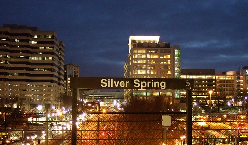
Downtown Silver Spring from the Metro station. Photo by mindgutter

Tysons will have 4 stations, but they will only be able to handle about 40% of the rides of stations at Silver Spring, Bethesda, Rosslyn, and King Street. Matt Johnson at Track Twenty-Nine created an excellent diagram showing how track sharing by Metro lines closer in to the city prevent the same capacities on the outer spokes of the system (except on the Red Line, which does not share tracks with any other line). Even with four stations, the capacity of the line does not stack up to urbanizations in Montgomery County, Arlington, and Alexandria. Can it support an even larger development with less system capacity? Can the already-clogged North Arlington Orange Line corridor support the additional riders with its finite capacity? Optimal success of the Tysons plan would require more Metro capacity such as a separated Blue Line on a new Potomac crossing.

I'm also lead to wonder if this has not contributed to the overall inferior urbanization in Prince George's County. No station in Prince George's has more than 60% capacity because the Green, Blue, and Orange lines all share track inside the District (though the northern section of the Green Line as the potential to do so if the Yellow Line ever runs all the way to Greenbelt regularly). Certainly the County's poor planning policies have contributed to the lack of urban development around virtually all 14 Metro stations, often egregiously, but perhaps lack of capacity has contributed as well.

The stretch of Metro in Prince George's County with the most service, the northern Green(/sometimes Yellow) Line has experienced the most development. Prince George's Plaza Station has probably seen the most. Though not exactly Downtown Silver Spring yet, University Town Center is probably the best example of urban development around a Metro station in Prince George's. Much has been planned for West Hyattsville, College Park, and Greenbelt, though little has come to fruition. New Carrollton, which will have added capacity once the Purple Line comes to town, also has grand plans for development. Stops on the Blue and lower Green Lines, however, are not experiencing as much planning buzz.

I have never heard of any study that implies the impact of station capacity versus development around stations, but it stands to reason that the more capacity, the more successful and robust development can be. The Orange Line corridor might be somewhat of an exception. West of Rosslyn, the Orange line can handle about 60% of the trips Silver Spring or Bethesda can handle. The strip is anchored, however, by Rosslyn, which has the same capacity as Silver Spring and Bethesda.

David Alpert suggested some innovative ways to create more system capacity by separating the Green and Yellow lines and rerouting some of the Silver Line trains. This would help Prince George's County, Tysons Corner, and other locations in Virginia and still be cheaper (in theory) than a separated Blue Line. If Silver Spring, Bethesda, and Rosslyn are models we seek to emulate, station capacity ought to be equivalent of those successful areas.

Wednesday, October 14, 2009

Bolling Air Force Waste

Neil at GGW had a great article about the proposal to narrow the Anacostia River (dubbed the McMillian Two Plan) and bring a bit of Paris to eastern DC. If it works and can be done with environmental prudence, I am absolutely in love with the idea. It strengthens the urban fabric of the city, it extends the grid to an underdeveloped but historic part of the city, and it creates more monumental space in the city.

But my favorite part? The plan appears to redevelop the northern part of Bolling Air Force Base. Bolling AFB is an abominable waste of valuable riverfront real estate. Some might argue that the Nation's Capital ought to play host to military facilities. As a former soldier, this is a no-brainer. Of course it should. But DoD property within the District ought to use the space in a manner that is congruent with the rest of the city. Across the Anacostia River, Fort McNair interacts with its urban environment productively and in keeping with the other infrastructure surrounding it. Bolling AFB looks like it could have been built on an empty greenfield an hours drive from the city:

View Larger Map


Does an Air Force base (especially one without an active air strip since 1962) need to take up this much land? Does the utterly suburban housing stock need to sit atop land above one of the most iconic rivers in the world? I'm sure this is no problem at Minot AFB in North Dakota, but the District of Columbia has only 68 square miles. Should almost 5% of it be devoted to isolated, wasteful suburban style land use? Perhaps its time to consolidate Bolling's facilities into something that works better with the city surrounding it, and redevelop Southwest's Potomac waterfront in a manner more suited to its urban environment.

Friday, April 3, 2009

Stupid Growth: Palisades

Early this week, DC Mud profiled a new development finally going for sale in Northwest. The post captures the "McMansion" feel of the development, which is at the intersection of Foxhall and W, in the shadow of Georgetown University. This development has quick access to Georgetown, Rosslyn, and Downtown. It is even a quick drive to the Beltway. This was the best and most lucrative use of land these developers could come up with?

Worse yet, this sets a dismal precedent for the rest of the city. Ryan Avent confronts the absurd 46 4500-to-9000 sqf houses by comparing this development with the District's requests for the Brookland neighborhood to embrace greater density while just across town prime land is being wasted in such a gaudy manner (or should I say gaudy manors?)

There are differneces between the two areas, of course. Most notably, Brookland is next to a Metro station and Palisades is not. However, to borrow a phrase from my fellow GGW contributor, areas like these in the favored quarter ought to be increasing in density, if not socio-economic diversity. Neighborhoods like Palisades, Berkley, Foxhall, Colonial Hill, Wesley Heights, American University Park, and Kent ought not be held to a different standard than neighborhoods like Brookland, Anacostia, SW Waterfront, or Petworth. As these areas grow, the absorb more density. Palisades, however, appears to be immune for some reason.

Don't get me wrong, I know Washington, DC is a capital city, the most important in the world. Foreign dignitaries, ambassadors, policy makers, and other VIP's need to live here, often with greater requirements for security than most people. However, high end neighborhoods like Cleveland Park, Kalorama, Woodley Park, and Dupont Circle house many such VIP's in a form much more conducive to the city's urban fabric. The book Suburban Nation argues that more traditionally designed neighborhoods usually offer better security due to the more prevalent street activity and human presence. Tucked-away low-density developments like this one offer less "eyes on the street", provide more empty spaces and hiding places, and tend to have much longer emergency response times.

We don't need enormous high rises popping up over Whitehaven Parkway, but 17,000 sqf properties with enormous "estate homes" will ultimately only serve to partition Palisades from the rest of the city socially and politically. The wealthy and the privileged certainly have a right to live in higher quality housing stock, but in an urban setting, that sort of development ought to be constructed practicing more responsible land use.

Thursday, February 26, 2009

Imagine Prince George's Plaza

Though nowhere near up to par with Arlington's Rosslyn-Ballston Corridor, Old Town Alexandria, or the central business districts of Bethesda and Silver Spring, Prince George's Plaza might be the best example of transit-oriented development in Prince George's County. It combines a Metro station with heavy retail, medium density housing, and a walkable street grid. Unfortunately, those things are not integrated with each other.

I love the City of Hyattsville. As soon as I can afford to do so, I plan on moving there. It has a ton of potential. Potential, however, means room for improvement.

Anecdotally, I was told by a Hyattsville Police officer that the city plans to annex and redevelop the suburban style medium-density apartment complexes north and west of the mall. In this same conversation, the officer, who was advising me on where the city experienced most crime, cited garden style apartment complexes like these (like Kirkwood near West Hyattsville station or the apartments on the southwest corner of University and Adelphi) as the worst offenders. I can only assume the isolation of the buildings behind PG Plaza makes them ideal places to engage in criminal activity.

Generally, I don't like the idea of putting heavy transit near a mall. Malls are inherently car-oriented, and over the past decade they have experienced severe decline in image and practicality. The Mall at Prince George's (which I will forever call PG Plaza despite its new name and this newfangled civic movement against saying "PG" in favor of "Prince George's") might be able to take advantage of the Metro station across the street.

Many of the larger development projects in Prince George's County have been greenfield developments outside the Beltway and far from transit taking on a semi-new urbanist format, but are far from transit and isolated from the better urban design closer in. Bowie Town Center and National Harbor are good yardsticks for what we can expect out of planned developments at Brandywine, Westphalia(pdf), Konterra, and Woodmore Town Center (pdf): far from existing transit, isolated pockets of walkable mixed use surrounded by parking. PG Plaza, if redeveloped, can present a retail design similar to that of Bowie Town Center with the added advantage of being across the street from a Metro station in an area that can easily be reticulated into the surrounding street grid.

Remove the roof, which PG Plaza didn't always have anyway, and lay down the grid. I give you new Hyattsville:


View Larger Map

With this, perhaps more pedestrian friendly changes will occur as well. East-West Highway has three shockingly bad design flaws on that stretch. First, the median fences. Anytime a street has a fenced median to discourage jaywalking, it's a sure sign of poor design. Pedestrian traffic is like water flow. It will find the path of least resistance from origin to destination, and will creatively by-pass obstacles. Instead of trying to force pedestrians to go out of their way to cross East-West, embrace the foot traffic with more crossings, traffic signals, and a parallel street to spread out the traffic.

Next, the pedestrian bridge from the Metro station to the mall parking lot has to go. Parking ought to be consolidated into a garage, and the street frontage should be developed. pedestrian bridges over suburban arteries like this are not functional, they encourage speeding on the road, they kills street life, and they are unbearably tacky. Perhaps if the street frontage has an arcade with an upper level of shops and whatnot, it could stay, but generally it looks horrible and it proves to be cumbersome for access to the Metro station.

Third, rename the damn road. East-West Highway (MD route 410) is a title unbecoming for a road passing through the CBD's of Bethesda, Silver Spring, Takoma Park, and Hyattsville. In Takoma Park, 410 is actually called Ethan Allen Avenue. Perhaps Hyattsville could follow suit and rename it something like "John Clark Hyatt Avenue" after the town's founder. Apt, historical, and far less generic.

Hyattsville is evolving as a city. It has come a very, very long way in the last decade, and it continues to grow and improve. PG Plaza will undoubtedly emerge as a hot spot for good urbanism. Eyesores like the pedestrian bridge will be replaced by more of what we're seeing in the nearby Hyattsville Arts District, and instead of an island of good urbanism, it will grow into the fabric of the surrounding areas.

Tuesday, October 28, 2008

Stupid Growth: The CCC

When the Arc and the Dove landed on the shores of the lower Potomac in 1634, Southern Maryland was as pristine as it had ever been. Beautiful estuaries, diverse flora and fauna,
and verdant landscapes have always highlighted the area, and they no doubt helped contribute to the success of the first European colony in Maryland.

Most recently, parts of Charles, Calvert, and Saint Mary's County have come to look more like the off-the-highway towns I came to know in the remote parts of the Midwest back in my Army days. Car culture, big boxes, and inefficient land use has taken its toll in places like Waldorf and Dunkirk, and the effects are spreading. Vital wetlands in the Potomac and Patuxent watersheds are bearing the brunt of the ecological damage.

And now a new highway is moving forward.

The Charles County Connector. Consider it the baby brother of the ICC. And thanks to the big brother, you're not likely to hear anything about it. I myself have had a difficult time finding up-to-date information on this highway, but I managed to dig up an old National Environmental Policy Act report (warning: PDF).

I first heard of this freeway through a colleague of mine who is a member of the Maryland Ornithological Society. The group is of course concerned about the outright destruction the vital wetlands of the Mattawoman Creek as well as increasing impervious surfaces that will feed polluted water into the wetlands, home to scores of species of Maryland birds. These concerns are shared directly by the Mattawoman Watershed Society, who is urging people to write the governor in opposition of the plan. In all, the four-mile, $60m highway would require the destruction of 74 acres of forest and 7.5 acres of wetland. Much of the surrounding area is slated for development upon completion of the new road.

Tim Wheeler at the Baltimore Sun's Bay and Environment blog points out that this deleterious construction would be carried out under the guise of the Maryland Smart Growth initiatives. This to me is incredibly bizarre and most frustrating. Obviously, keeping development in the northern portion of Charles County makes sense for a number of reasons. It is closer to DC, there are larger towns (Waldorf, LaPlata) that are already somewhat developed, and there are ample road and utility connections already present. But smart growth by definition would dictate that development would take place in and around those towns, not in brand new developments around them. Smart growth implies LESS use of the automobile, quite contrary to the notion of constructing a highway.

Granted I have only skimmed the NEPA report, but nowhere have I seen any plans for sidewalks, trails, or transit along the highway. Of course, If they are there, they may get canceled for "environmental impact" reasons like the ironic fate of the ICC bike trail.

For those that argue that they need the highway to alleviate traffic in the area, consider the following analogy: building highways to alleviate traffic is like scratching poison Ivy to get rid of the irritation. It will be better for a short while, but ultimately you are only spreading the problem. Perhaps before Charles County partitions and destroys its most valuable resource, denser construction and transit around Waldorf ought to be considered. That's real smart growth. And if they do, perhaps Southern Maryland will keep a bit more of its idyllic charm from getting eaten up by cul-de-sacs and parking lots. And perhaps my friend from work will be able to spot a common snipe on the Mattawoman for years to come.

Wednesday, October 15, 2008

...Fight For Ol' DC

Talk of bringing the Redskins back inside District lines is abound lately. Cost estimates for a domed stadium are roughly in the $1 billion range. The stadium would be designed to host all the Redskins' home games with hopes of bringing the Super Bowl or the NCAA final four to Washington, DC in the future.

Let me start off by saying that I am the biggest Redskins fan around. Apart from military a few obligations, I haven't missed watching a Redskins game since the 80's. One of my goals in life is to be well-off enough to get season tickets. I have accumulated a very extensive memorabilia collection. You get the idea.

It is important to point out that the Washington Redskins have been a part of this city since 1937. The team has set NFL attendance records eight years in a row, and it is the third most valuable sports franchise in the world. The team has sold out every home game since 1967. The NFL is by far the most prominent professional sports league today, and the Redskins are the second most valuable franchise in the league.

Which was why I was a little troubled by something I read on Richard Layman's blog regarding the notion of relocating the Redskins' stadium back into the District:
"SPENDING MONEY ON SPORTS STADIUMS IS A WASTE OF TIME....

...NOW IS THE TIME FOR LEADERSHIP.

NOT PANDERING ON RIDICULOUS STUPID THINGS LIKE GUYS RUNNING AROUND IN COLORED UNDERWEAR AND SIMILAR STUFF."
(Emphasis was in the original text)
There are an endless stream of reasons that building a new Redskins stadium in the District would be a bad idea, but I must strongly object to this language when approaching this topic. Professional sports are a very, very important cultural institutions for the cities where they exist. Sports institutions are just as large a part of the culture of a city as its cuisine, art, music, and theater. Spending money on sports venues is just as important as spending money on other cultural venues like the Kennedy Center or the Corcoran Galleries.

I was for the Verizon Center. I was for Nationals Park. and I am for DC United Stadium. But as much as I love the Redskins, I cannot foresee any parcel of land where a new Redskins stadium would be a good thing for the city. For starters, this new stadium is going to be larger than FedEx Field, the Redskins current home, a 92,000-seat stadium in Landover. It will also likely be larger than the new Dallas Cowboys Stadium, a 100,000+ monstrosity. Even the most casual football fan knows that the Redskins and the Cowboys are constantly one-upping each other.

So now we are talking about a stadium with almost DOUBLE the capacity of RFK's 57,000. RFK didn't have too much more capacity than National's Park, and Metro could handle the game day rush. I'm not so sure that this would be true if the numbers were doubled. Assuming three quarters of ticket holders (75,000) live outside the District (which I feel may be conservative, but I don't know where to get the numbers on that), that means that on game day, the population of the city swells by about one eighth. This project has absolutely no chance of getting rid of the surface parking that plagues the area, especially considering the significantly larger footprint of the stadium structure.

Football fans are going to drive because football fans are going to tailgate before and probably after the game. This is why they open up parking five hours before kickoff. When I go to a Redskins game, it usually winds up being a 10 hour ordeal. Most of the folks I know have rather elaborate tailgating set-ups. This phenomenon certainly is not unique to the Redskins. Any team, any city, any weather, there will be tailgating. And why not? At $8 a beer and $5 for a bratwurst, may as well have a party outside the stadium in the parking lot. I imagine this also has to do with the fact that venues as large as football stadiums would flood local businesses on gamedays, and therefore you don't see too many NFL stadiums surrounded by commerce like the Verizon Center. The difference between 17,000 fans and 91,000 fans is... well, do the math. Then imagine five or six times as many people cramming into RFD and Fido in Chinatown on game night.

I poked around, and I can't seem to find an inner-city NFL stadium that appears to have a positive impact on the surrounding area. Soldier Field in Chicago appeared to be among the best:


View Larger Map

Lambeau Field
in Green Bay didn't appear to have any surface parking around the stadium, but Green Bay is the smallest American city with a major pro sports team. However, if it were possible to build a stadium with that small of a relative footprint, I'm all for it. Unfortunately, the majority of NFL stadiums wind up looking more like Detroit's Ford Field, vast expanses of surface parking in the downtown. Just like FedEx Field, only FedEx Field's parking is effectively in the middle of nowhere.

This raises the question, is the payoff from the stadium worth the bad urbanism? Well, Ryan Avent doesn't think it's such a good deal to begin with. This enormous chunk of land will host 10 football games a year, eight regular season and two preseason. Best case scenario, another two if my Skins suddenly make a run at the Super Bowl. There may be a Super Bowl or two held there, plus a couple of NCAA tournament games every couple of years. Let's also throw in a major concert, like the HFStival once a year. Maybe another major event or two a year that I'm not considering. My most generous estimation gives fifteen events at this venue in one year. Nationals Park hosts 81 Nats games alone every year. As for the Phone Booth, I've seen the Capitals, Wizards, Georgetown Hoyas, multiple concerts, and a three ring circus there. every other day there is a major event at that place.

GreaterGreaterWashington argues that if all this venue will bring is civic pride, $1 billion is too too costly. This place is going to be sitting vacant for 350+ days a year, occupying riverfront property and containing surface parking that will no doubt contribute to pollution in the Anacostia River. GGW points out the National Capital Framework Plan would have a much more positive economic impact on the city. I tend to agree.

Fedex Field is only 12 years old. It is currently the largest stadium in the NFL. It has sufficient parking, it is convenient to highways, it is served by Morgan Boulevard Metro station, and it is at a location close in and relevant to the city. It may not be inside the District, but it is at least inside the Beltway. As I mentioned in the post linked above, the stadium (and the Metro station, for that matter) have not led to any fantastic economic development in Landover, why on earth would it lead to such progress in East End? RFK Stadium never did.

So here it is, coming out of the mouth of the most die-hard Redskins fan on earth: There is no place for a new stadium in the District of Columbia. Perhaps an adjacent site in Landover or elsewhere in Pringe George's County (hopefully a little more convenient to Metro), maybe something in Virginia along the Silver Line, but certainly not anywhere in DC. I'd love to see this town host a Super Bowl. But not at the expense of acres of some of the city's most valuable real estate.

PS- if you're at the game on Sunday, I will be tailgating in Green Lot F60. Look for the eccentric guy with the knit cap with the ball on top.

Tuesday, September 16, 2008

Top 10 Infill Sites Under the Radar

Poplar Point. The Soldiers Home. Near Southeast. Columbia Heights. The Kennedy Center. Anacostia. NoMa. Southwest Waterfront. It's no secret that DC is in the process of getting a makeover, and several prominent locations are seeing a major influx of infrastructure development that will bring new amenities to the city. the 50 year trend of exodus from DC is over.

There are a bunch areas that could probably use some urban infill, but I never hear about them. Perhaps this is because I'm not looking in the right places, perhaps it's because there are no plans, and perhaps it is because some of these places are wholly impractical for development. But I chose the 10 spots, all within the District, that I thought would be the best candidates for urban infill development that don't seem to be getting the attention they ought to deserve.

10. Buzzard Point

Southwest, between Potomac Avenue, South Capitol Street, and the Potomac River
With all the work being done around Nationals Park and Navy Yard, You don't hear too much about that nice little piece of riverfront real estate on the other side of South Capitol Street. On this map by the Capitol Riverfront BID, not much improvement is shown. This summer when I was down there exploring, it was still largely industrial wasteland north of V Street and parking lots and wasted riverfront vista south of V Street. That industrial stone plant at Half and R Streets HAS to go some times, doesn't it? I haven't heard anything about it yet.

9. Benning Power Plant
Northeast, Benning Rd between the Anacostia River and the Orange Line tracks
I talked about this last week. What is currently an antiquated and pollution creating coal power plant that blankets this neighborhood and adjacent estuary with heavy pollution could potentially be one of the top mixed-use locations on the Anacostia.

8. Fort Lincoln
Northeast, between New York, South Dakota, Bladensburg Rd, and the state line
Something looks like it is being built here, but I have no idea what. The wide roads are indicitive of future development, but I haven't been able to dig anything up on how whatever it is will fit into the urban fabric of Northeast or the surrounding historic communities in Prince George's County.

7. Lamond-Riggs
Northeast, Kansas Avenue at Blair Road
This area would be a great spot for an infill station on the Red Line. About halfway between the Fort Totten and Takoma stations, this area has seen its commercial areas blighted over the last few decades. A Metro station and a little investment could pay big dividends in this neighborhood.

6. RFK Stadium Site
Northeast and Southeast, along west bank of Anacostia River
Dan Snyder is jealous of the Dallas Cowboys planned stadium which, when completed, will be the largest stadium in the NFL. He also doesn't like the fact that FedEx field is outside the District. If he builds a new stadium at the RFK site (or anywhere else, for that matter), it will be a dome with a capacity approaching 110,000. This will attract a Super Bowl to the city. I'm all in favor of a venue of that size located in the district on a couple of Metro lines. But something needs to be done about that horrible surface parking. I love to tailgate, but I'll modify my gameday plans if it means less pavement along the river.

5.
Saint Elizabeth's Hospital
Southeast, along MLK Avenue between Malcolm X Avenue and Suitland Parkway
I am aware of Department of Homeland Security's plans to relocate to some of the western portion of the campus, but currently most of the campus sits in disrepair while only the tiny portion on John Marr Circle is still used as a hospital. This area is full of historic buildings with spectacular vistas to the rivers, the Capitol, and other prominent DC landmarks. There's a ramp to an interstate and a Metro station. But over 30 years of disrepair has left this campus as a chunk of blight partitioning an area of the city in dire need of connectivity and economic development. And Now, Anacostia says the east campus looks like an Ivy League school. Well, why not put a university there? ANA hopes that a campus of UDC is located there when renovation begins. Current plans to break ground in 2012 will bring a mixed-use community.

4. Theodore Roosavelt Island
Northwest, in the Potomac River
I like to think that perhaps a Metro station could be built on the north end of the island, and a pedestrians-only colony might spring up on the island, which is currently only accessible via a footbridge from Rosslyn. A pipe dream. But who knows, when we run out of good real estate in the city, it may happen.

3. Fort Totten
Northeast, south of South Dakota Avenue and Riggs Road
This stop is served by three lines. It is the only such station in the system outside of downtown. But there's nothing there. This is completely unacceptable. I understand that there is not currently the road network to support very high density, nor would I call for such a network to be built. But can we manage some decent retail along South Dakota or Hamilton? Perhaps some better pedestrian access to the station? Perhaps it is just par for the curse for the Green Line, which is notoriously disconnected from its surrounding communities.

2. Ivy City
Northeast, between New York, Florida, and Mount Olivet Road
I would love to see a metro line built along New York Avenue out to Mount Rainier, Hyattsville, and ultimately College Park. But even without one, Ivy City sits along a favored corridor but remains mostly industrial and auto-oriented retail space. I would like to see New York Avenue become a grand boulevard leading downtown, and a makeover for Ivy city would be a nice start. I don't know of any plans to make this happen at this time.

1. McMillian Slow Sand Filter Plant
Northwest, between North Capitol and 1st Streets near the McMillian Reservoir
It took some research for me to figure out what was going on on this site. It seems like a prominent site for a park, a library, some condos, a marketplace, or just about anything over an abandoned water filtration plant. Alas, the filtration system below was built of unreinforced concrete, meaning significant and expensive retrofitting would have to be done of structures were to be built atop the site. To complicate matters, in 1991 it was deemed a historic landmark by the city. The fact that this eyesore sits deteriorating along North Capitol Street in a prominent part of the city is criminal. It sits between Howard and Catholic Universities, adjacent to the Hospital Center, with somewhat scenic views of the McMillian reservoir. isn't this important enough for someone to do something on this site, which has sat useless for over 20 yeas?

By all means, if you know of something I failed to mention on one of these sites, leave a comment. If you feel I left somewhere out, let me know.

50 years ago, race riots and highway construction gutted the Capitol City, but finally this trend is reversing, and Washington is a highly desirable city worthy of building up. Now is the time to invest in the blighted or underutilized spots in the city. We can't let areas like these be ignored.