
Today I was talking to a good friend of mine at work about Takoma Park. She is a relative newcomer to the area, moving up here from the South just over a year ago. She works with me at Fort Meade, lives in Annapolis, and goes to church in Takoma Park. She was considering moving closer in to the city, but wasn't too fond of Takoma Park, her only experience with it being the two mile drive down University Boulevard from the Beltway to her church on Carroll Avenue.
This, of course, is right by where I grew up. So naturally, I had to chime in and offer to take her on a tour of a town much more pleasant than the snippets that she has experienced over the last sixteen months.
I could sing Takoma Park's praises for hours. It's a very pleasant streetcar suburb. It's very friendly, clean, and safe. It houses a very diverse spectrum of people. And it's close to everything. Frankly, I was perturbed that this hadn't been exposed to her previously. Why was this? I can attest that she is highly intelligent. But when she moved up here for her job at Fort Meade, my guess is that the hiring office pointed her toward the drab car-oriented apartment complexes of Central Maryland so that she could be (relatively) close to work. To her credit, she moved to Annapolis and not Columbia or Odenton, but nonetheless, after a year of suburban isolation, she wants to move closer to one of the cities.
She chose the DC area because that is where her church is, in Takoma Park. But a word she threw around often during our conversation was "community". Not just church community, but community as a place to live. Her apartment complex, though safe and quiet, offers no such sense of community.
I explained to her my philosophy on choosing an apartment complex (I've only once ever lived in one, and would never do it again now that I own a house, but I love offering my unwarranted advice). If you can enter an apartment building from a sidewalk along a street and you don't have to walk across a surface parking lot, it is more likely to be better than other apartment buildings in the area.
-Apartments with street entrances generally make better use of the land on which they lie, leaving fewer dark corners for crime to breed.
-They encourage pedestrian activity, which adds eyes on the street, detering criminal activity.
-People walking around are more likely to interact every day, and thus less likely to behave poorly towards each other (as I've found the anonymous neighbor might tend to do).
-Pedestrian activity also implies less dependence (real or perceived) on the automobile.
-Less automobile dependence ipso facto means less money spent on the automobile, which in turn implies a larger disposable income, raising their socio-economic status
-People of higher socio-economic status demand a higher standard of amenities and are less likely to tolerate crime or unsanitary conditions in and around the building.
Again, the above is just my own little method of choosing a decent apartment, and it is entirely unscientific. But I use the example of down town Silver Spring: The apartment buildings on East-West Highway between Georgia Avenue and Colesville Road are far superior than those just a quarter mile away in the Summit Hills complex (Slummit Thrills, as my college buddies who lived there call it) at East-West and 16th Street. Better urbanism makes a more palatable place to live. Thing is, we're seeing that transformation to urbanism in Silver Spring and Takoma Park... not so much in Anne Arundel and Howard Counties.
It got me to think about where I live. I work at Fort Meade, which I've stated before is absolutely horrible for the region as a whole. I live in Laurel, because it is close to work. My father, who also worked at Fort Meade, chose a much longer commute, coming from Silver Spring... because it was near my parents' church, good schools, a community. And he moved there in the car-happy early '70s. And now, I find myself driving to Silver Spring at least four times a week to partake in that community (my church, the football team I coach, my family, many of my friends). And drive I must, because Laurel doesn't have convenient transit for me to bus or train it to Silver Spring.
So now you have me driving 13 miles round trip to and from work every day, plus 25+ miles round trip to Silver Spring several times a week. Then there's my friend who drive about 41 miles round trip every day for work, plus another 62 miles round trip every Sunday for church. If we could commute to work via transit, chances are we'd both live near a transit hub, set our roots there, and that would eliminate 300+ miles driving a week right there. Richard Layman points out the dangers of sending thousands more jobs to military. If there are going to be thousands of new jobs sent out here with the BRAC, perhaps there should be an initiative to encourage these folks settle in an area-- a community-- that minimizes their impact on the highways (and their wallets) with the commute.
After the BRAC takes full effect, Fort Meade will have over 50,000 jobs on it, and thousands more around it. And Fort Meade doesn't have a single transit station. It's a ticking time bomb.
Tuesday, September 30, 2008
Wednesday, September 24, 2008
People Movers, Highway Removal, and Thoughts on Rosslyn
Update to yesterday's post: I recommend PRT for business campuses, when in fact a people mover is what I was thinking when I proposed the idea. Large, semi-on demand vehicles that could carry about 20 people at a time to one of a few destinations, much like the University of West Virginia's system. The more I think about it, the more my idea starts to look like a last mile light rail. Thanks to Cavan for the insightful link in his comment. It somewhat supported my theory that people movers were good for large campuses, and it also elucidated on many of the hyperbolic myths of PRT proposals. Once again, if it were really feasible, Europe and the Far East would have been doing it years ago.
***
Ryan Avent posted a story that recommending removal of the Southeast-Southwest Freeway (I-395) though downtown. I like the idea of getting rid of this highway and reestablishing the Axises for Maryland Avenue and Virginia Avenue. However I left a comment on Aven'ts site pondering the need for a regional study before removing a freeway, which was attacked by a couple of other commentors. Perhaps I didn't clearly state the thought that the study ought to be the precursor to a plan that not only eliminates the freeway, but also beefs up transit and walkability in the areas that feed the freeway set for removal. Is this such a bad idea? Seems like a win/win to me.
Perhaps what catalyzed the rebuttals was my mentioning that highways in DC have one benefit, insofar as they keep industrial and military traffic off the regular city streets. Industrial traffic is an eyesore, and ought to be limited on city streets with regulations, but I don't suppose it is a major issue if through industrial traffic traveled on roads like North Capitol Street and Pennsylvania Avenue. Undesirable, but not appalling.
Military traffic, on the other hand, has absolutely no business whatsoever on the city streets of the Nation's Capital. I firmly believe this. Military vehicles flying up and down monumental boulevards may fly in Moscow, Pyongyang, or Tehran, but it has no business happening in DC. Not in the Capital. not for all the tourists to see. Considering the Pentagon and three military bases (NAS Anacostia, Bolling AFB, and Ft. McNair) in Southeast are directly served by the Freeway plus indirect service to Ft. Meyer, Andrews AFB, Ft. Meade, Ft. Belvoir, and MCB Quantico, some considerations ought to be made with what to do with that traffic. Certainly a segregated two-way street ought to do the trick, but this also ought to be heavily considered with the removal of the freeway. The capital of any nation will need to serve military traffic, unfortunately, and we ought to give strong consideration to keeping this traffic off of the city streets at all costs.
***
I was in Rosslyn tonight. I've spent plenty of time around the other stations on that stretch of the Orange Line, but not Rosslyn. I was amazed at how dead that area is after 9pm on a weeknight. I went up to Court House (just one stop on Metro [don't worry I walked]) to get chili at Hard Times Cafe, and the difference was amazing. Pedestrians, storefronts, and night life could be observed buzzing with activity. I wonder why Rosslyn, which is served by two (and soon, three) Metro Lines is so dead after 9pm. Of course, one night there doesn't make me an expert. Perhaps I just chose a bad evening.
***
Ryan Avent posted a story that recommending removal of the Southeast-Southwest Freeway (I-395) though downtown. I like the idea of getting rid of this highway and reestablishing the Axises for Maryland Avenue and Virginia Avenue. However I left a comment on Aven'ts site pondering the need for a regional study before removing a freeway, which was attacked by a couple of other commentors. Perhaps I didn't clearly state the thought that the study ought to be the precursor to a plan that not only eliminates the freeway, but also beefs up transit and walkability in the areas that feed the freeway set for removal. Is this such a bad idea? Seems like a win/win to me.
Perhaps what catalyzed the rebuttals was my mentioning that highways in DC have one benefit, insofar as they keep industrial and military traffic off the regular city streets. Industrial traffic is an eyesore, and ought to be limited on city streets with regulations, but I don't suppose it is a major issue if through industrial traffic traveled on roads like North Capitol Street and Pennsylvania Avenue. Undesirable, but not appalling.
Military traffic, on the other hand, has absolutely no business whatsoever on the city streets of the Nation's Capital. I firmly believe this. Military vehicles flying up and down monumental boulevards may fly in Moscow, Pyongyang, or Tehran, but it has no business happening in DC. Not in the Capital. not for all the tourists to see. Considering the Pentagon and three military bases (NAS Anacostia, Bolling AFB, and Ft. McNair) in Southeast are directly served by the Freeway plus indirect service to Ft. Meyer, Andrews AFB, Ft. Meade, Ft. Belvoir, and MCB Quantico, some considerations ought to be made with what to do with that traffic. Certainly a segregated two-way street ought to do the trick, but this also ought to be heavily considered with the removal of the freeway. The capital of any nation will need to serve military traffic, unfortunately, and we ought to give strong consideration to keeping this traffic off of the city streets at all costs.
***
I was in Rosslyn tonight. I've spent plenty of time around the other stations on that stretch of the Orange Line, but not Rosslyn. I was amazed at how dead that area is after 9pm on a weeknight. I went up to Court House (just one stop on Metro [don't worry I walked]) to get chili at Hard Times Cafe, and the difference was amazing. Pedestrians, storefronts, and night life could be observed buzzing with activity. I wonder why Rosslyn, which is served by two (and soon, three) Metro Lines is so dead after 9pm. Of course, one night there doesn't make me an expert. Perhaps I just chose a bad evening.
Monday, September 22, 2008
PRT in Business Parks
I aborted my plans to protest my office's lack of transit access by sleeping in my office tonight. A colleague passed away over the weekend and I deemed the ensuing fanfare of the sleep-in highly inappropriate, all things considered. I'm sure that little improvement will be made in the next 365 days, however, so I'll give it another go next year.
Last week, The Overhead Wire wrote a post on PRT. Now, I agree with the overall sentiment in the comment thread on this one. If PRT was the least bit practical, it would already be up and running in East Asia or Europe. They know how to spend transit money over there. Though often proposed, it has not yet been widely implemented in any cities.
There are a couple of places, though, where PRT or people movers have been implemented. At the University of West Virginia, they have been using a such a system since 1975 to get students around the campus at Morgantown. London's Heathrow Airport will be rolling out a true PRT system next year, but the verdict is still out as to whether or not the system will achieve any success. There are also a planned system in Dubai, however they'll throw money at any half cocked project over there. The first two projects have something in common that may contribute to their success, however... they are getting people around a campus rather than public space.
Talk of replacing systems like Metro, the New York City Subway, the T in Boston, and Chicago's El with PRT would be absolutely ridiculous. But I don't think it would be that crazy to see if PRT could fix the "last mile" problem for business campuses like the one where I work in central Maryland. Perhaps a PRT could connect a couple of buildings in an office park to a Metro, MARC or VRE station a reasonable distance away (close enough that a PRT system would be feasible, but not close enough for transit oriented development to be more cost-effective).
Naturally, it makes more sense to redevelop an area and make it more walkable. but if a large company or government institution operates a large, spread out business campus (I'm looking at you, military bases). It would be important to make these systems usable only by approved personnel.
Perhaps Bethesda's Medical Center stop would be a good test case. The campuses of Suburban Hospital, NIH, Bethesda Naval Medical Center, and the Forest Glen Annex of Walter Reed are all within a reasonable distance, but the campuses are dreadfully car oriented. NASA's Goddard Space Flight Center would be another candidate, employing 10,000 people on a 1,300 acre campus that is not accessible from not-too-far-away Greenbelt Metro Station. NIST in Gaithersburg is close enough to Shady Grove station to make it feasible. Fort Meade, Fort Belvoir, Fort Meyer, and Andrews AFB could use whatever accessibility they can get. And of course, there are the Airports, though ours probably don't need as much added mobility as Heathrow. Plus I'm sure there are a few office parks in Columbia, Reston, and other outlying cities where PRT might be more cost-effective than redeveloping the entire campuses. If PRT can cut it.
At the end of the day, PRT is not a solution. It promotes sprawl the same way cars do. But it would be a reasonable way to retrofit spread-out office campuses until it is economical to redevelop them. It could ostensibly take cars off the road if it connects businesses to transit. I could also remove surface parking lot, which ironically could speed up the redevelopment of such locations.
So replacing Metro with PRT is a laughable prospect. But if the Heathrow experiment works out, perhaps we ought to consider it as an alternative to promote transit use for job centers like mine at Fort Meade, which houses over 30,000 jobs, not to mention the nearby contractor facilities and 5,700 new jobs expected over the next decade, all without transit access. If connecting those jobs to transit could take 1/8 of the cars off the road, we're talking about 5,000 cars a day not on the highways burning gasoline, creating traffic and pollution, or sucking up land with asphalt parking spaces.
Thursday, September 18, 2008
Car Free Day: I'll Sleep On It
Monday, September 22nd is National Car Free Day. And I want to participate. But I am at a loss.
Tomorrow, Friday, is International Talk-Like-a-Pirate Day. I know what I'm doing for that. I'm going to Piratz Tavern in Silver Spring. Driving there, of course, as there is no feasible evening transit access from Laurel to Silver Spring. Saturday, I'll drive from Laurel to Silver Spring to pick up some kids and then to our game in South Germantown (bonus: carpooling). Sunday, I will be driving to FedEx Field to tailgate the Redskins game. I usually drive out of necessity, but this weekend there will be some gratuitous driving, and I really want to prove to myself that I can get to and from work by myself without a car, if it came down to it.
Here are the dilemmas...
My Job: On a military base surrounded by limited access highways (MD 32 and the B-W Parkway). This means that it actually illegal for me to walk to work. I could bike, but my office lacks bike racks. (Of course, I also have that little problem of not owning a bike... not much reason to own one where I live).
My House: one block off of Route 1 in Laurel, near a bus route. Unfortunately, the bus only goes up and down Route 1. My drive to work is 6 and a half miles, and frankly, much closer than anyone else I know at my work.
For me to get to work without driving, I would have to take a bus to Greenbelt, take the Green Line to Fort Totten, switch to the Red Line, take that to Union Station, then switch to the MARC Penn Line. Take the MARC to Odenton, where I get off and wait for a shuttle. This shuttle takes me to the front gate, where I then walk a quarter of a mile to my building. I might be able to transfer busses and pick up the Penn Line at New Carrollton, but I'm not that savvy with the bus routes in PG.
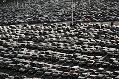
Obviously, I've never even attempted this. It is a highly inefficient means of getting around. It's 47 miles and four separate modes of transportation. The first leg alone of this grueling commute (bus to Greenbelt Metro) would be 8 miles. So instead I drive my six and a half miles to Fort Meade and pray that I can find a spot somewhere in the 900 acres of parking.
Why should you care? I'm sure very few of my readers venture into the wasteland that is Central Maryland on a daily basis. Perhaps some places are just meant to be designed for drivers. What do you care about a few federal employees that drive to work every day.
You should care because I work for the largest employer in the State of Maryland. Over 30,000 people drive to where I work day. The only transit access is a 40-person shuttle that runs three times in the morning and three times in the evening from the MARC station at Odenton, and a 24 person bus that runs from a surrounding community twice (very) early in the morning and twice in the afternoon. The 900 acres of paved surface parking drain into the Patuxent River watershed, which includes several protected wetlands down stream, and ultimately empties into the Chesapeake Bay. Oh, and by the way, this is your Federal Government using your tax dollars for maintaining this deleterious parking system and the highways needed to support job centers like this.
I love my job, and I don't want to quit. I've been exploring options to perhaps work at a satellite location that is Metro-friendly after I move. I buy cars that get good gas mileage, and when I can, I carpool. I raise hell every chance I get trying to promote better transit access to Fort Meade.
It is job centers like this that drive seemingly useless freeways like MD 32, MD 100, and MD 200 aka the Intercounty Connector. It is job centers like these that force the federal government to bleed talented young professionals who can barely live off otherwise decent salaries. I am a GS-11 and over 20% of my monthly take home salary is automatically devoted to my car payment, insurance, gas, and maintenance. I know scores of young professionals that have taken a contractor job that practically doubles their salary and allows them to live and work somewhere that does not require car ownership. It is job centers like this that create traffic, traffic accidents, and exurban sprawl that eat away our region's farms and wildlife areas.
And think of how much worse the Base Realignment and Closure will make this when it brings 5,700 more jobs to Fort Meade.
So as I am writing this, I've decided what I am going to do for car-free day on Monday. I'm going to to sleep in my office for two nights. And once again, I will put out an open letter demanding transit access.
I work there. I get incensed every day wasting money on gas while driving around hunting for a parking space. But every citizen of Maryland and the DC region ought to be irate over the wastefulness and downright lack of foresight in the complete lack of sustainable urban planning at the largest job center in Maryland. If anyone has any other suggestions for me (that are at least as unlikely to get me fired as this stunt) please let me know. Otherwise, I'm looking forward to a protest where all I have to do is sleep.
Tomorrow, Friday, is International Talk-Like-a-Pirate Day. I know what I'm doing for that. I'm going to Piratz Tavern in Silver Spring. Driving there, of course, as there is no feasible evening transit access from Laurel to Silver Spring. Saturday, I'll drive from Laurel to Silver Spring to pick up some kids and then to our game in South Germantown (bonus: carpooling). Sunday, I will be driving to FedEx Field to tailgate the Redskins game. I usually drive out of necessity, but this weekend there will be some gratuitous driving, and I really want to prove to myself that I can get to and from work by myself without a car, if it came down to it.
Here are the dilemmas...
My Job: On a military base surrounded by limited access highways (MD 32 and the B-W Parkway). This means that it actually illegal for me to walk to work. I could bike, but my office lacks bike racks. (Of course, I also have that little problem of not owning a bike... not much reason to own one where I live).
My House: one block off of Route 1 in Laurel, near a bus route. Unfortunately, the bus only goes up and down Route 1. My drive to work is 6 and a half miles, and frankly, much closer than anyone else I know at my work.
For me to get to work without driving, I would have to take a bus to Greenbelt, take the Green Line to Fort Totten, switch to the Red Line, take that to Union Station, then switch to the MARC Penn Line. Take the MARC to Odenton, where I get off and wait for a shuttle. This shuttle takes me to the front gate, where I then walk a quarter of a mile to my building. I might be able to transfer busses and pick up the Penn Line at New Carrollton, but I'm not that savvy with the bus routes in PG.
Obviously, I've never even attempted this. It is a highly inefficient means of getting around. It's 47 miles and four separate modes of transportation. The first leg alone of this grueling commute (bus to Greenbelt Metro) would be 8 miles. So instead I drive my six and a half miles to Fort Meade and pray that I can find a spot somewhere in the 900 acres of parking.
Why should you care? I'm sure very few of my readers venture into the wasteland that is Central Maryland on a daily basis. Perhaps some places are just meant to be designed for drivers. What do you care about a few federal employees that drive to work every day.
You should care because I work for the largest employer in the State of Maryland. Over 30,000 people drive to where I work day. The only transit access is a 40-person shuttle that runs three times in the morning and three times in the evening from the MARC station at Odenton, and a 24 person bus that runs from a surrounding community twice (very) early in the morning and twice in the afternoon. The 900 acres of paved surface parking drain into the Patuxent River watershed, which includes several protected wetlands down stream, and ultimately empties into the Chesapeake Bay. Oh, and by the way, this is your Federal Government using your tax dollars for maintaining this deleterious parking system and the highways needed to support job centers like this.
I love my job, and I don't want to quit. I've been exploring options to perhaps work at a satellite location that is Metro-friendly after I move. I buy cars that get good gas mileage, and when I can, I carpool. I raise hell every chance I get trying to promote better transit access to Fort Meade.
It is job centers like this that drive seemingly useless freeways like MD 32, MD 100, and MD 200 aka the Intercounty Connector. It is job centers like these that force the federal government to bleed talented young professionals who can barely live off otherwise decent salaries. I am a GS-11 and over 20% of my monthly take home salary is automatically devoted to my car payment, insurance, gas, and maintenance. I know scores of young professionals that have taken a contractor job that practically doubles their salary and allows them to live and work somewhere that does not require car ownership. It is job centers like this that create traffic, traffic accidents, and exurban sprawl that eat away our region's farms and wildlife areas.
And think of how much worse the Base Realignment and Closure will make this when it brings 5,700 more jobs to Fort Meade.
So as I am writing this, I've decided what I am going to do for car-free day on Monday. I'm going to to sleep in my office for two nights. And once again, I will put out an open letter demanding transit access.
I work there. I get incensed every day wasting money on gas while driving around hunting for a parking space. But every citizen of Maryland and the DC region ought to be irate over the wastefulness and downright lack of foresight in the complete lack of sustainable urban planning at the largest job center in Maryland. If anyone has any other suggestions for me (that are at least as unlikely to get me fired as this stunt) please let me know. Otherwise, I'm looking forward to a protest where all I have to do is sleep.
Wednesday, September 17, 2008
Trains to the Future
I have been working tirelessly on my fantasy WMATA-MTA-MARC-VRE system map, coming soon. I currently lack the graphic design skills of my counterparts at Beyond DC, Track Twenty-Nine, and Greater Greater Washington, but rest assured that as soon as I figure out a half decent manner to present it to you guys, I'll be throwing my hat into the ring.
In the mean time, I encourage you to sign the petition (via GGW) supporting the Purple Line. I'd love to see it get started in New Carrollton and built westward if MoCo doesn't find a way to make it happen soon. Perhaps a successful stretch in PG County will silence the naysayers, perhaps even make a few more people start asking for it once it is build and working somewhere.
If anyone has any tips for making my map, I'm all ears. Until then, I'm still screwing around in Google Earth. If you want a sneak peek, I mentioned some of the basics in an open thread at GGW.
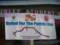
Tuesday, September 16, 2008
Top 10 Infill Sites Under the Radar
Poplar Point. The Soldiers Home. Near Southeast. Columbia Heights. The Kennedy Center. Anacostia. NoMa. Southwest Waterfront. It's no secret that DC is in the process of getting a makeover, and several prominent locations are seeing a major influx of infrastructure development that will bring new amenities to the city. the 50 year trend of exodus from DC is over.
There are a bunch areas that could probably use some urban infill, but I never hear about them. Perhaps this is because I'm not looking in the right places, perhaps it's because there are no plans, and perhaps it is because some of these places are wholly impractical for development. But I chose the 10 spots, all within the District, that I thought would be the best candidates for urban infill development that don't seem to be getting the attention they ought to deserve.
10. Buzzard Point
Southwest, between Potomac Avenue, South Capitol Street, and the Potomac River
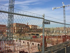
With all the work being done around Nationals Park and Navy Yard, You don't hear too much about that nice little piece of riverfront real estate on the other side of South Capitol Street. On this map by the Capitol Riverfront BID, not much improvement is shown. This summer when I was down there exploring, it was still largely industrial wasteland north of V Street and parking lots and wasted riverfront vista south of V Street. That industrial stone plant at Half and R Streets HAS to go some times, doesn't it? I haven't heard anything about it yet.
9. Benning Power Plant
Northeast, Benning Rd between the Anacostia River and the Orange Line tracks
I talked about this last week. What is currently an antiquated and pollution creating coal power plant that blankets this neighborhood and adjacent estuary with heavy pollution could potentially be one of the top mixed-use locations on the Anacostia.
8. Fort Lincoln
Northeast, between New York, South Dakota, Bladensburg Rd, and the state line
Something looks like it is being built here, but I have no idea what. The wide roads are indicitive of future development, but I haven't been able to dig anything up on how whatever it is will fit into the urban fabric of Northeast or the surrounding historic communities in Prince George's County.
7. Lamond-Riggs
Northeast, Kansas Avenue at Blair Road
This area would be a great spot for an infill station on the Red Line. About halfway between the Fort Totten and Takoma stations, this area has seen its commercial areas blighted over the last few decades. A Metro station and a little investment could pay big dividends in this neighborhood.
6. RFK Stadium Site
Northeast and Southeast, along west bank of Anacostia River
Dan Snyder is jealous of the Dallas Cowboys planned stadium which, when completed, will be the largest stadium in the NFL. He also doesn't like the fact that FedEx field is outside the District. If he builds a new stadium at the RFK site (or anywhere else, for that matter), it will be a dome with a capacity approaching 110,000. This will attract a Super Bowl to the city. I'm all in favor of a venue of that size located in the district on a couple of Metro lines. But something needs to be done about that horrible surface parking. I love to tailgate, but I'll modify my gameday plans if it means less pavement along the river.
5. Saint Elizabeth's Hospital
Southeast, along MLK Avenue between Malcolm X Avenue and Suitland Parkway
I am aware of Department of Homeland Security's plans to relocate to some of the western portion of the campus, but currently most of the campus sits in disrepair while only the tiny portion on John Marr Circle is still used as a hospital. This area is full of historic buildings with spectacular vistas to the rivers, the Capitol, and other prominent DC landmarks. There's a ramp to an interstate and a Metro station. But over 30 years of disrepair has left this campus as a chunk of blight partitioning an area of the city in dire need of connectivity and economic development. And Now, Anacostia says the east campus looks like an Ivy League school. Well, why not put a university there? ANA hopes that a campus of UDC is located there when renovation begins. Current plans to break ground in 2012 will bring a mixed-use community.
4. Theodore Roosavelt Island
Northwest, in the Potomac River
I like to think that perhaps a Metro station could be built on the north end of the island, and a pedestrians-only colony might spring up on the island, which is currently only accessible via a footbridge from Rosslyn. A pipe dream. But who knows, when we run out of good real estate in the city, it may happen.
3. Fort Totten
Northeast, south of South Dakota Avenue and Riggs Road
This stop is served by three lines. It is the only such station in the system outside of downtown. But there's nothing there. This is completely unacceptable. I understand that there is not currently the road network to support very high density, nor would I call for such a network to be built. But can we manage some decent retail along South Dakota or Hamilton? Perhaps some better pedestrian access to the station? Perhaps it is just par for the curse for the Green Line, which is notoriously disconnected from its surrounding communities.
2. Ivy City
Northeast, between New York, Florida, and Mount Olivet Road
I would love to see a metro line built along New York Avenue out to Mount Rainier, Hyattsville, and ultimately College Park. But even without one, Ivy City sits along a favored corridor but remains mostly industrial and auto-oriented retail space. I would like to see New York Avenue become a grand boulevard leading downtown, and a makeover for Ivy city would be a nice start. I don't know of any plans to make this happen at this time.
1. McMillian Slow Sand Filter Plant
Northwest, between North Capitol and 1st Streets near the McMillian Reservoir
It took some research for me to figure out what was going on on this site. It seems like a prominent site for a park, a library, some condos, a marketplace, or just about anything over an abandoned water filtration plant. Alas, the filtration system below was built of unreinforced concrete, meaning significant and expensive retrofitting would have to be done of structures were to be built atop the site. To complicate matters, in 1991 it was deemed a historic landmark by the city. The fact that this eyesore sits deteriorating along North Capitol Street in a prominent part of the city is criminal. It sits between Howard and Catholic Universities, adjacent to the Hospital Center, with somewhat scenic views of the McMillian reservoir. isn't this important enough for someone to do something on this site, which has sat useless for over 20 yeas?
By all means, if you know of something I failed to mention on one of these sites, leave a comment. If you feel I left somewhere out, let me know.
50 years ago, race riots and highway construction gutted the Capitol City, but finally this trend is reversing, and Washington is a highly desirable city worthy of building up. Now is the time to invest in the blighted or underutilized spots in the city. We can't let areas like these be ignored.
There are a bunch areas that could probably use some urban infill, but I never hear about them. Perhaps this is because I'm not looking in the right places, perhaps it's because there are no plans, and perhaps it is because some of these places are wholly impractical for development. But I chose the 10 spots, all within the District, that I thought would be the best candidates for urban infill development that don't seem to be getting the attention they ought to deserve.
10. Buzzard Point
Southwest, between Potomac Avenue, South Capitol Street, and the Potomac River
With all the work being done around Nationals Park and Navy Yard, You don't hear too much about that nice little piece of riverfront real estate on the other side of South Capitol Street. On this map by the Capitol Riverfront BID, not much improvement is shown. This summer when I was down there exploring, it was still largely industrial wasteland north of V Street and parking lots and wasted riverfront vista south of V Street. That industrial stone plant at Half and R Streets HAS to go some times, doesn't it? I haven't heard anything about it yet.
9. Benning Power Plant
Northeast, Benning Rd between the Anacostia River and the Orange Line tracks
I talked about this last week. What is currently an antiquated and pollution creating coal power plant that blankets this neighborhood and adjacent estuary with heavy pollution could potentially be one of the top mixed-use locations on the Anacostia.
8. Fort Lincoln
Northeast, between New York, South Dakota, Bladensburg Rd, and the state line
Something looks like it is being built here, but I have no idea what. The wide roads are indicitive of future development, but I haven't been able to dig anything up on how whatever it is will fit into the urban fabric of Northeast or the surrounding historic communities in Prince George's County.
7. Lamond-Riggs
Northeast, Kansas Avenue at Blair Road
This area would be a great spot for an infill station on the Red Line. About halfway between the Fort Totten and Takoma stations, this area has seen its commercial areas blighted over the last few decades. A Metro station and a little investment could pay big dividends in this neighborhood.
6. RFK Stadium Site
Northeast and Southeast, along west bank of Anacostia River
Dan Snyder is jealous of the Dallas Cowboys planned stadium which, when completed, will be the largest stadium in the NFL. He also doesn't like the fact that FedEx field is outside the District. If he builds a new stadium at the RFK site (or anywhere else, for that matter), it will be a dome with a capacity approaching 110,000. This will attract a Super Bowl to the city. I'm all in favor of a venue of that size located in the district on a couple of Metro lines. But something needs to be done about that horrible surface parking. I love to tailgate, but I'll modify my gameday plans if it means less pavement along the river.
5. Saint Elizabeth's Hospital
Southeast, along MLK Avenue between Malcolm X Avenue and Suitland Parkway
I am aware of Department of Homeland Security's plans to relocate to some of the western portion of the campus, but currently most of the campus sits in disrepair while only the tiny portion on John Marr Circle is still used as a hospital. This area is full of historic buildings with spectacular vistas to the rivers, the Capitol, and other prominent DC landmarks. There's a ramp to an interstate and a Metro station. But over 30 years of disrepair has left this campus as a chunk of blight partitioning an area of the city in dire need of connectivity and economic development. And Now, Anacostia says the east campus looks like an Ivy League school. Well, why not put a university there? ANA hopes that a campus of UDC is located there when renovation begins. Current plans to break ground in 2012 will bring a mixed-use community.
4. Theodore Roosavelt Island
Northwest, in the Potomac River
I like to think that perhaps a Metro station could be built on the north end of the island, and a pedestrians-only colony might spring up on the island, which is currently only accessible via a footbridge from Rosslyn. A pipe dream. But who knows, when we run out of good real estate in the city, it may happen.
3. Fort Totten
Northeast, south of South Dakota Avenue and Riggs Road
This stop is served by three lines. It is the only such station in the system outside of downtown. But there's nothing there. This is completely unacceptable. I understand that there is not currently the road network to support very high density, nor would I call for such a network to be built. But can we manage some decent retail along South Dakota or Hamilton? Perhaps some better pedestrian access to the station? Perhaps it is just par for the curse for the Green Line, which is notoriously disconnected from its surrounding communities.
2. Ivy City
Northeast, between New York, Florida, and Mount Olivet Road
I would love to see a metro line built along New York Avenue out to Mount Rainier, Hyattsville, and ultimately College Park. But even without one, Ivy City sits along a favored corridor but remains mostly industrial and auto-oriented retail space. I would like to see New York Avenue become a grand boulevard leading downtown, and a makeover for Ivy city would be a nice start. I don't know of any plans to make this happen at this time.
1. McMillian Slow Sand Filter Plant
Northwest, between North Capitol and 1st Streets near the McMillian Reservoir
It took some research for me to figure out what was going on on this site. It seems like a prominent site for a park, a library, some condos, a marketplace, or just about anything over an abandoned water filtration plant. Alas, the filtration system below was built of unreinforced concrete, meaning significant and expensive retrofitting would have to be done of structures were to be built atop the site. To complicate matters, in 1991 it was deemed a historic landmark by the city. The fact that this eyesore sits deteriorating along North Capitol Street in a prominent part of the city is criminal. It sits between Howard and Catholic Universities, adjacent to the Hospital Center, with somewhat scenic views of the McMillian reservoir. isn't this important enough for someone to do something on this site, which has sat useless for over 20 yeas?
By all means, if you know of something I failed to mention on one of these sites, leave a comment. If you feel I left somewhere out, let me know.
50 years ago, race riots and highway construction gutted the Capitol City, but finally this trend is reversing, and Washington is a highly desirable city worthy of building up. Now is the time to invest in the blighted or underutilized spots in the city. We can't let areas like these be ignored.
Monday, September 15, 2008
Thoughts on Rail, National and Local
While driving from the football game in Oxon Hill to my brother's bar in Bethesda today, I was lamenting the lack of passenger rail opportunities. Primarly, this was because I tried going through the city to avoid the Redskins traffic and found myself turned around several times because of some sort of a marathon for which I had know prior knowledge. I would have much rather Metro'd across town than driving. 10K's and marathons have a habit of not disrupting rail they way they disrupt the roads. It also made me even more frustratingly aware of the fact that several highways dead end in the middle of the city, facilitating a traffic disaster when something like this occurs with poor signage.
Bit if rail is done right, there's a lot of things that aren't disrupted. When I drive from Laurel to Oxon Hill and then Bethesda and back to Laurel, this is all metro area traffic. But I'm mixing with folks just running to the store, and people ostensibly driving from Miami to Boston. I'm mixing with individuals running errands, families on vacation, and trucks carting freight all over creation.
With rail we can separate the passenger and freight, something we rarely do on roads (exceptions being perhaps the Baltimore-Washington Parkway and other roads that limit trucks). And with passenger rail, we can have streetcars for local, subways for metropolitan, commuter rail for regional, and AMTRAK/national rail for interstate. It is similar to a road hierarchy, however if one group, say, the metropolitan travelers are backed up by heavy volume for an event, like say a pro football game, the local, regional, and national rails aren't backed up, even if they run along the same right of way, provided they all use separate tracks. Same goes for freight rail.
Separate tracks is the key. Richard Layman makes the case for a better national rail infrastructure, citing a passenger/freight crash in LA. We have 16+ lane highways. Why can't we have four lane rail rights-of-way? I'm no engineer, but wouldn't it be cheaper to build rail bridges and tunnels? Isn't there less space required? Wouldn't it be cheaper to bury more of the rail network instead of burying freeways through the city? Bury them all, in my opinion. Bury them together!
Sharing tracks, I believe, is the main reason that MARC stations have largely failed to promote transit oriented development around their stations. I think of it this way: a family with kids might not mind living on a street with lots of bus traffic. But if those buses are 18 wheelers, the impression of the street changes. Not to mention, sharing the tracks with freight trains and AMTRAK is what prevents MARC from having a schedule useful for anything more than commuting. The tracks are too crowded.
Imagine a separate highway for trucks, another for interstate travel with exits only in major cities. If a CSX train derails, it doesn't ruin MARC and AMTRAK service for the day. Any thoughts on this theory?
Friday, September 12, 2008
The American Highway
In Arlington, the Pentagon unveiled its permanent 9/11 Memorial, a park with benches and small pools, one for each person that died on that site in the attack. I find it modern but simple, and quietly powerful. A fitting tribute in deed. But there was another tribute I saw today.
Driving down I-95 on my way from work to practice for the football team I coach, I noticed something unusual. There were about five American flags and what looked like a military color guard on the overpass of Vollmerhausen Road. I guess it's suburban Maryland's own quirky way of doing a 9-11 tribute.
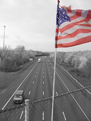
I-495 South at Powder Mill Road
Originally uploaded by F1RSTBORN
I distinctly remember the first time I saw flags on the overpasses on I-95. It was when I returned to Maryland from Army training, about to be stationed at Fort Meade. I thought it was a strange tribute, but a highly visible one. Apart from the high visibility (I-95 is one of the most traveled highways in the world), I wonder if there was any specific reason that this began taking place.
9/11 is a very close to home topic for me. On that tragic date, I was in Basic Combat Training at Ft. Leonard Wood, Missouri. I had joined the Army exactly four weeks earlier. In basic training, there was no TV, no radio, no newspaper, and no phone calls. We received word from our first sergeant, And I didn't get to watch the news until October 25th after I graduated. That whole time I lived in fear and uncertainty, relying on my commander for information. I opine that I might have missed out on the "cultural experience" of 9/11. But it's a day that hangs heavy in my heart.
I also served in both Afghanistan and Iraq during my four years in service, and I have lost a couple of friends in each theater. All politics aside, seeing the flag being shown to everyone gave me a bit of a sense of pride and comfort.
But I wonder, why overpasses? I can't help but think that the Interstate Highway System is something in which our country takes a lot of pride. Rooted in national defense, I believe that to date it is the largest public works project in history. It is also so quintessentially American: huge, luxurious, pervasive, and universal.
On Ryan Avent's blog this week, a discussion of speed limit caps for automobiles spurned quite a bit of tension, that people in the cities were unaware of rural lifestyle for advocating such a cap, which in turn started a dialog on elitism as it pertains to urban planning (in particular, the highways).
Love them or hate them, the highways are completely intertwined with the daily life of every single American. We can (and should) mitigate the urban sprawl that they facilitate, we can (and should) decrease the number of cars and the amount of fuel used on them, and we can (and should) be smart about building and maintaining them. We can definitely even stand to decommission of a few of them. But right now, There are few things more American than our highways. They are our grandest structures and our most used resource. And considering how much they have enabled this nation to accomplish, we ought to take a great deal of pride in them. More importantly, we should continue to evolve them to meet the changing needs of the nation. Perhaps one day we will use this project as a model for a high speed rail network.
Best to all of you and your families. God bless America.
Driving down I-95 on my way from work to practice for the football team I coach, I noticed something unusual. There were about five American flags and what looked like a military color guard on the overpass of Vollmerhausen Road. I guess it's suburban Maryland's own quirky way of doing a 9-11 tribute.
I-495 South at Powder Mill Road
Originally uploaded by F1RSTBORN
I distinctly remember the first time I saw flags on the overpasses on I-95. It was when I returned to Maryland from Army training, about to be stationed at Fort Meade. I thought it was a strange tribute, but a highly visible one. Apart from the high visibility (I-95 is one of the most traveled highways in the world), I wonder if there was any specific reason that this began taking place.
9/11 is a very close to home topic for me. On that tragic date, I was in Basic Combat Training at Ft. Leonard Wood, Missouri. I had joined the Army exactly four weeks earlier. In basic training, there was no TV, no radio, no newspaper, and no phone calls. We received word from our first sergeant, And I didn't get to watch the news until October 25th after I graduated. That whole time I lived in fear and uncertainty, relying on my commander for information. I opine that I might have missed out on the "cultural experience" of 9/11. But it's a day that hangs heavy in my heart.
I also served in both Afghanistan and Iraq during my four years in service, and I have lost a couple of friends in each theater. All politics aside, seeing the flag being shown to everyone gave me a bit of a sense of pride and comfort.
But I wonder, why overpasses? I can't help but think that the Interstate Highway System is something in which our country takes a lot of pride. Rooted in national defense, I believe that to date it is the largest public works project in history. It is also so quintessentially American: huge, luxurious, pervasive, and universal.
On Ryan Avent's blog this week, a discussion of speed limit caps for automobiles spurned quite a bit of tension, that people in the cities were unaware of rural lifestyle for advocating such a cap, which in turn started a dialog on elitism as it pertains to urban planning (in particular, the highways).
Love them or hate them, the highways are completely intertwined with the daily life of every single American. We can (and should) mitigate the urban sprawl that they facilitate, we can (and should) decrease the number of cars and the amount of fuel used on them, and we can (and should) be smart about building and maintaining them. We can definitely even stand to decommission of a few of them. But right now, There are few things more American than our highways. They are our grandest structures and our most used resource. And considering how much they have enabled this nation to accomplish, we ought to take a great deal of pride in them. More importantly, we should continue to evolve them to meet the changing needs of the nation. Perhaps one day we will use this project as a model for a high speed rail network.
Best to all of you and your families. God bless America.
Wednesday, September 10, 2008
Town Centers in PG: Ur Doing It Wrong

Prince George's County, Maryland. I've called it home the last five years of my life. It is a county of promise and potential. With an unparalleled demographic of wealthy minorities and a wide ethnic diversity coupled with a 312 year historical heritage, there's no lack of culture here. With a population rapidly approaching one million, there's a quality tax base as well. What the county lacks-- more than any other county that touches Washington, DC-- is a sense of place throughout.
But that's all changing, right? Largo Town Center, Konterra, Bowie Town Center, National Harbor, Woodmore Towne Centre, and other developments are sprouting up all over the county. They are walkable retail districts that create a sense of place. But unfortunately, you only get that sense of place when you hop in the car and drive to those places (with the exception of Largo, which is on the terminus of the Blue Line).
I absolutely despise it when developers throw "Town Center" at the end of an isolated retail development that is completely car oriented and disconnected from the surrounding areas. I especially hate it when it's spelled "Towne Centre". But let's ingore that for a second...
These areas are a good start for PG, I believe. But acres of surface parking and a big box store mar sites like Woodmore Towne Centre. But surface parking can always be built upon, and big box stores can either be integrated into their surroundings (like in DC USA) or transformed into other uses. Most of the surface parking is probably mandated by some horrible parking minimum over which the developers have no control anyway. What I find most disconcerting with the layout here is that there is only one direct street connection with Glenarden, the municipality in which this development lies. To me, this sends a message. It is not integrated into the community. It is its own entity for other people who will drive there from wherever else. Largo Town Center is even worse. Despite it's own Blue Line Metro station, the development is little more than an island of retail in a sea of parking
Glenarden, Woodmore Towne Centre, and the Landover Gateway development area all lie on a corridor that may wind up being a stop on the Purple Line eventually. Largo Town Center came along with a Metro station. What about other greenfield developments in PG? Konterra is built somewhat near a MARC station along Route 1, but the town center is about a mile away from this station and the design on the tract does not engage the MARC station. National Harbor, the bustling upscale community on the Potomac across from Alexandria, is grossly underserved by Metrobus and is grossly isolated from rail service.
This is bad, but it is much worse when considered with the lack of development around Metro and MARC stations in Prince George's County. Walkable, mixed use development is planned and/or starting to trickle in around Greenbelt, Capitol Heights, and a few other stations, but are they really doing it right anywhere? Sort of. Prince George's Plaza ought to be the model around which new developments in PG are modeled. The surface lots are being replaced by towers hosting a diverse demographic. The area is widely connected to the surrounding areas, helping push development in downtown Hyattsville. PG Plaza definitely isn't all the way there yet, but it's closer than anywhere else.
What makes good development even better is interconnectivity. Largo shows us that just a transit stop doesn't give you a truely great sense of place. National Harbor might prove that no matter how mixed-use, walkable, and upscale a place may be, isolation makes it somewhat of a kitschy novelty location. The ingredients are there. The County just needs to take advantage of it.
I am planning to attend Envision Prince George's on October 3rd at University of Maryland University College Inn and Conference Center in Adelphi. Thanks to Richard Layman for highlighting this event. Better days lie ahead for Prince George's, and I'm hoping to get a glimpse of that at this event.
Sunday, September 7, 2008
Imagine River Terrace
GreaterGreaterWashington thinks there should be a Metro station there. So does BeyondDC. Track Twenty-Nine envisions four Metro lines going right through that area. It's a little over two miles from the Capitol, on top of a freeway and an existing Metro station, scenically located next to the Anacostia River and the Arboretum, and a walk across the bridge to RFK Stadium. River Terrace a prime piece of real estate in the world's most powerful city. Why then, is it so blighted?
How about a coal power plant? And not one of the new, waste-recovery coal power plants. This one dates back to 1906. Though it only runs on the hottest and coldest of days when the city burns more energy, it blankets the surrounding communities with an average of 1,000 pounds of carbon smog a day, causing neighborhood residents to be 3 to 5 times more likely to have cancer, asthma or bronchitis than any other group of people in the city.
Maybe it's the housing projects. The Great Society-era Mayfair projects were home to Marvin Gaye, but I submit that their location and orientation do little to empower low income residents on the eastern bank of the Anacostia. At the very least, they do less than they could. Though close to Minnesota Avenue Metro Station, they are isolated from amenities and their surrounding communities. Affordable housing in this case is a sentence to a blighted campus of garden apartments disconnected from the rest of the city.
What if Goerge Gurley and the African American Environmental Association succeeded in having this plant shut down? What if the housing projects were redeveloped into a walkable neighborhood with ample connections to the surrounding neighborhoods? What if mixed-income and mixed-use came together on top of a new Metro station? Construct a marina and other local amenities, offer modest leases for local businesses, and tax breaks for minority and veteran business owners, and then you have my vision of a new River Terrace and Mayfair:
 Red - Residential
Blue - Commercial
Yellow - Civic
Green - Parkland
Orange - Transit
As always, the disclaimer
The orange on the left would be the River Terrace Metro Station, Blue and Orange Lines, perhaps a street car or two. A station with multiple lines on the east side of the Anacostia River, what a novel idea. To the north of it, a classical transit-oriented development with office over retail inside of residential units of gradually decreasing density.
Mayfair would (almost) completely torn down and redeveloped into an actual community rather than a dumping ground of cheap housing. I'm picturing townhouses and walk-up apartments, perhaps some street level retail. Yes, we should actually put jobs near cheap housing. Mayfair would be more oriented towards the Minnesota Avenue station, however good street connectivity would allow a variety of transit options.
The bit of commercial along the riverfront would include a marina and perhaps a fishing pier. This could be the primary attraction/amenity for the development. It would certainly be a lot more eco-friendly than a coal burning power plant.
Most importantly, if something like this is to happen to a neighborhood, it has to happen without displacing the current residents. Give the folks in Mayfair first crack at the moderatly priced River Terrace development, then redevelop Mayfair, keeping the area available to nearby residents of DC. Businesses should be heavily favored toward River Terrace, Mayfair, and Deanwood residents.
Now, what about the displaced power supply? Perhaps this could be supplemented by new nuclear plants in more remote Maryland and Virginia locations. Perhaps throw some windmills down at the Blue Plains Water Treatment Plant further down the river. But whether or not this part of town is developed, that power plant has to go. I'm all for coal power over other fossil fuels, but certainly not in the middle of the Capital City, and definitely not in a neighborhood where its presence purports a sense of inequality for the predominantly black neighborhoods east of the Anacostia.
Possible? Likely? Does anyone know of any plans to develop this power plant? Or to replace it? I'd love to see more info on it.
Subscribe to:
Comments (Atom)

