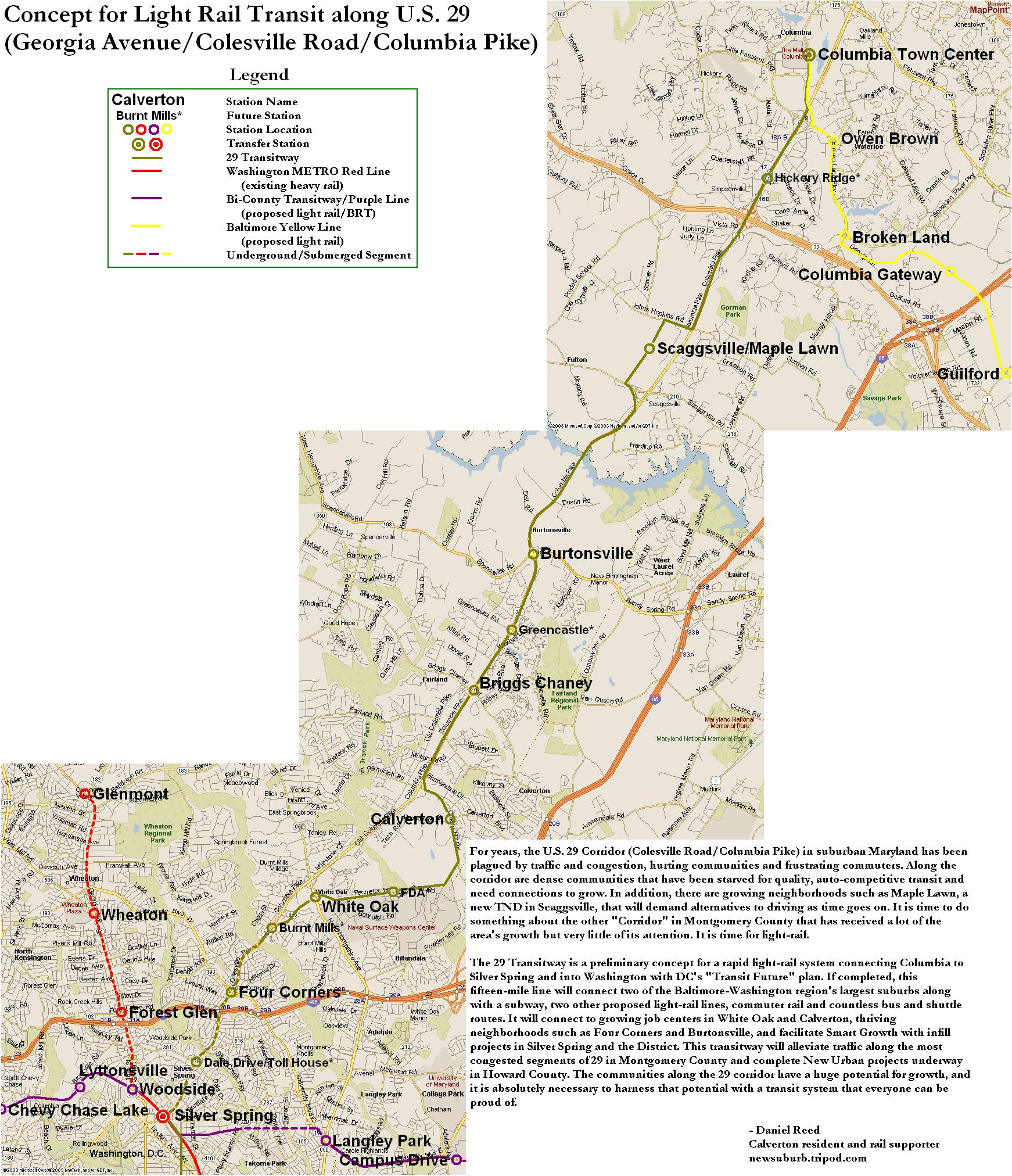
Maryland's Housing and Community Development headquarters will be the first Maryland state agency to move into Prince George's County. In accordance with Governor O'Malley's transit-oriented development initiative, the offices will be relocated from practically-rural Crownsville in Anne Arundel County to a site adjacent to one of the Metro or MARC stations identified for O'Malley's plan.
The four stations in Prince George's County identified by O'Malley's plan are Laurel MARC, New Carrollton, Naylor Road, and Branch Avenue. This can be an excellent opportunity to implement a plan that could become a turning point for the County's future growth. My fear, however, is that it won't be.
Prince George's County has a long history of squandering valuable property along transit stations. College Park Station is the best example of that. Surrounding the transit hub, which has Metro, MARC, and several bus connections is an office park fit for suburban Atlanta. Its poor pedestrian approaches and wasteful spread-out design offer maximum parking without any continuity of place among the buildings. Despite being very convenient to transit, the design and layout of the area scream "drive here!"
Even worse in my opinion is Suitland. Suitland is a destitute area with high crime and a weak economy. When the Suitland Federal Center was built adjacent to the Metro, it came out as a sprawling officeplex with absolutely no orientation to the surrounding area. But don't worry, there is ample parking. Worse yet, the fenced monstrosity acts as a barrier between the town and the Metro station.
I hope this agency goes to Naylor Road station, where O'Malley made the announcement. And I sincerely hope they get it right. But if we get more Suitland and College Park, thanks but no thanks. Keep your office buildings in rural Anne Arundel County where they won't do any more damage to Prince George's County's transit access. Putting office buildings next to a Metro station is not all it takes to make good transit-oriented development.
Showing posts with label transit oriented development. Show all posts
Showing posts with label transit oriented development. Show all posts
Sunday, June 20, 2010

Saturday, December 5, 2009
PG Stands for Poor Growth
Now, I like to stick up for my county. I believe that in many ways, Prince George's County has been dealt the short end of the smart growth stick. But the fact is that the county government isn't even trying, and it seems that any smart, transit oriented growth that does occur happens by accident or coincidence.

What puts me over the edge was this Washington Post article in Greater Greater Washington's Breakfast Links. A concrete plant has been approved near Sheriff and Cabin Branch Roads near Fairmount Heights.The Post article points out the multitude of other industrial plants near this site, surrounded on all sides by middle class residential zoning. GGW highlights this concentration, pointing out that the region in majority black. Pushing around non-wealthy minorities is not a new thing Prince George's County.
Cheverly Metro Station. Photo by Genista from Flickr
But what the Post doesn't point out is that the site where this concrete plant has been approved is less than a mile from Cheverly Metro station, one of the most underused stations on Metro. And it's on the same side of US-50 as the Metro station, meaning that useful growth could potentially occur in that area if Prince George's County wasn't treating it as a dumping ground for undesirable industry. It's a location inside the Beltway with easy access to the city and multiple forms of transit, including two Metrobuses that directly serve the site, five Metro stations within two miles (Cheverly, Landover, Deanwood, and Capitol Heights, and Addison Road-Seat Pleasant), and an Amtrak and MARC station at New Carrollton under three miles from the site. This is not the first, but only the latest controversy where PG County has throw its citizens under the bus and tried to drop an industrial plant in residential areas near Metro stations.
This site could be used for transit-oriented development at Cheverly station. It could be a crossroads between Cheverly and Capitol Heights. Instead it is home to an asphalt plant, a recycling transfer station, and a clay mine. And now, coming soon, a concrete plant. These uses would be far more suitably placed along US 50 outside the Beltway just a few short miles away, alas those areas have been blanketed with very low density McMansion developments. Byzantine laws promoting sprawl in PG will continue to force industrial growth in inappropriate places, including Fairmount Heights, one of the oldest black settlements in Maryland.
Prince George's County will not continue to prosper as it runs out of agricultural land while continuing to neglect its valuable inner ring suburbs. Transit investment will continue to be difficult to justify, making it more difficult to fund. And PG will continue to mean poor growth until the county's planning begins to take a look towards the future with regard to land use economy.
Monday, October 19, 2009
Transit Capacity
Last month I criticized the plan to scale back Tysons Corner because of the need for increased freeway capacity. The more I think about it, the more merit I see in the notion that a revamped Tysons Corner will be desperately transit-starved. Freeways, however, are not the panacea. The plan to urbanize the region's most prominent edge city will bring thousands more jobs and residents to the area. Even if the area becomes more self contained, it will require much greater capacity for transportation in and out of the area's densest job center.
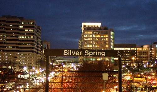 Downtown Silver Spring from the Metro station. Photo by mindgutter
Tysons will have 4 stations, but they will only be able to handle about 40% of the rides of stations at Silver Spring, Bethesda, Rosslyn, and King Street. Matt Johnson at Track Twenty-Nine created an excellent diagram showing how track sharing by Metro lines closer in to the city prevent the same capacities on the outer spokes of the system (except on the Red Line, which does not share tracks with any other line). Even with four stations, the capacity of the line does not stack up to urbanizations in Montgomery County, Arlington, and Alexandria. Can it support an even larger development with less system capacity? Can the already-clogged North Arlington Orange Line corridor support the additional riders with its finite capacity? Optimal success of the Tysons plan would require more Metro capacity such as a separated Blue Line on a new Potomac crossing.
I'm also lead to wonder if this has not contributed to the overall inferior urbanization in Prince George's County. No station in Prince George's has more than 60% capacity because the Green, Blue, and Orange lines all share track inside the District (though the northern section of the Green Line as the potential to do so if the Yellow Line ever runs all the way to Greenbelt regularly). Certainly the County's poor planning policies have contributed to the lack of urban development around virtually all 14 Metro stations, often egregiously, but perhaps lack of capacity has contributed as well.
The stretch of Metro in Prince George's County with the most service, the northern Green(/sometimes Yellow) Line has experienced the most development. Prince George's Plaza Station has probably seen the most. Though not exactly Downtown Silver Spring yet, University Town Center is probably the best example of urban development around a Metro station in Prince George's. Much has been planned for West Hyattsville, College Park, and Greenbelt, though little has come to fruition. New Carrollton, which will have added capacity once the Purple Line comes to town, also has grand plans for development. Stops on the Blue and lower Green Lines, however, are not experiencing as much planning buzz.
I have never heard of any study that implies the impact of station capacity versus development around stations, but it stands to reason that the more capacity, the more successful and robust development can be. The Orange Line corridor might be somewhat of an exception. West of Rosslyn, the Orange line can handle about 60% of the trips Silver Spring or Bethesda can handle. The strip is anchored, however, by Rosslyn, which has the same capacity as Silver Spring and Bethesda.
David Alpert suggested some innovative ways to create more system capacity by separating the Green and Yellow lines and rerouting some of the Silver Line trains. This would help Prince George's County, Tysons Corner, and other locations in Virginia and still be cheaper (in theory) than a separated Blue Line. If Silver Spring, Bethesda, and Rosslyn are models we seek to emulate, station capacity ought to be equivalent of those successful areas.
Downtown Silver Spring from the Metro station. Photo by mindgutterTysons will have 4 stations, but they will only be able to handle about 40% of the rides of stations at Silver Spring, Bethesda, Rosslyn, and King Street. Matt Johnson at Track Twenty-Nine created an excellent diagram showing how track sharing by Metro lines closer in to the city prevent the same capacities on the outer spokes of the system (except on the Red Line, which does not share tracks with any other line). Even with four stations, the capacity of the line does not stack up to urbanizations in Montgomery County, Arlington, and Alexandria. Can it support an even larger development with less system capacity? Can the already-clogged North Arlington Orange Line corridor support the additional riders with its finite capacity? Optimal success of the Tysons plan would require more Metro capacity such as a separated Blue Line on a new Potomac crossing.
I'm also lead to wonder if this has not contributed to the overall inferior urbanization in Prince George's County. No station in Prince George's has more than 60% capacity because the Green, Blue, and Orange lines all share track inside the District (though the northern section of the Green Line as the potential to do so if the Yellow Line ever runs all the way to Greenbelt regularly). Certainly the County's poor planning policies have contributed to the lack of urban development around virtually all 14 Metro stations, often egregiously, but perhaps lack of capacity has contributed as well.
The stretch of Metro in Prince George's County with the most service, the northern Green(/sometimes Yellow) Line has experienced the most development. Prince George's Plaza Station has probably seen the most. Though not exactly Downtown Silver Spring yet, University Town Center is probably the best example of urban development around a Metro station in Prince George's. Much has been planned for West Hyattsville, College Park, and Greenbelt, though little has come to fruition. New Carrollton, which will have added capacity once the Purple Line comes to town, also has grand plans for development. Stops on the Blue and lower Green Lines, however, are not experiencing as much planning buzz.
I have never heard of any study that implies the impact of station capacity versus development around stations, but it stands to reason that the more capacity, the more successful and robust development can be. The Orange Line corridor might be somewhat of an exception. West of Rosslyn, the Orange line can handle about 60% of the trips Silver Spring or Bethesda can handle. The strip is anchored, however, by Rosslyn, which has the same capacity as Silver Spring and Bethesda.
David Alpert suggested some innovative ways to create more system capacity by separating the Green and Yellow lines and rerouting some of the Silver Line trains. This would help Prince George's County, Tysons Corner, and other locations in Virginia and still be cheaper (in theory) than a separated Blue Line. If Silver Spring, Bethesda, and Rosslyn are models we seek to emulate, station capacity ought to be equivalent of those successful areas.
Friday, July 3, 2009
Imagine a Better Rail Link to Frederick
I have always hated Interstate 270. Always. It is a little confusing with the local and HOV lanes. It is much, much wider than it ought to be, creating huge bottlenecks in northern Montgomery County and at the Beltway. It is preposterously ugly, unbearably congested, and I feel particularly unsafe driving it. It is, in my humble opinion, very poorly planned. The last thing we need is more of it. But that is what they want to give us.
Lots of people travel this corridor in both directions every day. Frederick County has a population of a quarter million and growing. The Bethesda-Gaithersburg-Frederick corridor has a population encroaching on five times that number, or roughly 20% of the Metropolitan area population. Downtown DC and Frederick are about 40 miles apart from each other. So this is a long corridor with a lot of people on it. A transportation solution must be found.
Obviously MARC's Brunswick Line is not getting it done. Its circuitous route through Brunswick adds several additional miles to the trip. Stops at small stations like Garrett Park, Washington Grove, Boyds, Barnesville, and Dickerson. Only 7000 people are riding this line daily (warning: pdf), and it is pushing its capacity. Even MARC's 2035 plan (pdf) only raise the capacity 26,000 per day (pdf). Meanwhile, between 75,000 and 108,000 vehicles clog I-270 every day. Imagine if we were talking about a solution that was faster than an expanded freeway or an improved MARC.
Widening I-270 is a colossal failure of an idea. Creating a bigger bottleneck at the Beltway for commuters from Frederick is just going to increase the number of cars that will sit on the parking lot that is 270 southbound in the morning. Here is my vision for a rail solution:
View Frederick Line in a larger map
If local transit (light rail, buses, etc.) ferried these commuters to a few stations, the trains could make fewer stops and travel at higher speeds. A system like this, I envision an average speed of 90 mph. Eight stops along the way, that's it. Stops at major transit centers and major suburbs along I-270.
There is nothing on the books for a direct high speed service between DC and Frederick. There are plenty of other transit priorities at this time. And I understand that some people have no choice but to drive to their jobs. I am one of them. But I live six miles from my job. If I am going to subsidize someone else's extra-long commute, I want to do it with a system that will work, not one that will only increase the number of cars that are wasting fuel while sitting idly on a congested freeway.
Saturday, June 20, 2009
Back In the States
 I have returned from Germany (the university town of Darmstadt, to answer previous inquiries) with a renewed sense of appreciation for the cities of both Europe and the United States. I will probably have several tales to tell about my travels on the Audobahn, local tram system, high speed trains, and airports.
The E-25 in Belgium. Photo copyright Dave Murphy.
It dawned on me that today marks a year of running this site (although there have been several obvious periods of lull) I have been most fortunate to have a good number of followers and I wanted to take the time to thank them, even the ones who don't often agree with me. This has been a fun and worthwhile extra curricular activity for me.
Naturally, while in Europe, I took advantage of the walkability and the ample mass transit. But what really surprised me was that I fell in love with the freeway system. I didn't drive often, mostly only on day trips to neighborhing cities, but Germany's Audobahn and European freeways in general are fun and exciting to drive. One thing in particular I noticed was that the expressways, often only two lanes in each direction, have much smaller footprints than interstate highways, and much less traffic. They are generally straighter and flatter than interstates, which allows the carriage lanes to be slightly narrower and the travel speeds to be higher (unlimited in Germany!). It made me wonder, for example, if the Beltway through Montgomery County might be able to survive with three straight, flat lanes instead of four lanes curving and weaving along Rock Creek.
Another thing I liked about the expressways were the ample underpasses. In the rare few areas where the expressways traversed an urban area or even a small town, the street grid was not sacrificed to make way for the new freeway. In Luxembourg, I noticed that it was common for freeways to tunnel underneath entire towns, something probably more affordable in a country as affluent as Luxembourg. The parts that run through forest or farmland are more engaging to their surroundings, making the drive much more scenic and pleasurable than say driving I-95 between Washington and Baltimore. Often in wilderness areas, bridges of vegetation would go over the roads to allow wildlife to pass across the highway. I know these exist in the US, but they were seemingly ubiquitous in the Ardennes Forest. In addition to being functional, they ad a bit more scenery to the highway.
Expressways rarely run through cities, however. They are connected by arterials that cross the freeways outside the cities. In the center cities, there is usually little if any vehicular traffic at all. Most cities that I visited have large pedestrian-only areas, but areas that are on the street grid. In Darmstadt, the main two streets drop below the center of town and intersect underground at a stop sign, a rather exotic layout by American standards. All of this made way for various layers of pedestrian, bicycle, and transit routing, roads often sharing all four modes of transportation.
Driving in general is not as dumbed down. driving through towns or even on the expressways is not quite as intuitive as it is in America. It makes American roads seem overengineered, oversigned, and generally dumbed down for drivers. Interestingly, Germany has far lower incidence of fatalities on the road compared to the US. The entire time I was in Europe I only saw a single traffic accident, whereas it is not uncommon for me to see two while driving the six miles from my house to work here in Maryland. Anecdotal evidence that our overengineering of roads results in drivers paying less attention to what they are doing.
Another great design of European Freeways: they focus your attention at a point on the horizon. Naturally, the narrower streets, usually lined with three storey buildings, direct attention straight ahead. But the expressways were often flanked closely by trees. One Expressway in the Netherlands is lined by 100-foot tall rows of trees, almost like a grand hallway welcoming you onto the freeway. In addition to looking nicer, I believe that this focuses the eyes forward and therefore makes driving that much safer on the road.
I found getting around Germany, France, and the Low Countries to be very easy on all modes of transportation. I was quite surprised to be so taken with the highway system. More posts will come as I get settled back in to the groove here at home. Thanks again for making the last year of blogging so enjoyable.
Monday, May 4, 2009
Update From Germany
I am staying in a medium-sized city of about 120,000, or about the size of Columbia, MD. Any other similarity to Columbia ends there.
The city is very ethnically diverse, with lots of Turks, Africans, Russians, Irish, Americans, and Koreans, as well as countless others. It is mostly middle to lower middle class. The city is connected to the Audobahn by a spur. No freeways run through the town, and only one runs by it, with two lanes in each direction. The width of that entire freeway is barely more than a third of the footprint of I-95 in Howard County.
There is a light rail train with a complimenting bus service, all of which lead to a rail station with IC train service, meaning if I step out of the front door of my apartment, I can walk 100 feet to a tram station and get anywhere in Europe without getting into a car, taxi, or airplane.
The entire city is also covered in bike lanes. They have their own traffic signals seperate from cars and pedestrians. Their lanes cross into pedestrian sidewalks about as often as cars have to share lanes with buses and streetcars, which isn't much.
There is very little crime, people walk around care free and confident virtually all parts of the city at all times of day.
My (American government) job requires me to drive daily. The city streets are 2 meters (about six and a half feet) wide and rarely more than one or two lanes in each direction, if that. The automiobiles of residents are parked in courtyards. At least half the street parking is metered. Iäd say I've never had trouble finding aparking space in town, but I have never driven anywhere in town because I generally walk when I am not working.
Since I have landed in Europe, I have yet to see a single car accident, and I have driven over 1000km in two different countries. I have also not been in a single traffic jam that was not construction related.
The down is distinctly separated from other towns by large tracts of farms and forests. Virtually all buildings are
The city center is closed to automobiles except taxis. It is about a square mile of apartments above shops and businesses, including a shopping mall that is two blocks from the nearest legal parking space.
Best of all, I have been in my apartment for only two weeks and I am on a first name basis with my grocer, the proprietors of four restaurants, the staff at two bars, three of my neighbors, and the gentlemen who run this internet cafe. By contrast, I have lived in Laurel for five years and the only people who know my name are three of my neighbors and my barber.
I am not exactly staing in Mayberry, either. This is a very blue collar industrial town in Central Europe. There are no skyscrapers, no large business headquarters, and no attractions you are likely to find in most guidebooks. If anything, this is a sub-standard European town by comparison to the others I have visited. But the quality of life here is phenomenal.
This experience really makes me stop and wonder what places like Columbia, MD are doing wrong. Columbia certainly boasts a wealthier population that here. But this town has more parkland, more greenspace within walking distance, less traffic, less crime, and a community of people that actually know each other.
This would be an interesting litmus test for many of us: How many people in walking distance to your house know your name? For me, 4 in Laurel, and 14 here. That is the difference of living in a community focused on itself.
Thursday, February 26, 2009
Imagine Prince George's Plaza
Though nowhere near up to par with Arlington's Rosslyn-Ballston Corridor, Old Town Alexandria, or the central business districts of Bethesda and Silver Spring, Prince George's Plaza might be the best example of transit-oriented development in Prince George's County. It combines a Metro station with heavy retail, medium density housing, and a walkable street grid. Unfortunately, those things are not integrated with each other.
I love the City of Hyattsville. As soon as I can afford to do so, I plan on moving there. It has a ton of potential. Potential, however, means room for improvement.
Anecdotally, I was told by a Hyattsville Police officer that the city plans to annex and redevelop the suburban style medium-density apartment complexes north and west of the mall. In this same conversation, the officer, who was advising me on where the city experienced most crime, cited garden style apartment complexes like these (like Kirkwood near West Hyattsville station or the apartments on the southwest corner of University and Adelphi) as the worst offenders. I can only assume the isolation of the buildings behind PG Plaza makes them ideal places to engage in criminal activity.
Generally, I don't like the idea of putting heavy transit near a mall. Malls are inherently car-oriented, and over the past decade they have experienced severe decline in image and practicality. The Mall at Prince George's (which I will forever call PG Plaza despite its new name and this newfangled civic movement against saying "PG" in favor of "Prince George's") might be able to take advantage of the Metro station across the street.
Many of the larger development projects in Prince George's County have been greenfield developments outside the Beltway and far from transit taking on a semi-new urbanist format, but are far from transit and isolated from the better urban design closer in. Bowie Town Center and National Harbor are good yardsticks for what we can expect out of planned developments at Brandywine, Westphalia(pdf), Konterra, and Woodmore Town Center (pdf): far from existing transit, isolated pockets of walkable mixed use surrounded by parking. PG Plaza, if redeveloped, can present a retail design similar to that of Bowie Town Center with the added advantage of being across the street from a Metro station in an area that can easily be reticulated into the surrounding street grid.
Remove the roof, which PG Plaza didn't always have anyway, and lay down the grid. I give you new Hyattsville:
View Larger Map
With this, perhaps more pedestrian friendly changes will occur as well. East-West Highway has three shockingly bad design flaws on that stretch. First, the median fences. Anytime a street has a fenced median to discourage jaywalking, it's a sure sign of poor design. Pedestrian traffic is like water flow. It will find the path of least resistance from origin to destination, and will creatively by-pass obstacles. Instead of trying to force pedestrians to go out of their way to cross East-West, embrace the foot traffic with more crossings, traffic signals, and a parallel street to spread out the traffic.
Next, the pedestrian bridge from the Metro station to the mall parking lot has to go. Parking ought to be consolidated into a garage, and the street frontage should be developed. pedestrian bridges over suburban arteries like this are not functional, they encourage speeding on the road, they kills street life, and they are unbearably tacky. Perhaps if the street frontage has an arcade with an upper level of shops and whatnot, it could stay, but generally it looks horrible and it proves to be cumbersome for access to the Metro station.
Third, rename the damn road. East-West Highway (MD route 410) is a title unbecoming for a road passing through the CBD's of Bethesda, Silver Spring, Takoma Park, and Hyattsville. In Takoma Park, 410 is actually called Ethan Allen Avenue. Perhaps Hyattsville could follow suit and rename it something like "John Clark Hyatt Avenue" after the town's founder. Apt, historical, and far less generic.
Hyattsville is evolving as a city. It has come a very, very long way in the last decade, and it continues to grow and improve. PG Plaza will undoubtedly emerge as a hot spot for good urbanism. Eyesores like the pedestrian bridge will be replaced by more of what we're seeing in the nearby Hyattsville Arts District, and instead of an island of good urbanism, it will grow into the fabric of the surrounding areas.
Saturday, February 21, 2009
Lady Bird Johnson Park
I have always thought Lady Bird Johnson Park was a little strange. Though closer to the Virginia shore, this island lies completely within the District, much like Roosevelt Island to the northwest. Although, unlike Roosevelt, this island is overrun with freeway spaghetti, most of it serving the Commonwealth and not the District. Also, this area is served by a Metro station, Arlington Cemetery. There is no residential, commercial, office, or industrial construction on the island, save a small marina on the south end. There are no park facilities. The entire area just seems like a serene setting to plop down a bunch of (confusing) highways.
Considering Lady Bird Johnson's efforts to beautify our nation's freeways, I suppose this is somewhat fitting (and probably intentional). though her Highway Beautification Act pertained mostly to interstates and ironically none of the highways on her island are interstates. Still, it seems like such a waste of a land. Why call it a "park" if there are no park facilities? It's not exactly the kind of place one can picnic or hike.
I would like to see the highway lanes consolidated, perhaps with some modest low rise apartments on the north side of the island oriented to the Metro station. And open the island up with some trails and waterside park facilities. Right now, the District seems to be allowing this land to be utilized only by the commuters in Arlington County.
Thursday, February 12, 2009
Imagine West Hyattsville
West Hyattsville Metro Station is one of the most underutilized stations on the Metro system, standing out even in TOD-beleaguered Prince George's County. It stands seemingly in a large field, discouraging the station's use as anything but a commuter stop. The County has plans (pdf) for vitalizing the area around the station, but I thought I might take a crack at it myself with some street connectivity.
View Larger Map
Queens Chapel Town Center has a great deal of potential to anchor a strong retail district. The area, at the intersection of Chillum, Mount Rainier, and Hyattsville, has the population to support retail progress. The success of the nearby Hyattsville Arts District has changed the image of the area. West Hyattsville, connected to the Arts District by a traditional suburban street grid, is poised to parlay the success of one of Prince George's County's most popular real estate ventures into success of its own. Only the presence of a Metro station,
The Northwest Branch runs just to the south of the station, but instead of serving as a barrier, I believe this watercourse can be embraced by development with small waterside paths. I included several new bridges over it, connecting potential new developments to the Metro station. The key element, in this case, is adding parallel roads. As I have stated time and time again (as with many before me), a street grid reduces traffic, lessens vehicle miles traffic, and eliminates car trips as the area becomes more walkable. Hopefully a developer with the vision will take advantage of the opportunity, and hopefully the County won't block any progressive efforts. Hyattsville could become the new Bethesda, it just takes some progressive leadership to make it happen.
Tuesday, January 6, 2009
Stupid Growth: Landover Metro
It's no secret that PG County is lousy at developing around its Metro stations. But check this madness out by Landover Metro station on the Orange Line:
View Larger Map
In the bottom right (southeast) is what at first glance looks like a bunch of huge single family homes. on second glance, I'm pretty sure they are apartments. But even if they are, they are incredibly suburban considering their proximity to Landover station. And proximity is something that station has in short supply.
To the north and west, the station is bulwarked by US-50. No pedestrian facilities to serve the neighborhood a stone's throw away on Parkwood Street. Instead, you have to drive almost a mile via Landover Road and Pennsy Drive to get to the station. At that point, most people may as well drive to Stadium-Armory or Eastern Market. Even low density neighborhoods should have access to their nearby stations.
But back to that residential development on 75th Avenue... granted, I've only been to Landover station once or twice, and I've never seen this development in person. But it doesn't appear to have any safe and direct access to the Metro station a couple blocks away. The only close thing to Landover station is ample parking. And there are few places where Landover station is more convenient than New Carrollton or Cheverly, or even driving. This is not how development around stations ought to look. This is why Landover and Cheverly are among the least used stations on the Orange Line
Industrial super-blocks around Metro stations definitely need to be broken up and repurposed for mixed use. Otherwise, the incentive to use trains is diminished, which increases traffic and devalues the investment in Metro. This is an unfortunate patter on the eastern end of the Orange line. More practical development practices must be embraced at these stations, otherwise they could become a financial strain on the rest of the system, obsolete stops slowing the trip from New Carrollton to Downtown.
Tuesday, November 18, 2008
I Thought Crime Took Transit?
Last month, the ridiculous argument that transit brings crime into the innocent little suburbs was revisited in response to this article in Freakonomics. More recently, Just Up the Pike followed a shooting that occurred on a Silver Spring bus recently, prompting more discussion on the possibility that mass transit has an effect on crime.
I eventually had to defend this argument to a good friend of mine who happens to be a Baltimore City police officer. His anecdotal claim: the subway in Baltimore has done absolutely nothing to positively impact the safety of the surrounding areas, and if anything has made them worse.
I argue that it has more to do with the bad urbanism for which the Baltimore Metro is now notorious. I believe even bad transit can positively impact crime rates in many cases, if for no other reason than by potentially lowering the cost of living. But perhaps the fact of the presence of transit has no impact on crime whatsoever, perhaps the onus lies entirely on the good urbanism that ought to come with transit. Maybe large, spread out parking lots are what really draw crime. Many transit stations have those, and it's bad urbanism. I certainly feel much safer getting off at Gallery Place late at night versus Greenbelt for that reason.
Recently, some federal employees at Fort Meade received an email alert cautioning them to stay away from Arundel Mills Mall after dark. Think about that: stay away from the largest shopping center in Central Maryland while the holiday shopping rush looms upon us. Why? Inside Charm City points toward this Baltimore Sun article that tells of a woman and her young child being robbed at gunpoint in the parking lot. Most disturbing is the fact that police believe that this crime is unrelated to two other robberies that took place around the giant oasis of auto-oriented commerce near the MD-100 interchange with the Baltimore-Washington Parkway. I did some further pecking and found another Sun article published just Thursday. There have been five robberies in the Arundel Mills parking lot in just the last month. Concerns over the robberies were echoed on MyFoxDC.
Urbanism doesn't get much worse than at Arundel Mills:
View Larger Map
But in most of the robberies reported there, did the criminals hop on the light rail back to Baltimore city? No, they hopped into a car and then disappeared into traffic. But no one ever says "That new highway is going to bring more crime!"
Friday, October 10, 2008
Incorporated
As a Prince George's County resident, I tend to focus my posts more on this area not only because it directly affects me, but also because I feel that it is widely overlooked on issues of urban development and sprawl prevention. This is all too common in Prince George's County... Someone gets struck by a car going at a high speed while crossing a street designed to serve cars and not pedestrians. My last post alarmed me when I saw how many roads are becoming freeways thanks to superfluous interchanges here in my home of Prince George's County. It is horrifying.
I have noted that incorporated towns in Prince George's County seem to be significantly more immune to this "freewayification". Unincorporated areas like Largo, Beltsville, and Greater Upper Marlboro seem to get the brunt of the poorly implemented car-oriented development. Certainly there are may be other factors, but perhaps an incorporated town with direct, small scale representation is less likely to be tolerant of a lack of a sense of place in the town.
Baltimore Inner Space posted this piece (via GGW) on Owings Mills, and its egregious display of poor urbanism, highlighted by a fence and 'No Trespassing' signs that keep mall patrons from accessing the Metro station even though the two are adjacent. Owings Mills, like every other town in Baltimore and Howard counties, is unincorporated. There is no mayor or council to petition against such poor urbanism. residents of the Owings Mills area are at the mercy of developers and a larger government that oversees the entire county of three quarters of a million people. Perhaps this is why Largo looks like this and downtown Hyattsville does not, even though Largo is centrally served by Metro and Hyattsville is not. Even when Hyattsville fell into blight, its primary artery, US-1 remained a four lane road with a speed limit of 30, plentiful cross streets and traffic signals.
Beyond DC writes about Prince William County's future plans to upgrade transit and create more walkable town centers. Beyond DC is skeptical of the plan's ability to succeed, but applauds the idea of improving one of the most populous counties in Virginia. There are only four incorporated areas in Prince William; Occoquan, Quantico, Dumfries, and Haymarket (Manassas and Manassas Park are both independent cities but are completely encompassed by Prince William County). I would be interested to see the success of this plan in those areas versus unincorporated areas like Dale City and Gainesville.
Not to say unincorporated towns can't thrive with good urbanism. Silver Spring and Bethesda are prime examples of unincorporated areas that have exercised a very intelligent master plan. Both those areas are among the most popular walkable areas outside the District. Of course, those two areas are atop Metro stations and they are both adjacent to the DC line situated on prominent corridors into the city. Wheaton, while not enjoying the same level renaissance, might be a good example of an unincorporated exception. It too has a Red Line station (home to the western hemisphere's longest escalator), and has been improving steadily for about the last twenty years. I ought to know, I went to high school there.
If the Tysons Corner plan gets off the ground, that will be another unincorporated area that enjoys smart redevelopment. Of course, the sector plan for the area seems to treat the area like an incorporated town (strict boundaries and districts, guidelines and regulations specific to the area, a council to govern the plan, etc). Obviously the existing density and planned metro stations have a great deal to do with this overhaul as well.
My Prince George's County seems to have a clear dichotomy between smartly designed incorporated towns working to improve their walkability and livability and unincorporated areas that are draped with high speed roads, poor pedestrian facilities, big box stores, and a depressing lack of a sense of place. Even my neighborhood, technically outside the corporate limits of the City of Laurel, lacks the sidewalks and curbs present in the neighborhoods to the east, north, and west. Does that mean it would be smarter to incorporate more towns? Beltsville, Chillum, Langley Park, Lanham, Clinton, Suitland, Largo, Oxon Hill, and Camp Springs, should we look into incorporating them?
The mayor of (incorporated) Kensington commented on my MARC post informing me that Kensington too will be making improvements to the downtown. Does a government directly serving a smaller group of people help an area create, grow, and preserve their sense of place? Perhaps the incorporation provides more organization for the residents to vocalize their desire to improve the state of their surroundings. Whatever it is, it will likely ensure that my next house will be in an incorporated town.
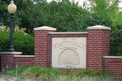
I have noted that incorporated towns in Prince George's County seem to be significantly more immune to this "freewayification". Unincorporated areas like Largo, Beltsville, and Greater Upper Marlboro seem to get the brunt of the poorly implemented car-oriented development. Certainly there are may be other factors, but perhaps an incorporated town with direct, small scale representation is less likely to be tolerant of a lack of a sense of place in the town.
Baltimore Inner Space posted this piece (via GGW) on Owings Mills, and its egregious display of poor urbanism, highlighted by a fence and 'No Trespassing' signs that keep mall patrons from accessing the Metro station even though the two are adjacent. Owings Mills, like every other town in Baltimore and Howard counties, is unincorporated. There is no mayor or council to petition against such poor urbanism. residents of the Owings Mills area are at the mercy of developers and a larger government that oversees the entire county of three quarters of a million people. Perhaps this is why Largo looks like this and downtown Hyattsville does not, even though Largo is centrally served by Metro and Hyattsville is not. Even when Hyattsville fell into blight, its primary artery, US-1 remained a four lane road with a speed limit of 30, plentiful cross streets and traffic signals.
Beyond DC writes about Prince William County's future plans to upgrade transit and create more walkable town centers. Beyond DC is skeptical of the plan's ability to succeed, but applauds the idea of improving one of the most populous counties in Virginia. There are only four incorporated areas in Prince William; Occoquan, Quantico, Dumfries, and Haymarket (Manassas and Manassas Park are both independent cities but are completely encompassed by Prince William County). I would be interested to see the success of this plan in those areas versus unincorporated areas like Dale City and Gainesville.
Not to say unincorporated towns can't thrive with good urbanism. Silver Spring and Bethesda are prime examples of unincorporated areas that have exercised a very intelligent master plan. Both those areas are among the most popular walkable areas outside the District. Of course, those two areas are atop Metro stations and they are both adjacent to the DC line situated on prominent corridors into the city. Wheaton, while not enjoying the same level renaissance, might be a good example of an unincorporated exception. It too has a Red Line station (home to the western hemisphere's longest escalator), and has been improving steadily for about the last twenty years. I ought to know, I went to high school there.
If the Tysons Corner plan gets off the ground, that will be another unincorporated area that enjoys smart redevelopment. Of course, the sector plan for the area seems to treat the area like an incorporated town (strict boundaries and districts, guidelines and regulations specific to the area, a council to govern the plan, etc). Obviously the existing density and planned metro stations have a great deal to do with this overhaul as well.
My Prince George's County seems to have a clear dichotomy between smartly designed incorporated towns working to improve their walkability and livability and unincorporated areas that are draped with high speed roads, poor pedestrian facilities, big box stores, and a depressing lack of a sense of place. Even my neighborhood, technically outside the corporate limits of the City of Laurel, lacks the sidewalks and curbs present in the neighborhoods to the east, north, and west. Does that mean it would be smarter to incorporate more towns? Beltsville, Chillum, Langley Park, Lanham, Clinton, Suitland, Largo, Oxon Hill, and Camp Springs, should we look into incorporating them?
The mayor of (incorporated) Kensington commented on my MARC post informing me that Kensington too will be making improvements to the downtown. Does a government directly serving a smaller group of people help an area create, grow, and preserve their sense of place? Perhaps the incorporation provides more organization for the residents to vocalize their desire to improve the state of their surroundings. Whatever it is, it will likely ensure that my next house will be in an incorporated town.
Monday, October 6, 2008
Ambitious Transit Advocacy
I really liked a point Ryan Avent made this week:
This is an excellent point, and one that ought to be further explored within the DC metropolitan region. We can build roads to support future development, but rails? Forget it. Furthering this point, Richard Layman had a good post on the sort of fundamental paradigm shifts we will to need to undergo in order to take the economic and environmental burden out of transit provision.
But if we could build rails anticipating future developments, I believe areas such as incorporated, close-in, traditionally-built suburban towns ought to be among the to speculate transit expansions. Incorporated towns because the local government may have a shorter route to approving smarter development around transit, close in so that they are relevant to the heart of the transit system, and traditionally-built neighborhoods because the open connectivity is conducive to residents reaching the transit station. Places like Hyattsville, Takoma Park, Kensington, Falls Church, and Forest Heights ought to be considered for such speculation.
 I have been toying around in Google Earth trying to imagine a transit system for the DC area that would make it easy to live anywhere in the region without a car, much like Manhattan. It is probably not a very feasible system, with 14 lines and 550+ miles of heavy and light rail track, plus the fact that my quasi-scientific formulas for designing my system have no way of predicting ridership or optimal routes. But I'm kind of curious as to why the DC metropolitan area and other cities aren't advocating for such a system that takes cars off the roads.
The extremely ambitious highway plan of half a century ago makes such a system of passenger trains seem rather small. Freeway revolts nixed much of the more detrimental inner city freeways, however much of the freeway infrastructure in our region has come to fruition. Remember, freeways don't necessarily have to be interstates (much like Metro doesn't necessarily have to be heavy rail, it can be light rail)
Below, I've listed the limited access divided freeways of our region (DC, plus Montgomery, Prince George's, Arlington, Fairfax and northeastern Prince William County and Alexandria City) Lengths approximate:
Mostly or completely pure freeway:
I-95 Maryland (College Park to Howard County) 8 miles
MD/DC-295, Balt-Wash Parkway (Anacostia to Fort Meade) 21 miles
I-495, Capital Beltway (loop around the city) 66 miles
I-270 (Bethesda to Frederick) 33 miles
I-95/395, Shirley Highway (Dale City to Downtown) 26 miles
I-295, Anacostia/Southeast Freeway (Oxon Hill to Downtown) 8 miles
Suitland Parkway (Anacostia to Andrews AFB) 10 miles
US-50, John Hanson Highway (Cheverly to Annapolis) 25 miles
US-50, Arlington Boulevard (Merrifield to The Mall) 11 miles
I-66 Custis Memorial Freeway (Gainesville to The Mall) 32 miles
Clara Barton Parkway (Georgetown to Potomac, MD) 10 miles
I-370/MD-200, Intercounty Connector (Gaithersburg to Laurel, under construction) 18 miles
George Washington Memorial Parkway (Alexandria to Great Falls) 15 miles
Dulles Toll Road/Greenway (Arlington to Loudon County) 16 miles
Key Br/Whitehurst Fwy/Potomac River Fwy (Rosslyn to The Mall) 2 miles
US-29, Columbia Pike (Silver Spring to Howard County) 11 miles
MD-4 Pennsylvania Avenue (Suitland to Anne Arundel County) 11 miles
MD-5 Branch Avenue (Suitland to Brandywine) 12 miles
VA-28 Sully Road (Manassas to Dulles International Airport) 21 miles
Montrose Parkway (Rockville) 4 Miles
Rock Creek Parkway (Woodley Park to The Mall) 3 miles
Rapidly becoming pure freeways:
US-301, Blue Star Memorial Highway (Bowie to Waldorf) 26 miles
MD-210, Indian Head Highway (Forest Heights to Accokeek) 11 miles
VA-7100, Fairfax County Parkway (Herndon to Springfield) 35 miles
VA-3000, Prince William Parkway (Woodbridge to Manassas) 16 miles
451 miles of freeway in Washington DC and adjacent counties. Sure makes the downtown sections that didn't get built seem like small apples. This doesn't include "mini freeways" embedded into the traffic system. It does not include the express tunnels on North Capitol, South Capitol, Connecticut Avenue, Massachusetts Avenue, or K Street. Nor do they include spur freeways like the Cabin John Parkway, 270 spur, Spout Run Parkway, or the E Street Expressway. Nor does it include roads that become freeways for short stretches, like Central Avenue in Largo, Military Road west of 14th Street, North Capitol Street north of the Hospitals, or Franconia Road in Springfield. Nor does it include interchanges at non-freeways, like Tyson's Corner, Glenmont, University Boulevard at Route 1, or Kingle Road. Nor does it take into account express lanes, HOV lanes, or exit ramps. I figure all of this combined ought to add up to at least 100 miles.
I'm curious about the percentage of area residents that live within walking distance to fixed transit versus the percentage of area residents that live within walking distance to a freeway or an interchange. I'd be willing to bet that the latter is the larger number. If highways can have their 550 miles of coverage, why not rails?
Perhaps highway advocates threw a bunch of ideas at the wall to see what stuck. Perhaps it was the relentless lobbying. But whatever it is, it is the highway lobby had more ambition than our current transit advocacy currently exudes. If we can emulate one thing from the freeway lobby of the mid-20th Century, it is the ambitious fortitude with which they lobbied for what ultimately became the largest public works project in world history.
I'm not going to settle for a transit system that doesn't allow most of the metropolitan area to survive without an automobile. I'm going to keep pushing for my 550 miles of fixed rail.
The point that highways are built speculatively all the time while transit is not is a very good one, and one which never fails to get my goat. But I think it’s worth emphasizing that speculative transit isn’t really about building lines into the wilderness. It’s about building lines into places people already live in order to take better advantage of valuable land there.
For instance, if we imagine a sunbelt boomtown, it’s easy to see an exurban ring road being built to accommodate “future development.” At the same time, a rail transit system through the downtown area would be nixed in a heartbeat because that area lacked an appropriate density for transit. But transportation linkages shape development whether they’re road or rail. When you fail to use the same speculative criteria for one mode that you do for another, you are making a judgment about what kind of development is appropriate. For decades, government has essentially said that in the overwhelming majority of cases, auto-oriented development is appropriate and nothing else. Considering the effects of that decision, it must be one of the most momentous government interventions of all time.
This is an excellent point, and one that ought to be further explored within the DC metropolitan region. We can build roads to support future development, but rails? Forget it. Furthering this point, Richard Layman had a good post on the sort of fundamental paradigm shifts we will to need to undergo in order to take the economic and environmental burden out of transit provision.
But if we could build rails anticipating future developments, I believe areas such as incorporated, close-in, traditionally-built suburban towns ought to be among the to speculate transit expansions. Incorporated towns because the local government may have a shorter route to approving smarter development around transit, close in so that they are relevant to the heart of the transit system, and traditionally-built neighborhoods because the open connectivity is conducive to residents reaching the transit station. Places like Hyattsville, Takoma Park, Kensington, Falls Church, and Forest Heights ought to be considered for such speculation.
 I have been toying around in Google Earth trying to imagine a transit system for the DC area that would make it easy to live anywhere in the region without a car, much like Manhattan. It is probably not a very feasible system, with 14 lines and 550+ miles of heavy and light rail track, plus the fact that my quasi-scientific formulas for designing my system have no way of predicting ridership or optimal routes. But I'm kind of curious as to why the DC metropolitan area and other cities aren't advocating for such a system that takes cars off the roads.
The extremely ambitious highway plan of half a century ago makes such a system of passenger trains seem rather small. Freeway revolts nixed much of the more detrimental inner city freeways, however much of the freeway infrastructure in our region has come to fruition. Remember, freeways don't necessarily have to be interstates (much like Metro doesn't necessarily have to be heavy rail, it can be light rail)
Below, I've listed the limited access divided freeways of our region (DC, plus Montgomery, Prince George's, Arlington, Fairfax and northeastern Prince William County and Alexandria City) Lengths approximate:
Mostly or completely pure freeway:
I-95 Maryland (College Park to Howard County) 8 miles
MD/DC-295, Balt-Wash Parkway (Anacostia to Fort Meade) 21 miles
I-495, Capital Beltway (loop around the city) 66 miles
I-270 (Bethesda to Frederick) 33 miles
I-95/395, Shirley Highway (Dale City to Downtown) 26 miles
I-295, Anacostia/Southeast Freeway (Oxon Hill to Downtown) 8 miles
Suitland Parkway (Anacostia to Andrews AFB) 10 miles
US-50, John Hanson Highway (Cheverly to Annapolis) 25 miles
US-50, Arlington Boulevard (Merrifield to The Mall) 11 miles
I-66 Custis Memorial Freeway (Gainesville to The Mall) 32 miles
Clara Barton Parkway (Georgetown to Potomac, MD) 10 miles
I-370/MD-200, Intercounty Connector (Gaithersburg to Laurel, under construction) 18 miles
George Washington Memorial Parkway (Alexandria to Great Falls) 15 miles
Dulles Toll Road/Greenway (Arlington to Loudon County) 16 miles
Key Br/Whitehurst Fwy/Potomac River Fwy (Rosslyn to The Mall) 2 miles
US-29, Columbia Pike (Silver Spring to Howard County) 11 miles
MD-4 Pennsylvania Avenue (Suitland to Anne Arundel County) 11 miles
MD-5 Branch Avenue (Suitland to Brandywine) 12 miles
VA-28 Sully Road (Manassas to Dulles International Airport) 21 miles
Montrose Parkway (Rockville) 4 Miles
Rock Creek Parkway (Woodley Park to The Mall) 3 miles
Rapidly becoming pure freeways:
US-301, Blue Star Memorial Highway (Bowie to Waldorf) 26 miles
MD-210, Indian Head Highway (Forest Heights to Accokeek) 11 miles
VA-7100, Fairfax County Parkway (Herndon to Springfield) 35 miles
VA-3000, Prince William Parkway (Woodbridge to Manassas) 16 miles
451 miles of freeway in Washington DC and adjacent counties. Sure makes the downtown sections that didn't get built seem like small apples. This doesn't include "mini freeways" embedded into the traffic system. It does not include the express tunnels on North Capitol, South Capitol, Connecticut Avenue, Massachusetts Avenue, or K Street. Nor do they include spur freeways like the Cabin John Parkway, 270 spur, Spout Run Parkway, or the E Street Expressway. Nor does it include roads that become freeways for short stretches, like Central Avenue in Largo, Military Road west of 14th Street, North Capitol Street north of the Hospitals, or Franconia Road in Springfield. Nor does it include interchanges at non-freeways, like Tyson's Corner, Glenmont, University Boulevard at Route 1, or Kingle Road. Nor does it take into account express lanes, HOV lanes, or exit ramps. I figure all of this combined ought to add up to at least 100 miles.
I'm curious about the percentage of area residents that live within walking distance to fixed transit versus the percentage of area residents that live within walking distance to a freeway or an interchange. I'd be willing to bet that the latter is the larger number. If highways can have their 550 miles of coverage, why not rails?
Perhaps highway advocates threw a bunch of ideas at the wall to see what stuck. Perhaps it was the relentless lobbying. But whatever it is, it is the highway lobby had more ambition than our current transit advocacy currently exudes. If we can emulate one thing from the freeway lobby of the mid-20th Century, it is the ambitious fortitude with which they lobbied for what ultimately became the largest public works project in world history.
I'm not going to settle for a transit system that doesn't allow most of the metropolitan area to survive without an automobile. I'm going to keep pushing for my 550 miles of fixed rail.
Friday, October 3, 2008
MARC =/= Metro
A lot of people criticize me for not liking MARC. I do like MARC, but I don't think it is a viable service to be integrated with Metro, and I think it only truly serves people who live and work along one of the corridors. Since it is not fully integrated with Metro, switching between the two services is an expensive inter-modal shift that deters people from using the system.
MARC's availability is another problem. Right now the system is wildly overcrowded. It only runs during the work week, during the day. The trains are overcrowded, and the availability to add more daily service is hampered by the fact that much of the system shares tracks with CSX and AMTRAK.
What really bothers me about the system is the fact that in the DC Metro area, MARC does not appear to influence transit-oriented development. Sure, some stations have good development, or at least plans for such development: Rockville, Silver Spring, Greenbelt, New Carrollton... of course, those stations all have Metro stations as well.
An excellent example of this would be the Kensington station. Kensington is on the Brunswick Line between Silver Spring and Rockville. Kensington is an incorporated town with a business district adjacent to the train station, but this station has done little to influence pedestrianism like in Rockville and Silver Spring, which have Metro stations. Kensington is merely a confluence of three rivers of cars, with a few office buildings and restaurants surrounded by parking.
View Larger Map of Kensington Lots of Parking fronting traffic gutters
I live on the Camden Line, perhaps the most useless fixed rail line in the region. I'm about halfway between the Laurel and Muirkirk stations. Muirkirk is a middle-of-nowhere station useful only to commuters who drive there from Beltsville. It serves no one. The Konterra development will be just across Rt 1, but it has seemingly little connectivity to the MARC station. It has been implied that Konterra's town center location along I-95 would support a new Metro station along I-95. Laurel is in the blossoming downtown of Laurel, a city of 30,000 people, but the station has little impact on development plans in the city. It seems that more of the development (such as Laurel Commons) has been more in anticipation for a future Metro station a mile or so south on an expanded Green Line.
View Larger Map of Muirkirk Station Office parks and no sidewalks
To make MARC a more viable system, it would require additional tracks along pretty much the entire system. Why not, then, build Metro tracks along the DC, PG, and MoCo portions of the system and connect those areas to the rest of the system with seamless transfers? Leave MARC as it is, a REGIONAL system that gets people between Baltimore, Washington, and Frederick. Heck, add another MARC line to Annapolis. We need MARC, but we can't treat it like a system that integrates areas into the greater transit system of the DC Metropolitan area.
MARC is not a suitable compliment to Metro. It may connect DC and Baltimore, but it doesn't connect Laurel, Bowie, Kensington, and other DC suburbs to the urban fabric of the metropolitan area.
My thoughts on replacing the stations on the lower portion of MARC with Metro:
Brunswick Line: Use the Yellow Line, build a spur at Ft. Totten and run along the Red Line to Silver Spring (Or better yet, run it under Georgia Avenue from Petworth Station to Silver Spring) and then along the Brunswick Line to Rockville.
Penn Line: Instead of terminating the Silver Line at Stadium-Armory, run the Silver Line along the Orange Line to New Carrollton and then extend it up to the BWI stop on the Penn Line. The Silver Line would then connect two major regional airports.
Camden Line: Bring the Green Line up to Laurel. Route One can support the TOD.
Of course this doesn't appear feasible, but as I have mentioned before, I believe our rail initiatives ought to be at least as ambitious as the Freeway Plan of the 1960's. Leave MARC. It is a great redundancy system for traveling between Baltimore and Washington. But instead of giving MARC more tracks, build tracks for a system that is going to effectively enhance the region's ability to develop more environmentally friendly transit-oriented suburbs with convenient transit access.
Tuesday, September 16, 2008
Top 10 Infill Sites Under the Radar
Poplar Point. The Soldiers Home. Near Southeast. Columbia Heights. The Kennedy Center. Anacostia. NoMa. Southwest Waterfront. It's no secret that DC is in the process of getting a makeover, and several prominent locations are seeing a major influx of infrastructure development that will bring new amenities to the city. the 50 year trend of exodus from DC is over.
There are a bunch areas that could probably use some urban infill, but I never hear about them. Perhaps this is because I'm not looking in the right places, perhaps it's because there are no plans, and perhaps it is because some of these places are wholly impractical for development. But I chose the 10 spots, all within the District, that I thought would be the best candidates for urban infill development that don't seem to be getting the attention they ought to deserve.
10. Buzzard Point
Southwest, between Potomac Avenue, South Capitol Street, and the Potomac River
With all the work being done around Nationals Park and Navy Yard, You don't hear too much about that nice little piece of riverfront real estate on the other side of South Capitol Street. On this map by the Capitol Riverfront BID, not much improvement is shown. This summer when I was down there exploring, it was still largely industrial wasteland north of V Street and parking lots and wasted riverfront vista south of V Street. That industrial stone plant at Half and R Streets HAS to go some times, doesn't it? I haven't heard anything about it yet.
9. Benning Power Plant
Northeast, Benning Rd between the Anacostia River and the Orange Line tracks
I talked about this last week. What is currently an antiquated and pollution creating coal power plant that blankets this neighborhood and adjacent estuary with heavy pollution could potentially be one of the top mixed-use locations on the Anacostia.
8. Fort Lincoln
Northeast, between New York, South Dakota, Bladensburg Rd, and the state line
Something looks like it is being built here, but I have no idea what. The wide roads are indicitive of future development, but I haven't been able to dig anything up on how whatever it is will fit into the urban fabric of Northeast or the surrounding historic communities in Prince George's County.
7. Lamond-Riggs
Northeast, Kansas Avenue at Blair Road
This area would be a great spot for an infill station on the Red Line. About halfway between the Fort Totten and Takoma stations, this area has seen its commercial areas blighted over the last few decades. A Metro station and a little investment could pay big dividends in this neighborhood.
6. RFK Stadium Site
Northeast and Southeast, along west bank of Anacostia River
Dan Snyder is jealous of the Dallas Cowboys planned stadium which, when completed, will be the largest stadium in the NFL. He also doesn't like the fact that FedEx field is outside the District. If he builds a new stadium at the RFK site (or anywhere else, for that matter), it will be a dome with a capacity approaching 110,000. This will attract a Super Bowl to the city. I'm all in favor of a venue of that size located in the district on a couple of Metro lines. But something needs to be done about that horrible surface parking. I love to tailgate, but I'll modify my gameday plans if it means less pavement along the river.
5. Saint Elizabeth's Hospital
Southeast, along MLK Avenue between Malcolm X Avenue and Suitland Parkway
I am aware of Department of Homeland Security's plans to relocate to some of the western portion of the campus, but currently most of the campus sits in disrepair while only the tiny portion on John Marr Circle is still used as a hospital. This area is full of historic buildings with spectacular vistas to the rivers, the Capitol, and other prominent DC landmarks. There's a ramp to an interstate and a Metro station. But over 30 years of disrepair has left this campus as a chunk of blight partitioning an area of the city in dire need of connectivity and economic development. And Now, Anacostia says the east campus looks like an Ivy League school. Well, why not put a university there? ANA hopes that a campus of UDC is located there when renovation begins. Current plans to break ground in 2012 will bring a mixed-use community.
4. Theodore Roosavelt Island
Northwest, in the Potomac River
I like to think that perhaps a Metro station could be built on the north end of the island, and a pedestrians-only colony might spring up on the island, which is currently only accessible via a footbridge from Rosslyn. A pipe dream. But who knows, when we run out of good real estate in the city, it may happen.
3. Fort Totten
Northeast, south of South Dakota Avenue and Riggs Road
This stop is served by three lines. It is the only such station in the system outside of downtown. But there's nothing there. This is completely unacceptable. I understand that there is not currently the road network to support very high density, nor would I call for such a network to be built. But can we manage some decent retail along South Dakota or Hamilton? Perhaps some better pedestrian access to the station? Perhaps it is just par for the curse for the Green Line, which is notoriously disconnected from its surrounding communities.
2. Ivy City
Northeast, between New York, Florida, and Mount Olivet Road
I would love to see a metro line built along New York Avenue out to Mount Rainier, Hyattsville, and ultimately College Park. But even without one, Ivy City sits along a favored corridor but remains mostly industrial and auto-oriented retail space. I would like to see New York Avenue become a grand boulevard leading downtown, and a makeover for Ivy city would be a nice start. I don't know of any plans to make this happen at this time.
1. McMillian Slow Sand Filter Plant
Northwest, between North Capitol and 1st Streets near the McMillian Reservoir
It took some research for me to figure out what was going on on this site. It seems like a prominent site for a park, a library, some condos, a marketplace, or just about anything over an abandoned water filtration plant. Alas, the filtration system below was built of unreinforced concrete, meaning significant and expensive retrofitting would have to be done of structures were to be built atop the site. To complicate matters, in 1991 it was deemed a historic landmark by the city. The fact that this eyesore sits deteriorating along North Capitol Street in a prominent part of the city is criminal. It sits between Howard and Catholic Universities, adjacent to the Hospital Center, with somewhat scenic views of the McMillian reservoir. isn't this important enough for someone to do something on this site, which has sat useless for over 20 yeas?
By all means, if you know of something I failed to mention on one of these sites, leave a comment. If you feel I left somewhere out, let me know.
50 years ago, race riots and highway construction gutted the Capitol City, but finally this trend is reversing, and Washington is a highly desirable city worthy of building up. Now is the time to invest in the blighted or underutilized spots in the city. We can't let areas like these be ignored.
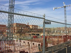
There are a bunch areas that could probably use some urban infill, but I never hear about them. Perhaps this is because I'm not looking in the right places, perhaps it's because there are no plans, and perhaps it is because some of these places are wholly impractical for development. But I chose the 10 spots, all within the District, that I thought would be the best candidates for urban infill development that don't seem to be getting the attention they ought to deserve.
10. Buzzard Point
Southwest, between Potomac Avenue, South Capitol Street, and the Potomac River
With all the work being done around Nationals Park and Navy Yard, You don't hear too much about that nice little piece of riverfront real estate on the other side of South Capitol Street. On this map by the Capitol Riverfront BID, not much improvement is shown. This summer when I was down there exploring, it was still largely industrial wasteland north of V Street and parking lots and wasted riverfront vista south of V Street. That industrial stone plant at Half and R Streets HAS to go some times, doesn't it? I haven't heard anything about it yet.
9. Benning Power Plant
Northeast, Benning Rd between the Anacostia River and the Orange Line tracks
I talked about this last week. What is currently an antiquated and pollution creating coal power plant that blankets this neighborhood and adjacent estuary with heavy pollution could potentially be one of the top mixed-use locations on the Anacostia.
8. Fort Lincoln
Northeast, between New York, South Dakota, Bladensburg Rd, and the state line
Something looks like it is being built here, but I have no idea what. The wide roads are indicitive of future development, but I haven't been able to dig anything up on how whatever it is will fit into the urban fabric of Northeast or the surrounding historic communities in Prince George's County.
7. Lamond-Riggs
Northeast, Kansas Avenue at Blair Road
This area would be a great spot for an infill station on the Red Line. About halfway between the Fort Totten and Takoma stations, this area has seen its commercial areas blighted over the last few decades. A Metro station and a little investment could pay big dividends in this neighborhood.
6. RFK Stadium Site
Northeast and Southeast, along west bank of Anacostia River
Dan Snyder is jealous of the Dallas Cowboys planned stadium which, when completed, will be the largest stadium in the NFL. He also doesn't like the fact that FedEx field is outside the District. If he builds a new stadium at the RFK site (or anywhere else, for that matter), it will be a dome with a capacity approaching 110,000. This will attract a Super Bowl to the city. I'm all in favor of a venue of that size located in the district on a couple of Metro lines. But something needs to be done about that horrible surface parking. I love to tailgate, but I'll modify my gameday plans if it means less pavement along the river.
5. Saint Elizabeth's Hospital
Southeast, along MLK Avenue between Malcolm X Avenue and Suitland Parkway
I am aware of Department of Homeland Security's plans to relocate to some of the western portion of the campus, but currently most of the campus sits in disrepair while only the tiny portion on John Marr Circle is still used as a hospital. This area is full of historic buildings with spectacular vistas to the rivers, the Capitol, and other prominent DC landmarks. There's a ramp to an interstate and a Metro station. But over 30 years of disrepair has left this campus as a chunk of blight partitioning an area of the city in dire need of connectivity and economic development. And Now, Anacostia says the east campus looks like an Ivy League school. Well, why not put a university there? ANA hopes that a campus of UDC is located there when renovation begins. Current plans to break ground in 2012 will bring a mixed-use community.
4. Theodore Roosavelt Island
Northwest, in the Potomac River
I like to think that perhaps a Metro station could be built on the north end of the island, and a pedestrians-only colony might spring up on the island, which is currently only accessible via a footbridge from Rosslyn. A pipe dream. But who knows, when we run out of good real estate in the city, it may happen.
3. Fort Totten
Northeast, south of South Dakota Avenue and Riggs Road
This stop is served by three lines. It is the only such station in the system outside of downtown. But there's nothing there. This is completely unacceptable. I understand that there is not currently the road network to support very high density, nor would I call for such a network to be built. But can we manage some decent retail along South Dakota or Hamilton? Perhaps some better pedestrian access to the station? Perhaps it is just par for the curse for the Green Line, which is notoriously disconnected from its surrounding communities.
2. Ivy City
Northeast, between New York, Florida, and Mount Olivet Road
I would love to see a metro line built along New York Avenue out to Mount Rainier, Hyattsville, and ultimately College Park. But even without one, Ivy City sits along a favored corridor but remains mostly industrial and auto-oriented retail space. I would like to see New York Avenue become a grand boulevard leading downtown, and a makeover for Ivy city would be a nice start. I don't know of any plans to make this happen at this time.
1. McMillian Slow Sand Filter Plant
Northwest, between North Capitol and 1st Streets near the McMillian Reservoir
It took some research for me to figure out what was going on on this site. It seems like a prominent site for a park, a library, some condos, a marketplace, or just about anything over an abandoned water filtration plant. Alas, the filtration system below was built of unreinforced concrete, meaning significant and expensive retrofitting would have to be done of structures were to be built atop the site. To complicate matters, in 1991 it was deemed a historic landmark by the city. The fact that this eyesore sits deteriorating along North Capitol Street in a prominent part of the city is criminal. It sits between Howard and Catholic Universities, adjacent to the Hospital Center, with somewhat scenic views of the McMillian reservoir. isn't this important enough for someone to do something on this site, which has sat useless for over 20 yeas?
By all means, if you know of something I failed to mention on one of these sites, leave a comment. If you feel I left somewhere out, let me know.
50 years ago, race riots and highway construction gutted the Capitol City, but finally this trend is reversing, and Washington is a highly desirable city worthy of building up. Now is the time to invest in the blighted or underutilized spots in the city. We can't let areas like these be ignored.
Monday, September 15, 2008
Thoughts on Rail, National and Local
While driving from the football game in Oxon Hill to my brother's bar in Bethesda today, I was lamenting the lack of passenger rail opportunities. Primarly, this was because I tried going through the city to avoid the Redskins traffic and found myself turned around several times because of some sort of a marathon for which I had know prior knowledge. I would have much rather Metro'd across town than driving. 10K's and marathons have a habit of not disrupting rail they way they disrupt the roads. It also made me even more frustratingly aware of the fact that several highways dead end in the middle of the city, facilitating a traffic disaster when something like this occurs with poor signage.
Bit if rail is done right, there's a lot of things that aren't disrupted. When I drive from Laurel to Oxon Hill and then Bethesda and back to Laurel, this is all metro area traffic. But I'm mixing with folks just running to the store, and people ostensibly driving from Miami to Boston. I'm mixing with individuals running errands, families on vacation, and trucks carting freight all over creation.
With rail we can separate the passenger and freight, something we rarely do on roads (exceptions being perhaps the Baltimore-Washington Parkway and other roads that limit trucks). And with passenger rail, we can have streetcars for local, subways for metropolitan, commuter rail for regional, and AMTRAK/national rail for interstate. It is similar to a road hierarchy, however if one group, say, the metropolitan travelers are backed up by heavy volume for an event, like say a pro football game, the local, regional, and national rails aren't backed up, even if they run along the same right of way, provided they all use separate tracks. Same goes for freight rail.
Separate tracks is the key. Richard Layman makes the case for a better national rail infrastructure, citing a passenger/freight crash in LA. We have 16+ lane highways. Why can't we have four lane rail rights-of-way? I'm no engineer, but wouldn't it be cheaper to build rail bridges and tunnels? Isn't there less space required? Wouldn't it be cheaper to bury more of the rail network instead of burying freeways through the city? Bury them all, in my opinion. Bury them together!
Sharing tracks, I believe, is the main reason that MARC stations have largely failed to promote transit oriented development around their stations. I think of it this way: a family with kids might not mind living on a street with lots of bus traffic. But if those buses are 18 wheelers, the impression of the street changes. Not to mention, sharing the tracks with freight trains and AMTRAK is what prevents MARC from having a schedule useful for anything more than commuting. The tracks are too crowded.
Imagine a separate highway for trucks, another for interstate travel with exits only in major cities. If a CSX train derails, it doesn't ruin MARC and AMTRAK service for the day. Any thoughts on this theory?
Wednesday, September 10, 2008
Town Centers in PG: Ur Doing It Wrong

Prince George's County, Maryland. I've called it home the last five years of my life. It is a county of promise and potential. With an unparalleled demographic of wealthy minorities and a wide ethnic diversity coupled with a 312 year historical heritage, there's no lack of culture here. With a population rapidly approaching one million, there's a quality tax base as well. What the county lacks-- more than any other county that touches Washington, DC-- is a sense of place throughout.
But that's all changing, right? Largo Town Center, Konterra, Bowie Town Center, National Harbor, Woodmore Towne Centre, and other developments are sprouting up all over the county. They are walkable retail districts that create a sense of place. But unfortunately, you only get that sense of place when you hop in the car and drive to those places (with the exception of Largo, which is on the terminus of the Blue Line).
I absolutely despise it when developers throw "Town Center" at the end of an isolated retail development that is completely car oriented and disconnected from the surrounding areas. I especially hate it when it's spelled "Towne Centre". But let's ingore that for a second...
These areas are a good start for PG, I believe. But acres of surface parking and a big box store mar sites like Woodmore Towne Centre. But surface parking can always be built upon, and big box stores can either be integrated into their surroundings (like in DC USA) or transformed into other uses. Most of the surface parking is probably mandated by some horrible parking minimum over which the developers have no control anyway. What I find most disconcerting with the layout here is that there is only one direct street connection with Glenarden, the municipality in which this development lies. To me, this sends a message. It is not integrated into the community. It is its own entity for other people who will drive there from wherever else. Largo Town Center is even worse. Despite it's own Blue Line Metro station, the development is little more than an island of retail in a sea of parking
Glenarden, Woodmore Towne Centre, and the Landover Gateway development area all lie on a corridor that may wind up being a stop on the Purple Line eventually. Largo Town Center came along with a Metro station. What about other greenfield developments in PG? Konterra is built somewhat near a MARC station along Route 1, but the town center is about a mile away from this station and the design on the tract does not engage the MARC station. National Harbor, the bustling upscale community on the Potomac across from Alexandria, is grossly underserved by Metrobus and is grossly isolated from rail service.
This is bad, but it is much worse when considered with the lack of development around Metro and MARC stations in Prince George's County. Walkable, mixed use development is planned and/or starting to trickle in around Greenbelt, Capitol Heights, and a few other stations, but are they really doing it right anywhere? Sort of. Prince George's Plaza ought to be the model around which new developments in PG are modeled. The surface lots are being replaced by towers hosting a diverse demographic. The area is widely connected to the surrounding areas, helping push development in downtown Hyattsville. PG Plaza definitely isn't all the way there yet, but it's closer than anywhere else.
What makes good development even better is interconnectivity. Largo shows us that just a transit stop doesn't give you a truely great sense of place. National Harbor might prove that no matter how mixed-use, walkable, and upscale a place may be, isolation makes it somewhat of a kitschy novelty location. The ingredients are there. The County just needs to take advantage of it.
I am planning to attend Envision Prince George's on October 3rd at University of Maryland University College Inn and Conference Center in Adelphi. Thanks to Richard Layman for highlighting this event. Better days lie ahead for Prince George's, and I'm hoping to get a glimpse of that at this event.
Friday, August 22, 2008
Affordable Housing
Just Up The Pike, who often writes about Moderately Priced Dwelling Units (MPDU's, a county initiative to provide more affordable housing) in eastern Montgomery County, recently wrote a post where he referred to eastern MoCo as a "dumping ground" for cheap housing. There's much controversy over MDPU's as the county struggles to walk the line of providing affordable housing while catering to the affluent populace of the county. Often it becomes a heated argument.
I work with a lot of families from MDPU's along US 29. I don't think the issue is with smaller, affordable housing bringing lower income residents, but with how the housing is laid out. Clearly there is not enough affordable housing in the county, otherwise we wouldn't be seeing things like this. JUTP provides a great take on ancillary dwelling units in traditional suburban neighborhoods, which in my opinion are a very good thing. But they will not satisfy the need for afforable housing in the region.
Briggs Chaney is a great example of how poorly MDPU's and other "affordable housing" can be thrown down into the suburban landscape. It is somewhat dense, but car oriented. It is an area that is seriously lacking in amenities. But thousands of people cram into garden apartments that isolate the lower middle class in a bubble of "lower class-ness", disconnected from their neighbors. If these MDPU's are for lower income residents, why do virtually all of them assume the occupants will own a car? None of them in East MoCo are near Metro stations. Often it is cumbersome to leave the apartment complex by foot. They absolutely discourage walking and transit.
This causes a number of problems from an urbanist standpoint. It creates traffic, wastes land, and is overall inefficient. But from a socio-economic standpoint, it lowers the quality of life of the occupants. Forcing car ownership (and more importantly, more car trips) creates a financial strain on people living in these complexes. Their concentration and isolation effectively make them watered down housing projects. And they're all over the region. Areas like this leave people to fester without mobility or cultural enrichment, and it's a given that there will be a subsequent rise in crime.
Why not try an experiment with MDPU's in a dense grid layout near a major bus route? Throw a discount grocery store and some essential commerce within walking distance and see if we don't create a neighborhood where lower income residents don't seem quite so scary to the folks in the McMansions on the other side of the highway. Scaled, walkable communities for lower income residents increase the residents' economic power, thereby allowing them to contribute more economically to the community around them, raising the quality of life, making their communities fit better into the fabric of the region.
Sequestering lower income residents to a concentrated homogeneous development that is isolated from the rest of the community and near few jobs has been done before. In the old days they called these developments "housing projects" and they were colossal failures. Cabrini Green in Chicago proved that mixed income housing is the best way to go. But we must remember that dropping a couple of isolated garden apartments in the middle of a bunch of McMansions is not mixed-income housing.
Good places to start, perhaps:
-The mall in Wheaton would be a great place to transform into a mixed-use live-work-shop area, with MDPU's to cater to the sizable Central American and Southeast Asian populations there. It's also right on top of transit.
-The empty space across the train tracks from Montgomery College in Rockville would be great. It's close to Derwood Industrial Park, and a Metro station could be placed right there.
-In PG, Brentwood and North Brentwood along Route 1 are full of empty industrial buildings. This is a major bus route with good access into the city. Couldn't there be some affordable apartments placed fronting the street, perhaps with some ground floor retail?
-In the District, the layout is there in most of the city. But Ward 8 looks more like a suburb than anything else. I don't believe this area needs gentrification so much as a better urban design. Keep placing affordable housing down there. Just make more efficient use of the land.
-Alexandria should include affordable housing in the Potomac Yards development. This might be in the works, I don't know. The same is true for Konterra.
-Fairfax County ought to look into the placement of affordable housing in Tysons Corner after the Silver Line is built.
-Have ideas? Share them.
Mixed use transit oriented development is a good thing. It works all over the region, and it creates a much more efficient cost of living. Sprinkling garden apartments in spread out areas far from decent transit, commerce, jobs, and amenities will only perpetuate a cycle of poor for the lower income residents of Montgomery County and the DC Metropolitan area.
Thursday, July 10, 2008
Traffic Gutters to TOD
I've been thinking about the Arlington model for TOD. Where else could we do that around DC? Should we do it? I say yes, but I think the capital investment required will keep such fantasies in my optimistic imagination.
As I have stated before, I believe the combination of transit access and a useful street grid is what makes Arlington's Orange Line stretch what it is today. I think, with a little elbow grease, there are a few other corridors we could likely transform to stave off urban sprawl and bring the development back into the city.
Obviously we'd need transit. It looks like better transit may be coming in the form of busses soon. Still, TOD works better where there is fixed rail. I think improved fixed rail access can benefit the region if we place it along the right corridors. Here are my top ten:
1. Route 1 from College Park to Laurel
Beyond DC stated to me (above link, in the comments) that Metro expansion would be far more expensive than upgrading MARC to Metro-like service capability. This is true, but I don't see evidence where MARC has promoted TOD. If someone believes otherwise I'd love to get a little more informed on this. Anyway, with a string-of-pearls of small cities flanked by two freeways, this corridor is halfway there with the TOD. Considering the Base Relocation And Closure (BRAC) bringing thousands of jobs to Fort Meade, Beltsville and Laurel will only become more attractive places to live. I hope we can do it right and provide connectivity between the jobs and the houses, and throw in a few walkable commercial districts while we're at it. In the mean time, at least Route 1 has an initiative. (warning: pdf)
2. Columbia Pike in Arlington.
This road is a gateway to the heart of the District. It's an attractive place to live and a reasonable place from which one could commute into the city. Fortunately, there is a streetcar on the books for this corridor. I hope once if/when it is built, it will carry passengers all the way to L'Enfant, to jobs and four lines of the Metro.
3. Columbia Pike from Silver Spring to Columbia
Also known as US29. This stretch is in the process of being turned into a limited access freeway from New Hampshire Avenue on up. But the highway design allows for light rail to be placed in the median. This could benefit some of the higher density developments in Briggs Chaney that are far from jobs. Light rail would be tricky, however, unless it went underground south of White Oak to Silver Spring, as 29 turns into another suburban traffic gutter south of there. A while back, Just Up The Pike produced this route, which would likely do the trick.
4. MD 355 from White Flint Mall to Germantown
Rockville Pike, Hungerford Drive, or Frederick Avenue... whatever you call MD355, it is a traffic gutter. I don't see why this has to be, considering that there is a freeway (I-270) running parallel a mile or so west. Many of the train stations are there thanks to the Red Line and the proposed Corridor Cities Transitway, but the corridor lacks a street grid supporting it. This vital technology corridor has been developed as urban sprawl so much that it now is seen as a major threat to Montgomery County farmland. Bringing that development inward can help reduce the negative effect on the farms and improve the corridor's positive impact on the regional economy.
5. Kenilworth Avenue from Cheverly to Konterra
Currently, Kenilworth Avenue ends in Beltsville, but construction should begin soon to extend the road to the Konterra site. The southern section passes though the abject blight of Prince George's County. Bladensburg, once a thriving seaport, has fallen into unsightly disrepair uncharacteristic of the charming town that 50 years ago was Chevy Chase with a waterfront. Edmonston, Riverdale, Berwyn Heights, and Greenbelt are also served by this road, which at parts looks more like a freeway. There is an effort to revitalized this stretch, though. The northern portion of this corridor could easily compliment the Route 1 corridor mentioned above. It would require more than the two existing Green Line Metro stations currently existing between the two corridors, but it is very doable and could create a far more suitable gateway between DC and Baltimore.
6. Alabama Avenue in Southeast
I wonder if a light rail along this road would promote some connectivity on the other side of the river. It certainly wouldn't have the economic impact that the other corridors boast, or even the potential for other corridors in Anacostia, but I believe it might improve the quality of life for Anacostia residents and make it a more attractive place to live or run a business. I'm sure this will never be a high priority, but it ought to get some attention as the central corridor of Southeast.
7. Georgia Avenue from Silver Spring to Olney
This is one of the first roads I picture when I think of a traffic gutter. It passes through so many great neighborhoods, commercial areas, and built up areas. It has four Red Line Stations. But the road has no charm or character. It's only there to shuttle people up and down the county. Residents would agree that there's absolutely no reason for this in Silver Spring, which is widely used by pedestrians that don't benefit from a six lane traffic gutter (or two! see #3) bisecting the town. Same at Seminary Lane. Same in Wheaton. And Glenmont. And Aspen Hill. And Rossmoor. And Olney. There's no reason Georgia Avenue can't be a real "avenue", or Main Street MoCo.
8. VA236/US50 from Alexandria to South Riding
This is a very long stretch, but again we have a road that's long and straight, passes through several town centers, and does little more for those towns than serve as a traffic gutter. There is currently no fixed guideway transit on this corridor except the King Street Metro station. That's nothing in Lincolnia, Bailey's Crossroads, Fairfax, Fair Oaks, Centerville, or South Riding. Wouldn't some transit on this stretch make it a more viable stretch to live or operate a business? Live here, walk around to do your errands, and commute to Alexandria.
9. University Boulevard from Kensington to College Park/Viers Mill Rd from Wheaton to Rockville
Yes, I'm calling out both of these entire roads. Kensington has no transit save for a MARC station, which is a shame because it's a wonderfully charming town where the walkability is swallowed up in 8 lanes of traffic. It is six lanes through Wheaton, Kemp Mill, and Four Corners. Langley Park is downright strangled by all the traffic lanes, making this "boulevard" a traffic gutter that is too clogged to effectively bring folks to its eponymous University of Maryland. As for Viers Mill Road, it connects this corridor to Rockville. driving it is painful even if it is the peth of least resistance to Rockville. It's time to admit that Viers Mill is no longer suburban, it is indeed very much urban. More transit, more TOD on these roads please!
10. New York and Rhode Island Avenues in Northeast
Could we use that MARC/CSX right of way for some local transit? I envision a line running from Union Station to Hyattsville along there. I support the District's attempts to make New York Avenue more like a city street, and what would help more than some TOD along the route? This could benefit Trinidad, Brentwood, Fort Lincoln, Ivy City, and in PG Mount Rainier, Cottage City Hyattsville, and Riverdale. These areas are so close to everything, and yet they're somewhat blighted. It would be of great benefit to the region to improve these areas.
Anyone else have some ideas about what corridors might be able to emulate the Orange Line part of Arlington?
Subscribe to:
Posts (Atom)

 Posts