
Naturally, there has been much written about the terrible Metro crash on the Red Line earlier this week. Had this been a nasty pile-up on the Beltway, we might have heard about it by by this point, we probably would have stopped talking about it by now, and it certainly never would have been international news. It is out of the ordinary, tragic, and was a failure of public infrastructure, unlike traffic accidents, which are usually the failures of individual drivers (we'll forgo the argument that fault may lie in road design). The fact that service disruptions continue on the Red Line is another reminder of this horrible accident. After all, these disruptions have a far greater impact on Metro than a bad traffic accident has on area highways.
If there is an accident on US-29 in Montgomery County, I can drive on Georgia or New Hampshire Avenues. But the stations that were shut down the past couple days isolated eastern Montgomery County from the rest of the Metro System. Originally, I tinkered with a map showing a separated Yellow Line for the sake of greater capacity and more geographic coverage for the Metro System. This week's accident has shown that adding redundancy to the system can be just as valuable as adding capacity.
Realizing the need for more redundancy on the system in the wake of this tragic crash is not an original idea. The Purple Line would obviously create alternate routes throughout the system. The Purple Line is both necessary and long overdue, however separating the Yellow and Green Lines would add capacity to existing track, much like separating the Blue and Orange Lines. In the case of the Yellow Line, it would allow for increased capacity on its Potomac River Bridge. If separated, the entire Green Line and the Yellow Line north of Pentagon would have the same capacity as the Red Line.
Here's what I would do with a separate Yellow Line:
View Separate Yellow Line in a larger map
This alignment is not 100% original either. Bringing Metro to North Capitol Street and Georgia Avenue is in no way a new idea. In these cases, however, people seem to want it for the geographic coverage, and not the additional capacity or system redundancy. Coverage is good, it brings transit to a new area. Capacity and redundancy, however, improve the entire system.
Perhaps I added a few too many stations, but they are just suggestions. While this would add service to the North Capitol Street and Georgia Avenue corridors, it would add redundancy to both the Green and Red Lines via Silver Spring, Georgia Av/Petworth, Union Station, and L'Enfant Plaza.
If this line existed already, the station closures on the Red Line might only have meant an additional transfer for Montgomery County commuters instead of the shuttle services to which Metro resorted after the crash.
Thursday, June 25, 2009
Monday, June 22, 2009
First Car Trip Back in the US, I Witness a Bike Accident
My first day back in the United States, the very first car trip I take (after jump starting my car, God help you if you don't drive them for 60 days) Just as I am acclimating myself back to American roads, I slammed on my breaks. The Ford Mustang driver in front of me had hit a cyclist. I did not see exactly what happened, but I did note that it occurred as the driver of the Mustang was pulling his car onto 198 from a curb cut entrance to an apartment complex.
The boy was okay, a couple nasty legions, but the bike was ruined. I offered my phone number and got the heck out of there, partly because I was in a hurry, and partly because I didn't want to take anyone's side int this one. After all, I didn't actually see what happened. The Mustang operator was polite and offered assistance, but when they you (probably about 19 or so) wanted to call the police, both occupants of the Mustang and another driver who had stopped after the incident insisted that the cyclist was at fault.
Again, I did not see the actual accident, but I can tell you for sure that on MD-198 in Laurel and Maryland City, the planners of the road were probably at fault. 198 is a six lane highway wrought with curb cuts. The sidewalks are widely traveled, but are only about four feet wide. And, in typical Prince George's and Anne Arundel County fashion, there are no bicycle lanes.
Ironically, as I was driving down the road, I was thinking about the best way to write about my recent travels in Europe and how easy it is to get around without a car. This was a sobering reminder of where I live, and how unwelcoming a place it can be. unless, of course, you are in your car.
Saturday, June 20, 2009
Back In the States
 I have returned from Germany (the university town of Darmstadt, to answer previous inquiries) with a renewed sense of appreciation for the cities of both Europe and the United States. I will probably have several tales to tell about my travels on the Audobahn, local tram system, high speed trains, and airports.
The E-25 in Belgium. Photo copyright Dave Murphy.
It dawned on me that today marks a year of running this site (although there have been several obvious periods of lull) I have been most fortunate to have a good number of followers and I wanted to take the time to thank them, even the ones who don't often agree with me. This has been a fun and worthwhile extra curricular activity for me.
Naturally, while in Europe, I took advantage of the walkability and the ample mass transit. But what really surprised me was that I fell in love with the freeway system. I didn't drive often, mostly only on day trips to neighborhing cities, but Germany's Audobahn and European freeways in general are fun and exciting to drive. One thing in particular I noticed was that the expressways, often only two lanes in each direction, have much smaller footprints than interstate highways, and much less traffic. They are generally straighter and flatter than interstates, which allows the carriage lanes to be slightly narrower and the travel speeds to be higher (unlimited in Germany!). It made me wonder, for example, if the Beltway through Montgomery County might be able to survive with three straight, flat lanes instead of four lanes curving and weaving along Rock Creek.
Another thing I liked about the expressways were the ample underpasses. In the rare few areas where the expressways traversed an urban area or even a small town, the street grid was not sacrificed to make way for the new freeway. In Luxembourg, I noticed that it was common for freeways to tunnel underneath entire towns, something probably more affordable in a country as affluent as Luxembourg. The parts that run through forest or farmland are more engaging to their surroundings, making the drive much more scenic and pleasurable than say driving I-95 between Washington and Baltimore. Often in wilderness areas, bridges of vegetation would go over the roads to allow wildlife to pass across the highway. I know these exist in the US, but they were seemingly ubiquitous in the Ardennes Forest. In addition to being functional, they ad a bit more scenery to the highway.
Expressways rarely run through cities, however. They are connected by arterials that cross the freeways outside the cities. In the center cities, there is usually little if any vehicular traffic at all. Most cities that I visited have large pedestrian-only areas, but areas that are on the street grid. In Darmstadt, the main two streets drop below the center of town and intersect underground at a stop sign, a rather exotic layout by American standards. All of this made way for various layers of pedestrian, bicycle, and transit routing, roads often sharing all four modes of transportation.
Driving in general is not as dumbed down. driving through towns or even on the expressways is not quite as intuitive as it is in America. It makes American roads seem overengineered, oversigned, and generally dumbed down for drivers. Interestingly, Germany has far lower incidence of fatalities on the road compared to the US. The entire time I was in Europe I only saw a single traffic accident, whereas it is not uncommon for me to see two while driving the six miles from my house to work here in Maryland. Anecdotal evidence that our overengineering of roads results in drivers paying less attention to what they are doing.
Another great design of European Freeways: they focus your attention at a point on the horizon. Naturally, the narrower streets, usually lined with three storey buildings, direct attention straight ahead. But the expressways were often flanked closely by trees. One Expressway in the Netherlands is lined by 100-foot tall rows of trees, almost like a grand hallway welcoming you onto the freeway. In addition to looking nicer, I believe that this focuses the eyes forward and therefore makes driving that much safer on the road.
I found getting around Germany, France, and the Low Countries to be very easy on all modes of transportation. I was quite surprised to be so taken with the highway system. More posts will come as I get settled back in to the groove here at home. Thanks again for making the last year of blogging so enjoyable.
Monday, May 4, 2009
Update From Germany
I am staying in a medium-sized city of about 120,000, or about the size of Columbia, MD. Any other similarity to Columbia ends there.
The city is very ethnically diverse, with lots of Turks, Africans, Russians, Irish, Americans, and Koreans, as well as countless others. It is mostly middle to lower middle class. The city is connected to the Audobahn by a spur. No freeways run through the town, and only one runs by it, with two lanes in each direction. The width of that entire freeway is barely more than a third of the footprint of I-95 in Howard County.
There is a light rail train with a complimenting bus service, all of which lead to a rail station with IC train service, meaning if I step out of the front door of my apartment, I can walk 100 feet to a tram station and get anywhere in Europe without getting into a car, taxi, or airplane.
The entire city is also covered in bike lanes. They have their own traffic signals seperate from cars and pedestrians. Their lanes cross into pedestrian sidewalks about as often as cars have to share lanes with buses and streetcars, which isn't much.
There is very little crime, people walk around care free and confident virtually all parts of the city at all times of day.
My (American government) job requires me to drive daily. The city streets are 2 meters (about six and a half feet) wide and rarely more than one or two lanes in each direction, if that. The automiobiles of residents are parked in courtyards. At least half the street parking is metered. Iäd say I've never had trouble finding aparking space in town, but I have never driven anywhere in town because I generally walk when I am not working.
Since I have landed in Europe, I have yet to see a single car accident, and I have driven over 1000km in two different countries. I have also not been in a single traffic jam that was not construction related.
The down is distinctly separated from other towns by large tracts of farms and forests. Virtually all buildings are
The city center is closed to automobiles except taxis. It is about a square mile of apartments above shops and businesses, including a shopping mall that is two blocks from the nearest legal parking space.
Best of all, I have been in my apartment for only two weeks and I am on a first name basis with my grocer, the proprietors of four restaurants, the staff at two bars, three of my neighbors, and the gentlemen who run this internet cafe. By contrast, I have lived in Laurel for five years and the only people who know my name are three of my neighbors and my barber.
I am not exactly staing in Mayberry, either. This is a very blue collar industrial town in Central Europe. There are no skyscrapers, no large business headquarters, and no attractions you are likely to find in most guidebooks. If anything, this is a sub-standard European town by comparison to the others I have visited. But the quality of life here is phenomenal.
This experience really makes me stop and wonder what places like Columbia, MD are doing wrong. Columbia certainly boasts a wealthier population that here. But this town has more parkland, more greenspace within walking distance, less traffic, less crime, and a community of people that actually know each other.
This would be an interesting litmus test for many of us: How many people in walking distance to your house know your name? For me, 4 in Laurel, and 14 here. That is the difference of living in a community focused on itself.
Monday, April 20, 2009
Imagine Europe
I'm going to be in Europe on official business for the next two months. Getting ready for this trip has contributed to light posting lately, but it is likely that I won't be doing much posting at all until June. If I can, I'll try and sneak a post or two in while I'm over there.
I'm currently reading James Howard Kuntsler's Geography of Nowhere, and I'm sure that it will help appreciate the differences between American and European cities, architecture, and transportation. I'm looking forward to sharing when I return sometime in June.
In the mean time, take advantage of the DC spring weather, support your local sports teams and concert venues, and get to know the city!
Tuesday, April 7, 2009
Imagine Grosvenor
I have often heard the question as to why Montgomery County's western Red Line has not enjoyed the vibrant urbanism or Arlington's Orange Line. There are several reasons for this, of course. The Red Line's stations are much further apart and further from the downtown core. MD-355 does not have the supporting road network that Wilson Boulevard enjoys. MD-355 also has several obstacles to maintaining urban continuity, such as the Georgetown Preparatory School campus, The Naval Medical Center, Rock Creek Park, and the Beltway.
But the constant comparisons between the two areas have perhaps driven Montgomery County to try to live up to the Orange Line. The White Flint plan has been taking effect in recent months, complimenting the 2007 completion of Rockville Town Square. But these two developments are islandscompared to the continuous row of urbanism in Arlington. It will be difficult to fill in the gaps, as the Red Line's stations are further apart, but it can be done.
Which brings me to Grosvenor, at the southern end or Rockville Pike. It is an important station, as it is the western terminus for half of the Red Line's rush hour trains, and thus recieves more service than any station to the north. It serves Strathmore Hall, MoCo's prominent center for the performing arts. But don't expect to get dinner nearby the idyllic odieum, there is nowhere to eat in walking distance. In fact, apart from some town houses, some apartments that would make LeCorbusier hot and bothered, and a couple of huge private school campuses, there isn't much near Grosvenor station. There is, however, ample space.
The Georgetown Prep campus (one of the oldest in America) is a solid obstacle against integrating TOD around Grosvenor to the planned urban fabric of White Flint, but it could grow them much closer together, and make Grosvenor a bit more of a desination stop. Surface parking replaced with parking garages, a more continuous street grid, and a couple bistros near Strathmore Hall might make this possible. It could also make the Metro station more accessible to the nearby Garret Park community. As it stands, several nearby amenities in walking distance are inacessible to pedestrians because of the overt suburban design of the area. not the least of these amenities are the two high schools practically touching the station.
Here is what I imagine for a road network that would support this sort of development in Grosvenor:
View Larger Map
Unfortunately, I presume that the station's location at a major interstate junction (I-270 and I-495) would be expected to have enormous parking requirements. Given the affluence of the area, however, I wonder if this parking could be consolidated into garages so that a walkable development could emerge. I also fear that this would be nearly impossible to accomplish without the destruction of a lot of housing stock, primarily because of the wasteful land use of the existing developments, which are laid out with the towers-in-the-park mindset. Unfortunately, the "park" in towers in the park is usually automobile parking.
Grosvenor will probably never see anything quite this urban, but hopefully someone will invest in the ample dead space, taking advantage of the Metro station and performing arts center. Perhaps a high end restaurant could become the hot reservation on performance night. Until then, Grosvenor will just be a questionably placed station at the junction of Rockville Pike, the 270 Spur, and the Beltway, not a destination station.
Friday, April 3, 2009
Stupid Growth: Palisades
Early this week, DC Mud profiled a new development finally going for sale in Northwest. The post captures the "McMansion" feel of the development, which is at the intersection of Foxhall and W, in the shadow of Georgetown University. This development has quick access to Georgetown, Rosslyn, and Downtown. It is even a quick drive to the Beltway. This was the best and most lucrative use of land these developers could come up with?
Worse yet, this sets a dismal precedent for the rest of the city. Ryan Avent confronts the absurd 46 4500-to-9000 sqf houses by comparing this development with the District's requests for the Brookland neighborhood to embrace greater density while just across town prime land is being wasted in such a gaudy manner (or should I say gaudy manors?)
There are differneces between the two areas, of course. Most notably, Brookland is next to a Metro station and Palisades is not. However, to borrow a phrase from my fellow GGW contributor, areas like these in the favored quarter ought to be increasing in density, if not socio-economic diversity. Neighborhoods like Palisades, Berkley, Foxhall, Colonial Hill, Wesley Heights, American University Park, and Kent ought not be held to a different standard than neighborhoods like Brookland, Anacostia, SW Waterfront, or Petworth. As these areas grow, the absorb more density. Palisades, however, appears to be immune for some reason.
Don't get me wrong, I know Washington, DC is a capital city, the most important in the world. Foreign dignitaries, ambassadors, policy makers, and other VIP's need to live here, often with greater requirements for security than most people. However, high end neighborhoods like Cleveland Park, Kalorama, Woodley Park, and Dupont Circle house many such VIP's in a form much more conducive to the city's urban fabric. The book Suburban Nation argues that more traditionally designed neighborhoods usually offer better security due to the more prevalent street activity and human presence. Tucked-away low-density developments like this one offer less "eyes on the street", provide more empty spaces and hiding places, and tend to have much longer emergency response times.
We don't need enormous high rises popping up over Whitehaven Parkway, but 17,000 sqf properties with enormous "estate homes" will ultimately only serve to partition Palisades from the rest of the city socially and politically. The wealthy and the privileged certainly have a right to live in higher quality housing stock, but in an urban setting, that sort of development ought to be constructed practicing more responsible land use.
Monday, March 16, 2009
A Big Box Tale
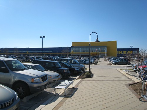 The massive parking lot of the College Park Ikea. Photo from Flickr by technotheory
When I moved into Laurel in late 2003, it seemed as if the city's primary industry was furniture sales. I found the jewel of the bunch, Carolina Furniture. I purchased the bulk of the furniture for my hew house at Carolina Furniture, then located on the corner of Main Street and Rt. 1. It was a small business, but had a very helpful staff and one of the best selections I have ever come across, especially impressive considering the modest size of the store. I loved it. I bought a couch and a love seat for half the price of what the Laurel Marlo (prominently located at Rt. 1 and Contee Road) was offering me for just the couch!
Then came the College Park Ikea. I'll admit, as far as big box stores go, I don't mind Ikea too much. But the College Park location was devastating to local businesses.
Carolina Furniture was the first to go. First it moved to an obviously cheaper site in an industrial park off Bowie Road. By early 2006, it had closed up shop. Galaxy Furniture, located on the site where Burtonsville's Dutch Country Farmers' Market was scheduled to move, fell shortly after. Another mile down Rt. 198 was Regency, a huge warehouse-like store located in a strip mall next to a Target. It closed up shop shortly after. Empire Furniture in Laurel Mall went next, followed by another smaller store that briefly opened in the mall. The tiny family-owned shop across from Galaxy closed just a few months ago. Several others have closed throughout the years in the industrial parks between Rt. 1 and the train tracks. Even the Peir One has closed its doors
Currently, Bargain Furniture is going out of business. This store sold scratched or irregular new furniture at a huge discount, and they offered delivery service only on a few select items. I thought this place would never close. It was always crowded with people looking for a deal on another store's rejected items. But today it is liquidating its stock, as you'll clearly see if you drive through the intersection of 197 and 198.
All in all, at least 9 furniture places have closed in Laurel in the last three years. The only furniture place left in Laurel is mega-chain Marlo, the only store in Laurel I've never recommended because of the poor service I recieved there when purchasing my furniture. All of them were either independent or small chains. I'm sure our recession has played a large part in shutting down these stores, but I can't help but think there were almost a dozen furniture stores before Ikea and now Laurel is down to one or two.
Ikea's iconic 200 foot sign visible from the Beltway for a mile in either direction draws people in to its acres and acres of parking. While the upper level features furniture, the lower level has all kinds of housewares, much like your average Wal-Mart (though of much better quality, generally). The store even features a Swedish cafeteria and a child day-care center. The furniture, however, is do-it-yourself. It is difficult at Ikea to find the country-style furniture I prefer. All the furniture is self-assembled. And no matter how friendly and courteous the staff at the store may be (they tend to be rather hard to pin down), you are one of thousands of shoppers. If you don't buy it, the next person will.
When I bought my living room and dining room sets at Carolina Furniture, everything was delivered and (if needed) assembled at my house at no extra charge. A year later, I took some Army buddies there who had just been stationed at Fort Meade. The sales rep recognized me immediately, even remembering my name and what I had bought. But in Laurel, it appears, those days are long gone. If I want to buy furniture locally, I have to stand in a long line at Ikea or get ripped off by Marlo.
Thursday, March 12, 2009
Light Posting Lately; The Metro Vision Update

Apologies for the light posting lately. I have been working a recession-induced second job, and much of my transit-nerd time has been devoted to poking around in Google Earth tweaking my Mass Transit Vision. I don't have much graphic design experience (read: I have none) and I'm slowly and painfully trying to learn how to use Inkscape, so it will be a while before I can post. it.
Shown right: a very early concept sketch.
Since I have gotten quite a few inquiries on this project, I thought I'd share some information. First of all, it won't be something we're likely to see in my grand-children's lifetime. It would probably cost a trillion or more to construct, and it would have far more capacity than this area could support with its current infrastructure and population. I haven't measured its current length, but I know it would be over 500 miles of track. I'll even go so far as to say it would be irresponsible to even study may of the proposed changes.
The concept I'm working has a core system with thirteen (!) lines, none of which share any track (i.e., separated the Green, Yellow, Blue, Orange and Silver lines from each other) so as to maximize capacity. There are six heavy rail and seven light rail/street car lines, a couple of the latter are spurred at the ends. I extended every single end of every existing and planned heavy rail line, though mostly only a station or two here and there. There are also several infill stations, particularly on the new separated routes. The light rails incorporate plans like the Anacostia Light Rail, the Columbia Pike transitways (both in VA and in MD), The Purple Line, and other DC streetcar proposals. There are two Purple Lines, in fact, both of which loop around the city (the Silver Spring-New Carrolton is the outer line). Much of it is completely unfeasible because it would require a fantastic amount of expensive tunnelling, right-of-way acquisition, engineering, and construction.
I expanded on MARC and VRE (but removed the Camden Line) and removed some of the smaller stations, treating them more like an integrated express service. Most of the smaller stops (like Riverdale and Clifton) were replaces with light rail stops. I put four Metro Lines at Union Station and likewise concentrated rail traffic to other MARC/VRE nodes like Silver Spring, L'Enfant Plaza, Rockville, New Carrollton, and King Street to emphasize their role as express lines.

Shown right: a later concept.
Also included in this plan are five supplemental services. In Maryland, the Corridor Cities Transitway, a series of light rail or BRT lines through Montgomery County (which I called Ride-On) and a light rail loop through Southern Maryland. In Virginia, I threw in a series of light rail/BRT lines for Fairfax and Prince William Counties, as well as an Aerotram along the "Techway" corridor from Shady Grove in Rockville to Dulles International Airport.
I have always felt like others' transit visions lack service in Prince Georges County and River East, so there is a concentration in those areas. I placed transit stops in close-in traditionally planned communities like Hyattsville's Arts District, Takoma Park, Old Town, and other places.
Denser areas that are poorly planned (Seven Corners, Tysons, Eastern MoCo, etc.) received lots of transit assuming they would be redeveloped into more transit oriented areas. Parts of the system are very far flung (Columbia, Fort Washington, South Riding, Woodbridge, Gaithersburg, Odenton, etc.)
I don't know if I'll include them initially, but I also have an integrated plan for Frederick, Annapolis, Baltimore, and the Atlantic Beaches.

Shown right: the current iteration of the project.
Basically, my goal was to visualize a Washington Metropolitan area that could support a population at least twice its current size, while allowing most of the city and closer-in region to comfortably live without a car. Hence its infeasibility. It has been a fun and interesting project so far, even if it has been overkill.
If anyone has the free time to teach me Inkscape, I would be much obliged, and would gladly provide a meal in exchange. Sadly I lack the graphic skills of the many other transit visions that have inspired me to embark on this project.
So please bear with me as I work my two jobs and attempt to get this into a nice readable map for everyone.
Subscribe to:
Posts (Atom)

