Maryland's Housing and Community Development headquarters will be the first Maryland state agency to move into Prince George's County. In accordance with Governor O'Malley's transit-oriented development initiative, the offices will be relocated from practically-rural Crownsville in Anne Arundel County to a site adjacent to one of the Metro or MARC stations identified for O'Malley's plan.
The four stations in Prince George's County identified by O'Malley's plan are Laurel MARC, New Carrollton, Naylor Road, and Branch Avenue. This can be an excellent opportunity to implement a plan that could become a turning point for the County's future growth. My fear, however, is that it won't be.
Prince George's County has a long history of squandering valuable property along transit stations. College Park Station is the best example of that. Surrounding the transit hub, which has Metro, MARC, and several bus connections is an office park fit for suburban Atlanta. Its poor pedestrian approaches and wasteful spread-out design offer maximum parking without any continuity of place among the buildings. Despite being very convenient to transit, the design and layout of the area scream "drive here!"
Even worse in my opinion is Suitland. Suitland is a destitute area with high crime and a weak economy. When the Suitland Federal Center was built adjacent to the Metro, it came out as a sprawling officeplex with absolutely no orientation to the surrounding area. But don't worry, there is ample parking. Worse yet, the fenced monstrosity acts as a barrier between the town and the Metro station.
I hope this agency goes to Naylor Road station, where O'Malley made the announcement. And I sincerely hope they get it right. But if we get more Suitland and College Park, thanks but no thanks. Keep your office buildings in rural Anne Arundel County where they won't do any more damage to Prince George's County's transit access. Putting office buildings next to a Metro station is not all it takes to make good transit-oriented development.
Sunday, June 20, 2010

Tuesday, June 15, 2010
A MARC solution for Fort Meade
I worked on Fort Meade for the better part of a decade. It made me hate commuting more than any Beltway traffic ever did. It is virtually impossible to get there without a car, and the parking is years of expansion beyond critical mass. The disastrous runoff and increasing traffic are wreaking havoc on the Patuxent River estuaries, and it is only going to get worse as Fort Meade receives almost 6,000 new BRAC jobs.
I have in the past called for Metro service to the base to service the 50,000 military, DoD, and contractors that work on the base and the adjacent facilities. And though that sure would be a nice connection, I am finally coming around to the reality that it would be more infrastructure investment that it would ever worth. The fact remains, however, that the base and surrounding facilities are not served by the MARC lines that run by either side of it. What more an obvious solution than to put a connection between the two of them?
View MARC Meade Line in a larger map
The idea would be to have trains leave Union Station and follow the Camden Line to Savage, where half of the trains would continue along the current Camden Line, and half of them would continue along a spur going eastward along MD 32. The spur would connect to the Penn Line at Odenton and continue to Baltimore and beyond. Stops along the way could include National Business Park, NSA, and the Fort Meade main gate. New tracks would be about six and a half miles long. Portions could easily be constructed along defunct railroad rights-of-way.
The Camden Line, which runs along Route 1 all the way from DC to Baltimore, has several sites such as : Laurel, Muirkirk, and Riverdale Park are struggling to implement transit oriented development by their respective MARC stations. The Camden Line, however, has by far the lowest level of service on the system, and that will still be the case when MARC's 2035 plan is complete. a Meade connection could be used to add more service to the southern half of the Camden Line, which could help encourage those TOD projects.
Best of all, this connection would bring a viable transit alternative to a growing facility with worsening traffic and catastrophic parking problems. It would bring regular, high capacity transit at a minimal infrastructure investment.
I have in the past called for Metro service to the base to service the 50,000 military, DoD, and contractors that work on the base and the adjacent facilities. And though that sure would be a nice connection, I am finally coming around to the reality that it would be more infrastructure investment that it would ever worth. The fact remains, however, that the base and surrounding facilities are not served by the MARC lines that run by either side of it. What more an obvious solution than to put a connection between the two of them?
View MARC Meade Line in a larger map
The idea would be to have trains leave Union Station and follow the Camden Line to Savage, where half of the trains would continue along the current Camden Line, and half of them would continue along a spur going eastward along MD 32. The spur would connect to the Penn Line at Odenton and continue to Baltimore and beyond. Stops along the way could include National Business Park, NSA, and the Fort Meade main gate. New tracks would be about six and a half miles long. Portions could easily be constructed along defunct railroad rights-of-way.
The Camden Line, which runs along Route 1 all the way from DC to Baltimore, has several sites such as : Laurel, Muirkirk, and Riverdale Park are struggling to implement transit oriented development by their respective MARC stations. The Camden Line, however, has by far the lowest level of service on the system, and that will still be the case when MARC's 2035 plan is complete. a Meade connection could be used to add more service to the southern half of the Camden Line, which could help encourage those TOD projects.
Best of all, this connection would bring a viable transit alternative to a growing facility with worsening traffic and catastrophic parking problems. It would bring regular, high capacity transit at a minimal infrastructure investment.
Against the Generistocracy
Fifteen years ago, I was a nonconformist in high school. Like my older brother before me, I sported wild hair and listened to the latest parent-unfriendly rock music. And I loved visiting Phantasmagoria, a (literally) underground record store on Grandview Avenue Wheaton
It was an easy walk from my high school, a since-demolished private Catholic school that has, in its relocation, implied that they want to keep lower middle class students like me from ever attending there again. But in 1995, that school was a quarter mile from the Wheaton Metro station where I caught the C2 or C4 home, and occasionally I would stop in at Phantasmagoria or one of the other quirky little off-the-beaten-path shops in Wheaton along the way.
Friday, June 11, 2010
Links and Open Thread
I have been very busy with work and selling my house lately, and there haven't been many posts in recent months. I have a couple posts in the works that will be posted soon. In the mean time, consider this an open thread to talk about somewhere in DC that needs a little re-imagining. Off the top of my head, here's a few:
Walter Reed Army Medical Center
RFK/East End
Southern Avenue Metro
Downtown Bowie
Bailey's Crossroads
Springfield
Lincolnia
Glover Park
Fort Davis
Suitland
Annandale
Buffalo faces mounting issues as suburbs spread out and city spreads thin.
Rethink College Park talks about a Streetsblog video on autocentricity
Yonah Freemark looks at what DC Transit will be in just a few short years.
And check out a couple of new transit ideas that were posted on GGW.
Walter Reed Army Medical Center
RFK/East End
Southern Avenue Metro
Downtown Bowie
Bailey's Crossroads
Springfield
Lincolnia
Glover Park
Fort Davis
Suitland
Annandale
Buffalo faces mounting issues as suburbs spread out and city spreads thin.
Rethink College Park talks about a Streetsblog video on autocentricity
Yonah Freemark looks at what DC Transit will be in just a few short years.
And check out a couple of new transit ideas that were posted on GGW.
Tuesday, May 4, 2010
I may not have to imagine much longer...
As scenic and wonderful as Laurel has been the past seven years, it looks like I'll finally be making my way back into the District. My humble abode will be going on the market this month.
I have a lot of history in the region here. I was born in Foggy Bottom. I grew up inside the Beltway in Silver Spring. I went to grade school just outside the Beltway, and high school in Wheaton. I attended Montgomery College, and I even lived in Rockville for a year. I joined the Army at 21 (pre-9/11, but just barely, if you were wondering) and resettled here after my basic and advanced training. I joined the Army to see the world, but they stationed me back in Maryland.
I purchased a house in Laurel in 2003 when I was 23 years old. I was a Specialist (E-4) in the Army at the time, making about $1,800 a month plus a housing allowance. It took a lot of scraping to stay in this house, but a couple of war zone deployments helped me pay the mortgage as my taxes skyrocketed during an unprecedented housing boom. After I got out of the Army, I languished in unemployment for about six months, during which I picked up odd jobs and took extreme measures to afford the mortgage until I managed to crack into a government job with an entry level wage suitable for allowing me to live somewhat comfortably while keeping my house.
I've come a long way since then, and so has the housing market, not to mention the city of Laurel and the DC Metro area. I know I am very fortunate to have survived the housing boom-and-bust and still have made money on my house. It was part determination, part luck, and part having smart people around me.
But as it goes, my current job sends me all over the DC area quite regularly and Laurel is no longer a suitable staging point. I'm moving back into the city of my birth, to a yet-to-be-determined neighborhood. Having grown up in the shadow of the Capitol and lived just about my entire life here and being a person who loves cities, it is a powerful notion for me to be moving back into a city that has overcome so much strife. In my youth, the mass exodus from DC was taking place. By the time I was in the sixth grade, DC was the murder capital of the US. While I was in high school, my mother fought with me every time I wanted to go to RFK or the 9:30 Club, citing my safety. And even as recently as 2004, the Army forbade me from going into the parts of the city where I am currently looking to purchase my next home.
But in November 2008, Election Day, I saw a celebration at 14th and U, an intersection that for the past forty years had been overcoming scars left by race riots, neglect, and construction of the Metro. It was a historic day for many reasons as Obama became the first African-American president in a critical period for the nation, but for me it was different, something that had nothing to do with politics. All kinds of people celebrated in the streets of a fully rejuvenated neighborhood. Washington had returned to being a great American city. It made me want to go back. And now it looks like I can finally do that.
So I'll be posting about that experience, schedule permitting. And if anyone is looking for a spot halfway between DC and Baltimore, I know of a cute little bungalow off of Route 1.
I have a lot of history in the region here. I was born in Foggy Bottom. I grew up inside the Beltway in Silver Spring. I went to grade school just outside the Beltway, and high school in Wheaton. I attended Montgomery College, and I even lived in Rockville for a year. I joined the Army at 21 (pre-9/11, but just barely, if you were wondering) and resettled here after my basic and advanced training. I joined the Army to see the world, but they stationed me back in Maryland.
I purchased a house in Laurel in 2003 when I was 23 years old. I was a Specialist (E-4) in the Army at the time, making about $1,800 a month plus a housing allowance. It took a lot of scraping to stay in this house, but a couple of war zone deployments helped me pay the mortgage as my taxes skyrocketed during an unprecedented housing boom. After I got out of the Army, I languished in unemployment for about six months, during which I picked up odd jobs and took extreme measures to afford the mortgage until I managed to crack into a government job with an entry level wage suitable for allowing me to live somewhat comfortably while keeping my house.
I've come a long way since then, and so has the housing market, not to mention the city of Laurel and the DC Metro area. I know I am very fortunate to have survived the housing boom-and-bust and still have made money on my house. It was part determination, part luck, and part having smart people around me.
But as it goes, my current job sends me all over the DC area quite regularly and Laurel is no longer a suitable staging point. I'm moving back into the city of my birth, to a yet-to-be-determined neighborhood. Having grown up in the shadow of the Capitol and lived just about my entire life here and being a person who loves cities, it is a powerful notion for me to be moving back into a city that has overcome so much strife. In my youth, the mass exodus from DC was taking place. By the time I was in the sixth grade, DC was the murder capital of the US. While I was in high school, my mother fought with me every time I wanted to go to RFK or the 9:30 Club, citing my safety. And even as recently as 2004, the Army forbade me from going into the parts of the city where I am currently looking to purchase my next home.
But in November 2008, Election Day, I saw a celebration at 14th and U, an intersection that for the past forty years had been overcoming scars left by race riots, neglect, and construction of the Metro. It was a historic day for many reasons as Obama became the first African-American president in a critical period for the nation, but for me it was different, something that had nothing to do with politics. All kinds of people celebrated in the streets of a fully rejuvenated neighborhood. Washington had returned to being a great American city. It made me want to go back. And now it looks like I can finally do that.
So I'll be posting about that experience, schedule permitting. And if anyone is looking for a spot halfway between DC and Baltimore, I know of a cute little bungalow off of Route 1.
Tuesday, March 30, 2010
A Bike Crossing and a Disconnected Street
I drive around the College Park Metro Station a lot. That area is home to one of the most notable examples on Prince George's County's long list of misguided transportation infrastructure disasters. The College Park Trolley Trail crossing at Paint Branch Parkway. Rethink College Park has chronicled the embarrassingly over-the-top markings, signs, and traffic implements to bring notice to the heavily traveled bike path crossing.
Allow me to set the scene: The College Park Trolley Trail runs along the bits and fragments of a disjointed Rhode Island Avenue between Route 1 and the MARC/Metro tracks. It is a heavily used trail that connects north College Park to the University and the Metro Center, and this crossing is a crucial point on the path. Paint Branch Parkway is a four lane road with a double yellow line. The south side of the road has a sidewalk that goes under the train tracks to the Metro station. The north side has nothing between the train tracks and Route 1 despite several bus stops along the route. The only signalized crossing accessible to the north side of the CPTT is at Route 1, about a quarter mile west. And as mentioned above, there are no sidewalks to get there.
College Park has been trying to get a HAWK signal at the intersection, an option the County dismissed quickly. There is another way to get the crossing signalized, however College Park is likely to foolishly dismiss it: connect Rhode Island Avenue to Paint Branch Parkway.
View Larger Map
The CPTT and Rhode Island Avenue would intersect Paint Branch Parkway at the same place, and the vehicular intersection could receive a traffic signal on which the bike and pedestrian path could piggy-back. This would also improve street connectivity in traffic-clogged College Park. But that's exactly why the idea will probably never be explored. It would attract cars into the neighborhood, a notion that the University and the residents will likely balk at. Never mind the fact that it houses College Park's newest parking garage at Knox Road and Yale Avenue. People won't want through traffic by-passing traffic-choked Route 1 on the narrow, speed-bumpy neighborhood streets.
Prince George's County, like most of the rest of the nation, favors funneling traffic onto main streets instead of keeping a permeable network of interconnected and redundant streets. Usually, this just isolates communities and creates traffic problems. In this case, however, it hurts (sometimes literally) pedestrians and bikers who cannot count on Paint Branch Parkway drivers to obey the 35 mph speed limit or the state law that mandates cars stop at all crosswalks for bikes and peds.
In most other wealthy countries on earth, bikes, cars, pedestrians and transit find a way to coexist together on publicly maintained roads. This separation of modes with a grossly negligent safety situation once again emphasizes that in a country that is already bad at that, Prince George's County finds a way to prove they are one of the worst.
Allow me to set the scene: The College Park Trolley Trail runs along the bits and fragments of a disjointed Rhode Island Avenue between Route 1 and the MARC/Metro tracks. It is a heavily used trail that connects north College Park to the University and the Metro Center, and this crossing is a crucial point on the path. Paint Branch Parkway is a four lane road with a double yellow line. The south side of the road has a sidewalk that goes under the train tracks to the Metro station. The north side has nothing between the train tracks and Route 1 despite several bus stops along the route. The only signalized crossing accessible to the north side of the CPTT is at Route 1, about a quarter mile west. And as mentioned above, there are no sidewalks to get there.
College Park has been trying to get a HAWK signal at the intersection, an option the County dismissed quickly. There is another way to get the crossing signalized, however College Park is likely to foolishly dismiss it: connect Rhode Island Avenue to Paint Branch Parkway.
View Larger Map
The CPTT and Rhode Island Avenue would intersect Paint Branch Parkway at the same place, and the vehicular intersection could receive a traffic signal on which the bike and pedestrian path could piggy-back. This would also improve street connectivity in traffic-clogged College Park. But that's exactly why the idea will probably never be explored. It would attract cars into the neighborhood, a notion that the University and the residents will likely balk at. Never mind the fact that it houses College Park's newest parking garage at Knox Road and Yale Avenue. People won't want through traffic by-passing traffic-choked Route 1 on the narrow, speed-bumpy neighborhood streets.
Prince George's County, like most of the rest of the nation, favors funneling traffic onto main streets instead of keeping a permeable network of interconnected and redundant streets. Usually, this just isolates communities and creates traffic problems. In this case, however, it hurts (sometimes literally) pedestrians and bikers who cannot count on Paint Branch Parkway drivers to obey the 35 mph speed limit or the state law that mandates cars stop at all crosswalks for bikes and peds.
In most other wealthy countries on earth, bikes, cars, pedestrians and transit find a way to coexist together on publicly maintained roads. This separation of modes with a grossly negligent safety situation once again emphasizes that in a country that is already bad at that, Prince George's County finds a way to prove they are one of the worst.
Thursday, March 11, 2010
Look at Southwest
Southwest was gutted by urban renewal a couple decades ago, and it became one of the less savory parts of the city. The area is now experiencing a revival, however the original street grid is still decimated by the elevated freeway and railroads and several of the residential and office complexes that occupy superblocks. What would Southwest look like if all the letter and number streets and diagonal avenues were connected across the quadrant? Something like this:
View Southwest L'Enfant in a larger map
View Southwest L'Enfant in a larger map
Wednesday, February 24, 2010
Imagine Lamond-Riggs
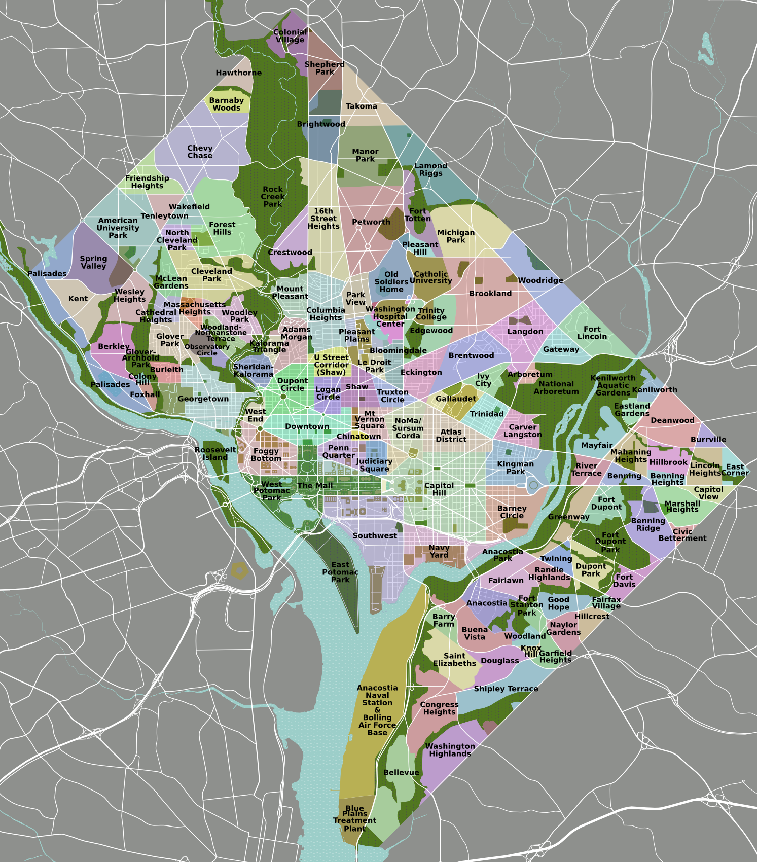
Northern DC has a huge swath of relatively dense urbanized area with little direct access to Metro. This area consists largely of the Petworth, 16th Street Heights, Brightwood, Manor Park, and Lamond Riggs neighborhoods, and the obvious reason is that there is no line running underneath Georgia Avenue. There are commercial corridors along this route on Georgia Avenue, Kennedy Street, Upshur Street, Blair Road.
While it is not economically feasible right now to dig underneath Georgia Avenue, that area is likely to get a streetcar connecting Silver Spring to the next station along Georgia, the Georgia Avenue/Petworth station (which technically is in Park View, just south of Petworth). The eastern reaches of this area would not benefit as much from this new transit line, however the opportunity exists to add a Metro station along the Red Line in the Lamond-Riggs neighborhood at Kansas Avenue and Blair Road:
View Larger Map
This station would lie about halfway between Takoma and Fort Totten, which are just under two miles apart. It would directly serve the Blair Road retail corridor, and if placed on the southeast side of Kansas Avenue, the New Hampshire Avenue corridor would be directly served as well.
What makes this site particularly amenable to a transit station is the plethora of suitable approaches. Peabody Street heads west and in less than a mile hits Georgia Avenue in the Vinegar Hill/Fort Stevens area. New Hampshire and Kansas Avenues head southwest into the heart of Petworth, an important neighborhood in the heart of northwest, densely populated and undergoing a true renaissance. New Hampshire Avenue also heads north through Takoma Park towards Langley Park, and this new station could serve as a hub for bus lines along New Hampshire.
Blair Road already connects this area to the Takoma station area, and linking transit-oriented developments can have a synergistic effect on the areas, like along the Orange Line in Arlington or the downtown areas in DC. To the south, Blair Road becomes North Capitol Street and crosses Riggs Road/Missouri Avenue near Fort Totten, another area which is rapidly growing. As Takoma and Fort Totten grow with more walkable, transit accessible developments, a station placed in between them could induce a string-of-pearls transit-oriented development environment that could become the focus of the northern part of the District, improving transit accessibility and the potential for growth and development. And it could be done without spending a single dime laying more track.
I imagine the first criticism of this station would be that it increases the time it takes to get downtown. For some, yes. However, there is an express train from Silver Spring to Union Station known as the MARC Brunswick Line. For many residents in Lamond Riggs, Manor Park, Takoma, Brightwood, and Petworth, it will most certainly shorten the amount of time it takes for them to get downtown. Considering the benefits of added grown and increased economic viability, adding one or two minutes to get downtown might be worth it. It certainly was at the New York Avenue station, which opened just six years ago and has induced billions in economic investment, even during troubled economic times.
What would this station be called? Track Twenty-Nine suggested "Kansas Avenue" some time ago, however I am partial to naming it after the neighborhood, Lamond-Riggs, or perhaps Fort Slocum after the nearby park and Civil War fortification. Though perhaps not well known right now, Lamond-Riggs has the potential to become a keystone for development along the northern edge of the District.
While it is not economically feasible right now to dig underneath Georgia Avenue, that area is likely to get a streetcar connecting Silver Spring to the next station along Georgia, the Georgia Avenue/Petworth station (which technically is in Park View, just south of Petworth). The eastern reaches of this area would not benefit as much from this new transit line, however the opportunity exists to add a Metro station along the Red Line in the Lamond-Riggs neighborhood at Kansas Avenue and Blair Road:
View Larger Map
This station would lie about halfway between Takoma and Fort Totten, which are just under two miles apart. It would directly serve the Blair Road retail corridor, and if placed on the southeast side of Kansas Avenue, the New Hampshire Avenue corridor would be directly served as well.
What makes this site particularly amenable to a transit station is the plethora of suitable approaches. Peabody Street heads west and in less than a mile hits Georgia Avenue in the Vinegar Hill/Fort Stevens area. New Hampshire and Kansas Avenues head southwest into the heart of Petworth, an important neighborhood in the heart of northwest, densely populated and undergoing a true renaissance. New Hampshire Avenue also heads north through Takoma Park towards Langley Park, and this new station could serve as a hub for bus lines along New Hampshire.
Blair Road already connects this area to the Takoma station area, and linking transit-oriented developments can have a synergistic effect on the areas, like along the Orange Line in Arlington or the downtown areas in DC. To the south, Blair Road becomes North Capitol Street and crosses Riggs Road/Missouri Avenue near Fort Totten, another area which is rapidly growing. As Takoma and Fort Totten grow with more walkable, transit accessible developments, a station placed in between them could induce a string-of-pearls transit-oriented development environment that could become the focus of the northern part of the District, improving transit accessibility and the potential for growth and development. And it could be done without spending a single dime laying more track.
I imagine the first criticism of this station would be that it increases the time it takes to get downtown. For some, yes. However, there is an express train from Silver Spring to Union Station known as the MARC Brunswick Line. For many residents in Lamond Riggs, Manor Park, Takoma, Brightwood, and Petworth, it will most certainly shorten the amount of time it takes for them to get downtown. Considering the benefits of added grown and increased economic viability, adding one or two minutes to get downtown might be worth it. It certainly was at the New York Avenue station, which opened just six years ago and has induced billions in economic investment, even during troubled economic times.
What would this station be called? Track Twenty-Nine suggested "Kansas Avenue" some time ago, however I am partial to naming it after the neighborhood, Lamond-Riggs, or perhaps Fort Slocum after the nearby park and Civil War fortification. Though perhaps not well known right now, Lamond-Riggs has the potential to become a keystone for development along the northern edge of the District.
Wednesday, February 17, 2010
Sneak Peek at Imagine, DC Transit Vision
Further explanation forthcoming, but at the GGW meet-up in Silver Spring tonight, a couple folks asked me about it, so here it is
What is on it?
-Potential extension of existing and under construction Metro Lines (including Silver), separated from each other to maximize capacity
-Two Metro Light Rail lines, the Purple Line (proposed) and the Black or "Columbia" Line (which hits Columbia Pike in MoCo, Columbia Heights, and Columbia Pike in VA)
-A vision for DC streetcars (red), Ride-On streetcars (light blue), streetcars for municipalities in Prince George's (various blues and purples), ART/DART (light green) and Fairfax Connector (white)
-Southern Maryland Area Rail Transport (SMART light rail, in yellow)
What's not on here yet:
-Corridor Cities Transitway
-MARC/VRE
-Baltimore Transit
-A "Pink Line" heavy rail inner loop
-A "Brown Line" crosstown light rail
I probably won't add these, it doesn't mean I don't think we should have them:
-Tram/Streetcar stations
-Intercity/HSR/MagLev
-Rapid/express bus (vision supplants most of this with rail anyway)
-Redevelopment and suburban ruralization that would ideally accompany this sort of plan
-Bicycle facilities (not my wheelhouse... yet)
-New/changed/removed freeways, parkways, and interchanges, as well as newly tolled roads
Here's a disclaimer: I am not under the delusion that this vision is feasible, politically expedient, affordable, cost effective, or in any other way possible. But I imagine it would be able to quickly and safely transport most of the area's growing population after gas prices breach the threshold of affordability.
Sorry I am currently incapable of putting together a beautiful graphic like many of my fellow transit nerds at BeyondDC, Track Twenty-Nine, or Greater Greater Washington, but hopefully the arrangement I have thrown together on GoogleMaps will give people an idea of what I'm going for here.
What is on it?
-Potential extension of existing and under construction Metro Lines (including Silver), separated from each other to maximize capacity
-Two Metro Light Rail lines, the Purple Line (proposed) and the Black or "Columbia" Line (which hits Columbia Pike in MoCo, Columbia Heights, and Columbia Pike in VA)
-A vision for DC streetcars (red), Ride-On streetcars (light blue), streetcars for municipalities in Prince George's (various blues and purples), ART/DART (light green) and Fairfax Connector (white)
-Southern Maryland Area Rail Transport (SMART light rail, in yellow)
What's not on here yet:
-Corridor Cities Transitway
-MARC/VRE
-Baltimore Transit
-A "Pink Line" heavy rail inner loop
-A "Brown Line" crosstown light rail
I probably won't add these, it doesn't mean I don't think we should have them:
-Tram/Streetcar stations
-Intercity/HSR/MagLev
-Rapid/express bus (vision supplants most of this with rail anyway)
-Redevelopment and suburban ruralization that would ideally accompany this sort of plan
-Bicycle facilities (not my wheelhouse... yet)
-New/changed/removed freeways, parkways, and interchanges, as well as newly tolled roads
Here's a disclaimer: I am not under the delusion that this vision is feasible, politically expedient, affordable, cost effective, or in any other way possible. But I imagine it would be able to quickly and safely transport most of the area's growing population after gas prices breach the threshold of affordability.
Sorry I am currently incapable of putting together a beautiful graphic like many of my fellow transit nerds at BeyondDC, Track Twenty-Nine, or Greater Greater Washington, but hopefully the arrangement I have thrown together on GoogleMaps will give people an idea of what I'm going for here.
Sunday, February 7, 2010
Keeping Money In the Community
My New Years resolution was to eat at more independently owned food joints. Originally, I opted to do this to get a better taste for DC cuisine, but there is a reason that benefits everyone to seek local fare from locally owned restaurants. That money comes flowing back to you by keeping the money in the place where you live. And this goes for everything, not just food.
I purchase some pork tenderloin at the Wal-Mart in Maryland City, the money goes a lot of places. New York investors, Chinese suppliers, various distributors, and of course the fat cats in Benton, AR where Wal-Mart started. But where doesn't it go? Laurel. Prince George's County. And for the most part, the State of Maryland. My hard earned cash is going to support gated communities like Hot Springs Village, AR, the largest gated community in the United States and not surprisingly convenient to Benton.
If I purchase the same pork tenderloin at the Laurel meat market on Main Street, my money is not going through all the corporate filters of a Wal-Mart. The product is more likely to come from the state of Maryland and will probably be fresher. A larger percentage of the taxed monies will go to the city of Laurel, Prince George's County, and Maryland. And a retailer that depends on the community. Those taxes will go towards investment in my city, not a segregated community halfway across the country with a disproportionate lack of minority population.
River East Idealist had a great article last week on how River East residents can keep their money in River East and break the debt cycle in which many less fortunate River East residents are mired. Her first point was to stop attending colleges you can't afford. I like to think I'm living proof that this works. I have an Associates of Applied Science from Montgomery College. I educated myself where I lived, and I now have what could be considered a decent paying job and a rather prestigious position in Federal Government. Of course, if you can find a way afford a degree from a better more expensive school, go for it. But educating yourself outside your means is not necessary. I believe I am doing much better than most of my friends with bachelors degrees from more prestigious institutions because I do not have six figure student loan debt. My six figure debt is a mortgage on the house I own.
Another observation she made: stop financing cars. If the money Americans spent on the interest alone of financed cars were instead spent on public transportation infrastructure, I wonder how much better our systems would be. If that were the case, I speculate many Americans would not even bother to own a car. At the very least, I bet Metro would not be facing such a tremendous budget gap.
There are a plethora of ways we can keep our money in the community continuing to benefit us. But it is important that those methods be accessible to everyone, regardless of their socio-economic status. Policy ought to be enacted promoting locally owned businesses over chains, mass transit over car ownership, and better investment in local schools to create sharp minds and keep them nearby. The status quo will continue to send money to out of touch corporations and Wall Street investors while siphoning investment away from our own communities.
I purchase some pork tenderloin at the Wal-Mart in Maryland City, the money goes a lot of places. New York investors, Chinese suppliers, various distributors, and of course the fat cats in Benton, AR where Wal-Mart started. But where doesn't it go? Laurel. Prince George's County. And for the most part, the State of Maryland. My hard earned cash is going to support gated communities like Hot Springs Village, AR, the largest gated community in the United States and not surprisingly convenient to Benton.
If I purchase the same pork tenderloin at the Laurel meat market on Main Street, my money is not going through all the corporate filters of a Wal-Mart. The product is more likely to come from the state of Maryland and will probably be fresher. A larger percentage of the taxed monies will go to the city of Laurel, Prince George's County, and Maryland. And a retailer that depends on the community. Those taxes will go towards investment in my city, not a segregated community halfway across the country with a disproportionate lack of minority population.
River East Idealist had a great article last week on how River East residents can keep their money in River East and break the debt cycle in which many less fortunate River East residents are mired. Her first point was to stop attending colleges you can't afford. I like to think I'm living proof that this works. I have an Associates of Applied Science from Montgomery College. I educated myself where I lived, and I now have what could be considered a decent paying job and a rather prestigious position in Federal Government. Of course, if you can find a way afford a degree from a better more expensive school, go for it. But educating yourself outside your means is not necessary. I believe I am doing much better than most of my friends with bachelors degrees from more prestigious institutions because I do not have six figure student loan debt. My six figure debt is a mortgage on the house I own.
Another observation she made: stop financing cars. If the money Americans spent on the interest alone of financed cars were instead spent on public transportation infrastructure, I wonder how much better our systems would be. If that were the case, I speculate many Americans would not even bother to own a car. At the very least, I bet Metro would not be facing such a tremendous budget gap.
There are a plethora of ways we can keep our money in the community continuing to benefit us. But it is important that those methods be accessible to everyone, regardless of their socio-economic status. Policy ought to be enacted promoting locally owned businesses over chains, mass transit over car ownership, and better investment in local schools to create sharp minds and keep them nearby. The status quo will continue to send money to out of touch corporations and Wall Street investors while siphoning investment away from our own communities.
Subscribe to:
Posts (Atom)

 Posts
Posts